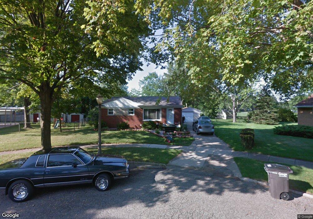
2913 Alsand Cir Lansing, MI 48906
Northwestside NeighborhoodEstimated Value: $171,000 - $207,000
3
Beds
2
Baths
1,649
Sq Ft
$111/Sq Ft
Est. Value
About This Home
This home is located at 2913 Alsand Cir, Lansing, MI 48906 and is currently estimated at $182,472, approximately $110 per square foot. 2913 Alsand Cir is a home located in Ingham County with nearby schools including Cumberland Elementary School, Pattengill Academy, and J.W. Sexton High School.
Ownership History
Date
Name
Owned For
Owner Type
Purchase Details
Closed on
Apr 30, 2008
Sold by
Land Rodney and Land Cassandra L
Bought by
Cushman Mark G
Current Estimated Value
Home Financials for this Owner
Home Financials are based on the most recent Mortgage that was taken out on this home.
Original Mortgage
$99,116
Outstanding Balance
$62,770
Interest Rate
5.88%
Mortgage Type
FHA
Estimated Equity
$119,702
Purchase Details
Closed on
Oct 22, 2004
Sold by
Marsh Cassandra L
Bought by
Land Rodney and Marsh Cassandra L
Home Financials for this Owner
Home Financials are based on the most recent Mortgage that was taken out on this home.
Original Mortgage
$41,422
Interest Rate
5.91%
Mortgage Type
Stand Alone Refi Refinance Of Original Loan
Purchase Details
Closed on
Jul 1, 1993
Create a Home Valuation Report for This Property
The Home Valuation Report is an in-depth analysis detailing your home's value as well as a comparison with similar homes in the area
Home Values in the Area
Average Home Value in this Area
Purchase History
| Date | Buyer | Sale Price | Title Company |
|---|---|---|---|
| Cushman Mark G | $99,900 | None Available | |
| Land Rodney | -- | Chicago Title | |
| -- | $59,000 | -- |
Source: Public Records
Mortgage History
| Date | Status | Borrower | Loan Amount |
|---|---|---|---|
| Open | Cushman Mark G | $99,116 | |
| Previous Owner | Land Rodney | $41,422 |
Source: Public Records
Tax History Compared to Growth
Tax History
| Year | Tax Paid | Tax Assessment Tax Assessment Total Assessment is a certain percentage of the fair market value that is determined by local assessors to be the total taxable value of land and additions on the property. | Land | Improvement |
|---|---|---|---|---|
| 2025 | $3,132 | $71,300 | $18,400 | $52,900 |
| 2024 | $25 | $65,900 | $18,400 | $47,500 |
| 2023 | $2,936 | $63,000 | $18,400 | $44,600 |
| 2022 | $2,647 | $59,300 | $17,200 | $42,100 |
| 2021 | $2,592 | $54,400 | $12,300 | $42,100 |
| 2020 | $2,576 | $50,200 | $12,300 | $37,900 |
| 2019 | $2,470 | $45,500 | $12,300 | $33,200 |
| 2018 | $2,314 | $42,500 | $12,300 | $30,200 |
| 2017 | $2,216 | $42,500 | $12,300 | $30,200 |
| 2016 | $2,119 | $40,300 | $12,300 | $28,000 |
| 2015 | $2,119 | $38,300 | $24,560 | $13,740 |
| 2014 | $2,119 | $37,600 | $26,524 | $11,076 |
Source: Public Records
Map
Nearby Homes
- 4221 N Grand River Ave
- 4005 N Grand River Ave
- 2519 Byrnes Rd
- 2400 Leon Ave
- 3230 Sheffer Ave
- 2220 Delta River Dr
- 2524 Newport Dr
- 2601 Newport Dr
- 2316 Barstow Rd
- 2300 Byrnes Rd
- 2206 Kuerbitz Dr
- 3500 Colchester Rd
- 2111 Delta River Dr
- 2123 Cogswell Dr
- 2241 Cumberland Rd
- 3733 Colchester Rd
- 5250 N Grand River Ave
- 1900 Kaplan St
- 3021 N Grand River Ave
- 1523 Biltmore Blvd
- 2914 Lafayette Ave
- 2918 Alsand Cir
- 2920 Lafayette Ave
- 2915 Paul Ave
- 2907 Paul Ave
- 2912 Alsand Cir
- 2918 Paul Ave
- 2912 Paul Ave
- 2919 Lafayette Ave
- 2913 Lafayette Ave
- 2924 Paul Ave
- 2923 Lafayette Ave
- 2907 Lafayette Ave
- 2919 Andrea Dr
- 2911 Andrea Dr
- 3002 Paul Ave
- 2923 Andrea Dr
- 3005 Lafayette Ave
- 2901 Lafayette Ave