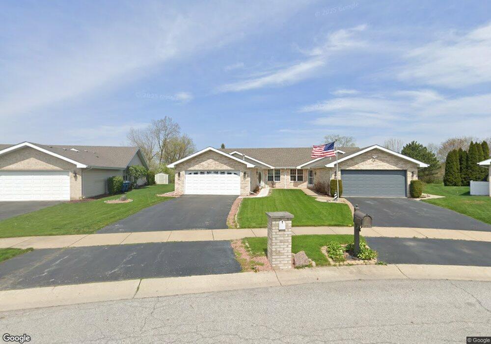
2913 Freedom Cir Crown Point, IN 46307
Estimated Value: $277,246 - $322,000
2
Beds
2
Baths
1,534
Sq Ft
$189/Sq Ft
Est. Value
About This Home
This home is located at 2913 Freedom Cir, Crown Point, IN 46307 and is currently estimated at $290,312, approximately $189 per square foot. 2913 Freedom Cir is a home located in Lake County with nearby schools including Peifer Elementary School, Hal E Clark Middle School, and Lake Central High School.
Ownership History
Date
Name
Owned For
Owner Type
Purchase Details
Closed on
Jul 26, 2021
Sold by
Vanek Edward J and Eichenberger Loreen M
Bought by
Piekarski Alexandra Ann
Current Estimated Value
Home Financials for this Owner
Home Financials are based on the most recent Mortgage that was taken out on this home.
Original Mortgage
$50,000
Outstanding Balance
$45,533
Interest Rate
3%
Mortgage Type
New Conventional
Estimated Equity
$244,779
Purchase Details
Closed on
May 9, 2018
Sold by
Vanek Edward J
Bought by
Vanek Edward J and Eichenberger Loreen M
Create a Home Valuation Report for This Property
The Home Valuation Report is an in-depth analysis detailing your home's value as well as a comparison with similar homes in the area
Home Values in the Area
Average Home Value in this Area
Purchase History
| Date | Buyer | Sale Price | Title Company |
|---|---|---|---|
| Piekarski Alexandra Ann | -- | Greater Indiana Title Co | |
| Vanek Edward J | -- | None Available |
Source: Public Records
Mortgage History
| Date | Status | Borrower | Loan Amount |
|---|---|---|---|
| Open | Piekarski Alexandra Ann | $50,000 |
Source: Public Records
Tax History Compared to Growth
Tax History
| Year | Tax Paid | Tax Assessment Tax Assessment Total Assessment is a certain percentage of the fair market value that is determined by local assessors to be the total taxable value of land and additions on the property. | Land | Improvement |
|---|---|---|---|---|
| 2024 | $4,629 | $254,400 | $35,800 | $218,600 |
| 2023 | $1,847 | $227,300 | $35,800 | $191,500 |
| 2022 | $1,847 | $203,700 | $35,800 | $167,900 |
| 2021 | $1,554 | $176,400 | $35,800 | $140,600 |
| 2020 | $1,509 | $169,300 | $28,100 | $141,200 |
| 2019 | $1,645 | $166,900 | $26,200 | $140,700 |
| 2018 | $1,565 | $159,300 | $26,200 | $133,100 |
| 2017 | $1,395 | $152,400 | $26,200 | $126,200 |
| 2016 | $1,351 | $148,100 | $26,200 | $121,900 |
| 2014 | $1,254 | $147,100 | $26,200 | $120,900 |
| 2013 | $1,265 | $145,100 | $26,200 | $118,900 |
Source: Public Records
Map
Nearby Homes
- 2921 Morningside Dr
- 2914 Morningside Dr
- 1813 Redwood Ct
- 1881 Orchard Ct
- 1896 Azalea Ct
- 5547 Maggie Mae Ct
- 5544 Maggie Mae Ct
- 1785 Wedgewood Ct
- 1765 Wedgewood Ct
- 2720 Painted Leaf Ct
- 6076 Wexford Way
- 5480 Victoria Place
- 2756 Autumn Dr
- 2609 Autumn Dr
- 2543 Harvest Dr
- 8109 Victoria Place
- 6440 W 89th Ave
- 10406 Whitney Place
- 10444 Whitney Place
- 10474 Whitney Place
- 2909 Freedom Cir
- 2915 Freedom Cir
- 2907 Freedom Cir
- 2919 Freedom Cir
- 2921 Freedom Cir
- 2925 Freedom Cir
- 2924 Freedom Cir
- 2927 Freedom Cir
- 2931 Freedom Cir
- 2922 Freedom Cir
- 2914 Liberty Dr
- 2920 Liberty Dr
- 2908 Liberty Dr
- 2926 Liberty Dr
- 2933 Freedom Cir
- 2932 Liberty Dr
- 2937 Freedom Cir
- 2952 Freedom Cir
- 2938 Liberty Dr
- 2844 Liberty Dr