2913 Lansdowne Rd Waterford, MI 48329
Highlights
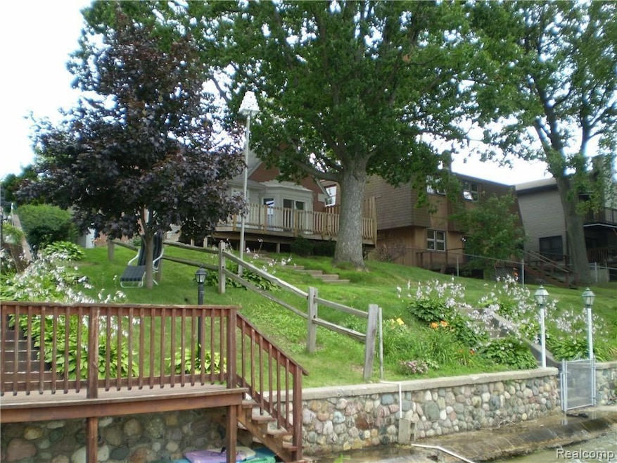
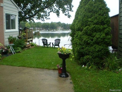
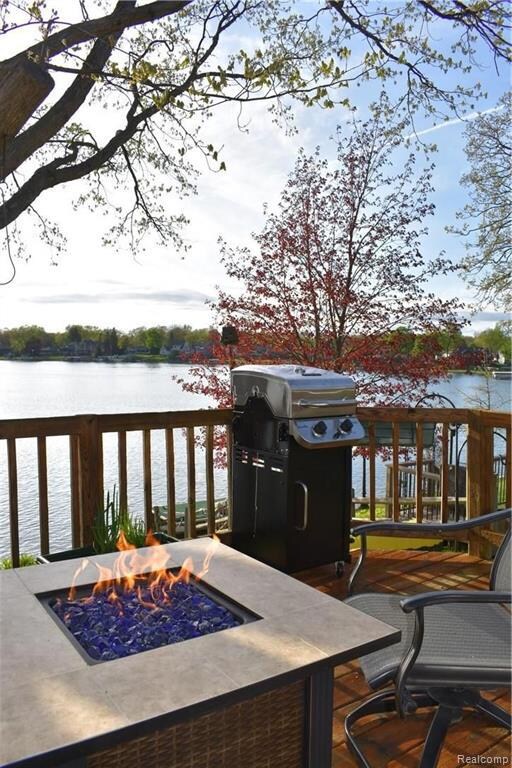
- Private Waterfront
- Ranch Style House
- No HOA
- Deck
- Ground Level Unit
- Community Barbecue Grill
About This Home
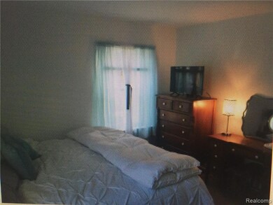
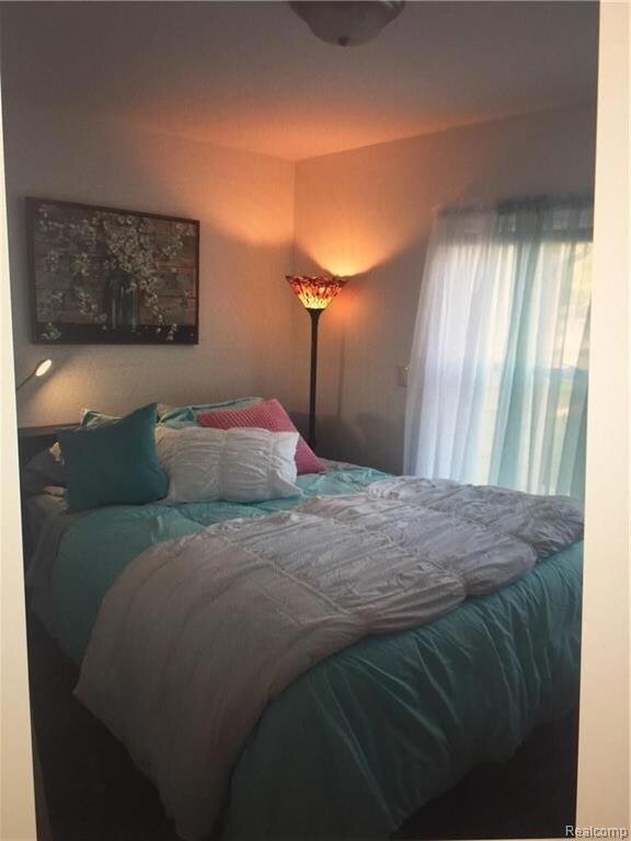
Short term lease available see owner for more information. Hardwood floors, great views, spotless and new furniture. Detroit is 50 minutes away. Perfect if you want to do some ice fishing, skating, skiing, or just sit back and put your feet up and enjoy the tranquil, clean, homey, home of your own. Agent is owner. Two bedrooms on the main floor. Basement is finished also. 155 acres of wonderful private Williams Lake!! Owner is Landlord. Completely furnished, ready to move in. Home is completely furnished just bring your wardrobe. Rent to enjoy the deck and view and a nice clean place to live for a few months till May 30th.
Home Details
Home Type
- Single Family
Year Built
- Built in 1941
Lot Details
- 8,276 Sq Ft Lot
- Lot Dimensions are 49x163
- Private Waterfront
- 50 Feet of Waterfront
- Lake Front
Home Design
- Ranch Style House
- Brick Exterior Construction
- Block Foundation
- Asphalt Roof
Interior Spaces
- 1,014 Sq Ft Home
- Gas Fireplace
- Family Room with Fireplace
- Finished Basement
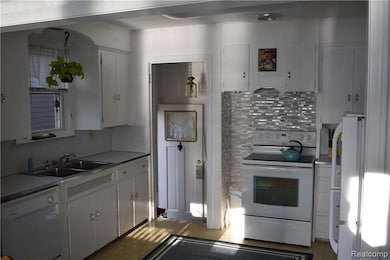
Kitchen
- Built-In Electric Oven
- Electric Cooktop
- Microwave
- Dishwasher
- Disposal
Bedrooms and Bathrooms
- 2 Bedrooms
- 1 Full Bathroom
Laundry
- Dryer
- Washer
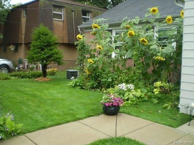
Outdoor Features
- Deck
- Exterior Lighting
- Shed
Location
- Ground Level Unit
Utilities
- Forced Air Heating and Cooling System
- Heating System Uses Natural Gas
- Natural Gas Water Heater
Listing and Financial Details
- Security Deposit $4,013
- Negotiable Lease Term
- Assessor Parcel Number 1308326010
Community Details
Overview
- No Home Owners Association
- Whitfield Estates Subdivision
Amenities
- Community Barbecue Grill
Recreation
- Water Sports
Pet Policy
- Call for details about the types of pets allowed
Map
Property History
| Date | Event | Price | List to Sale | Price per Sq Ft |
|---|---|---|---|---|
| 12/10/2025 12/10/25 | For Rent | $3,990 | -- | -- |
Source: Realcomp
MLS Number: 20251059322
APN: 13-08-326-010
Disclaimer: Certain information contained herein is derived from information provided by parties other than Homes.com. All information provided is deemed reliable, but is not guaranteed to be accurate and should be independently verified.
![]() IDX provided courtesy of Realcomp II Ltd. via Ten-X and MLS
IDX provided courtesy of Realcomp II Ltd. via Ten-X and MLS
Copyright 2026 Realcomp II Ltd. Shareholders
IDX information is provided exclusively for consumers' personal, noncommercial use and may not be used for any purpose other than to identify prospective properties consumers may be interested in purchasing. The accuracy of all information, regardless of source, is not guaranteed or warranted. All information should be independently verified.
Listing Information presented by local MLS brokerage: Ten-X, local REALTOR®- Arlene Richardson - (888)-952-6393
- 6465 Monrovia Dr
- 6780 Desmond Rd
- 3174 Pirrin Dr
- 2811 Orange Grove Rd
- 6350 Elmwood Dr
- 6376 Lanman Dr
- 6366 Dellwood Dr
- 3315 Warringham Ave
- 7048 Lapham
- 2365 Hartford Ave
- 2349 Ellery St
- 6394 Manson Dr
- 2922 Airport Rd
- 5969 Pleasant Dr
- 7226 Garvin
- 2863 Wisner
- 5985 Rowley Blvd
- 3525 Whitfield Dr
- 2596 N Williams Lake Rd
- 3520 Warringham Ave
- 6628 Longworth Dr
- 2500 Tuson Dr
- 2738 Birchwood Dr
- 6695 Highland Rd Unit 106
- 6695 Highland Rd Unit 200
- 6219 Waterfront Dr
- 6935 Tuson Blvd
- 5891-5901 Dixie Hwy
- 7380 Arbor Trail
- 1744 Crescent Lake Rd
- 3620 Windmill Dr
- 1049 N Oakland Blvd
- 4512 Dixie Hwy
- 1346 Hillcrest Dr
- 8385 Pontiac Lake Rd Unit 14
- 504 Maplebrook Ln
- 5147 Lancaster Hills Dr
- 6572 Ridgeview Dr
- 6596 Maple Dr
- 4500 Island Park Dr

Ask me questions while you tour the home.