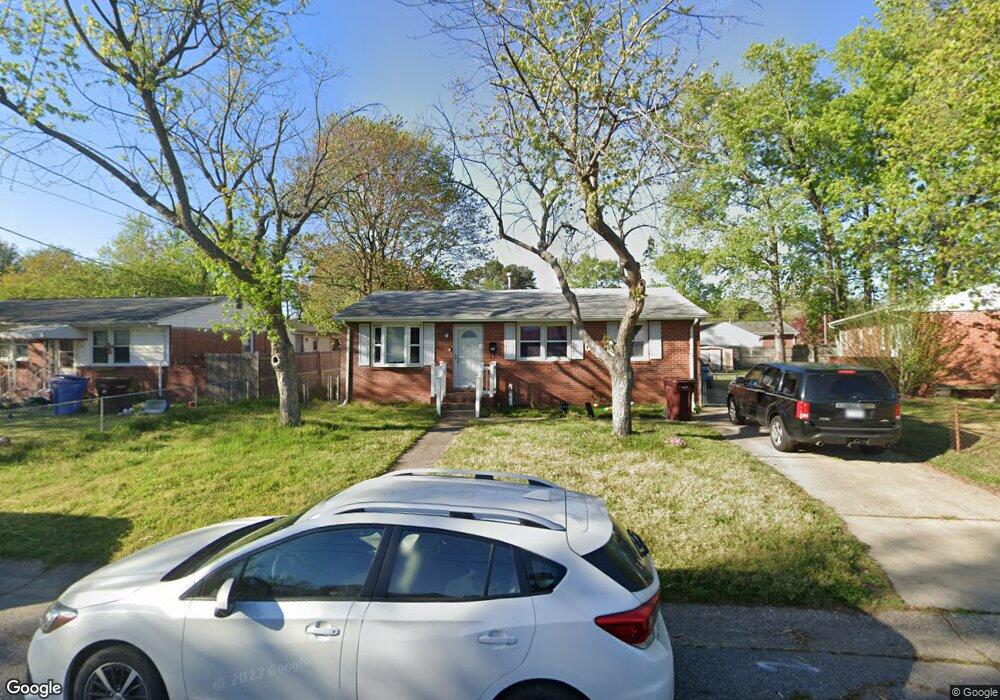
2913 Mattox Dr Chesapeake, VA 23325
Indian River NeighborhoodEstimated Value: $299,000 - $321,000
4
Beds
2
Baths
1,382
Sq Ft
$224/Sq Ft
Est. Value
About This Home
This home is located at 2913 Mattox Dr, Chesapeake, VA 23325 and is currently estimated at $310,147, approximately $224 per square foot. 2913 Mattox Dr is a home located in Chesapeake City with nearby schools including Georgetown Primary School, Sparrow Road Intermediate School, and Indian River Middle.
Ownership History
Date
Name
Owned For
Owner Type
Purchase Details
Closed on
Jul 14, 2022
Sold by
Weast Ellen D
Bought by
Root Tobias Madison and Herrera Sophia Nicole
Current Estimated Value
Home Financials for this Owner
Home Financials are based on the most recent Mortgage that was taken out on this home.
Original Mortgage
$286,440
Outstanding Balance
$272,515
Interest Rate
5.09%
Mortgage Type
VA
Estimated Equity
$37,632
Create a Home Valuation Report for This Property
The Home Valuation Report is an in-depth analysis detailing your home's value as well as a comparison with similar homes in the area
Home Values in the Area
Average Home Value in this Area
Purchase History
| Date | Buyer | Sale Price | Title Company |
|---|---|---|---|
| Root Tobias Madison | $280,000 | Stewart Title Guaranty Company |
Source: Public Records
Mortgage History
| Date | Status | Borrower | Loan Amount |
|---|---|---|---|
| Open | Root Tobias Madison | $286,440 |
Source: Public Records
Tax History Compared to Growth
Tax History
| Year | Tax Paid | Tax Assessment Tax Assessment Total Assessment is a certain percentage of the fair market value that is determined by local assessors to be the total taxable value of land and additions on the property. | Land | Improvement |
|---|---|---|---|---|
| 2025 | $2,542 | $269,900 | $100,000 | $169,900 |
| 2024 | $2,542 | $251,700 | $90,000 | $161,700 |
| 2023 | $1,911 | $236,600 | $80,000 | $156,600 |
| 2022 | $1,617 | $180,100 | $65,000 | $115,100 |
| 2021 | $1,617 | $154,000 | $55,000 | $99,000 |
| 2020 | $1,571 | $149,600 | $55,000 | $94,600 |
| 2019 | $1,528 | $145,500 | $55,000 | $90,500 |
| 2018 | $1,641 | $147,500 | $50,000 | $97,500 |
| 2017 | $1,579 | $150,400 | $50,000 | $100,400 |
| 2016 | $1,549 | $147,500 | $50,000 | $97,500 |
| 2015 | $1,529 | $145,600 | $50,000 | $95,600 |
| 2014 | $1,556 | $148,200 | $50,000 | $98,200 |
Source: Public Records
Map
Nearby Homes
- 2900 Mayon Dr
- 402 Stalham Rd Unit A
- 3005 Scotia Dr
- 3009 Mattox Dr
- 1324 Wingfield Ave
- 3006 Menands Dr
- 2913 Berkley Ave
- 2609 Harling Dr
- 708 Stalham Rd
- 2603 Berkley Ave
- 606 Bethel Rd
- 3317 Hornsea Rd
- 2111 Stalham Rd
- 1317 Yeadon Rd
- 1217 Cleona Dr
- 2932 Sunrise Ave
- Lot Angora Dr
- 1012 Oldwood St
- 1010 Oldwood St
- 1008 Oldwood St
- 2911 Mattox Dr
- 2914 Kilbride Dr
- 2909 Mattox Dr
- 2912 Kilbride Dr
- 2917 Mattox Dr
- 2916 Kilbride Dr
- 2914 Mattox Dr
- 2912 Mattox Dr
- 2918 Kilbride Dr
- 2916 Mattox Dr
- 2907 Mattox Dr
- 2910 Mattox Dr
- 2919 Mattox Dr
- 2918 Mattox Dr
- 2908 Kilbride Dr
- 2920 Kilbride Dr
- 2908 Mattox Dr
- 2905 Mattox Dr
- 2915 Kilbride Dr
- 2921 Mattox Dr