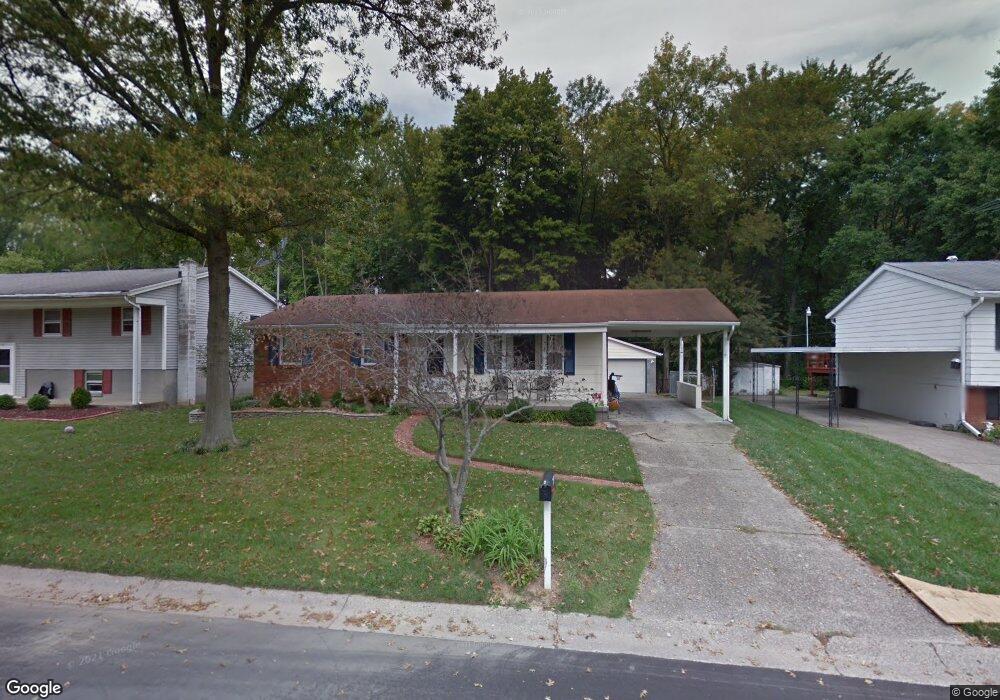
2913 N Walford Dr Jeffersonville, IN 47130
Oak Park NeighborhoodEstimated Value: $200,000 - $227,000
3
Beds
2
Baths
1,886
Sq Ft
$115/Sq Ft
Est. Value
About This Home
This home is located at 2913 N Walford Dr, Jeffersonville, IN 47130 and is currently estimated at $216,718, approximately $114 per square foot. 2913 N Walford Dr is a home located in Clark County with nearby schools including Bridgepoint Elementary School, Parkview Middle School, and Jeffersonville High School.
Ownership History
Date
Name
Owned For
Owner Type
Purchase Details
Closed on
Oct 23, 2019
Sold by
Bryant Jacquline S
Bought by
Bryant Jacqueline S and Bryant Heather E
Current Estimated Value
Purchase Details
Closed on
Jul 19, 2011
Sold by
Weber Joel D and Kessens Kandi M
Bought by
Bryant Jacqueline S
Purchase Details
Closed on
Nov 7, 2008
Sold by
Key James P and Key Beth M
Bought by
Weber Joel D and Kessens Kandi M
Create a Home Valuation Report for This Property
The Home Valuation Report is an in-depth analysis detailing your home's value as well as a comparison with similar homes in the area
Home Values in the Area
Average Home Value in this Area
Purchase History
| Date | Buyer | Sale Price | Title Company |
|---|---|---|---|
| Bryant Jacqueline S | -- | -- | |
| Bryant Jacqueline S | $113,000 | Regional First Title Group L | |
| Weber Joel D | $114,000 | Culler Law Office Llc |
Source: Public Records
Tax History Compared to Growth
Tax History
| Year | Tax Paid | Tax Assessment Tax Assessment Total Assessment is a certain percentage of the fair market value that is determined by local assessors to be the total taxable value of land and additions on the property. | Land | Improvement |
|---|---|---|---|---|
| 2024 | $2,073 | $177,600 | $30,800 | $146,800 |
| 2023 | $2,033 | $166,500 | $31,200 | $135,300 |
| 2022 | $1,526 | $152,900 | $31,200 | $121,700 |
| 2021 | $1,183 | $118,800 | $23,400 | $95,400 |
| 2020 | $1,736 | $118,800 | $23,400 | $95,400 |
| 2019 | $1,762 | $119,100 | $23,400 | $95,700 |
| 2018 | $1,647 | $110,200 | $23,400 | $86,800 |
| 2017 | $1,443 | $101,900 | $23,400 | $78,500 |
| 2016 | $1,235 | $91,800 | $23,400 | $68,400 |
| 2014 | $1,826 | $115,700 | $23,400 | $92,300 |
| 2013 | -- | $113,200 | $23,400 | $89,800 |
Source: Public Records
Map
Nearby Homes
- 1103 W Walford Dr
- 96 Forest Dr
- 83 Forest Dr
- 799 Dani Ann Way
- 2104 Allison Ln
- FREEPORT Plan at Middle Road Commons
- ALDRIDGE Plan at Middle Road Commons
- Manning Plan at Middle Road Commons
- SIENNA Plan at Middle Road Commons
- CHATHAM Plan at Middle Road Commons
- 407 Hemlock Rd
- 211 Forest Dr
- 3410 Middle Rd
- 403 Reba Jackson Dr
- 808 Acorn Ln
- 2066 Aster Dr
- 2087 Aster Dr
- 2085 Aster Dr
- 2089 Aster Dr
- 2091 Aster Dr
- 2911 N Walford Dr
- 2915 N Walford Dr
- 2909 N Walford Dr
- 2917 N Walford Dr
- 2912 N Walford Dr
- 2910 N Walford Dr
- 2914 N Walford Dr
- 2908 N Walford Dr
- 2919 N Walford Dr
- 2906 N Walford Dr
- 1309 E Walford Dr
- 2905 N Walford Dr
- 2904 N Walford Dr
- 1403 Allison Ln
- 2909 Browning Place
- 2911 Browning Place
- 2921 N Walford Dr
- 1307 E Walford Dr
- 2913 Browning Place
- 2907 Browning Place