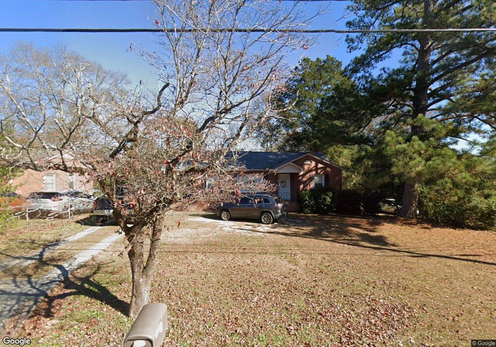
2913 W Britt David Rd Columbus, GA 31909
North Columbus NeighborhoodEstimated Value: $129,000 - $169,000
2
Beds
2
Baths
1,038
Sq Ft
$138/Sq Ft
Est. Value
About This Home
This home is located at 2913 W Britt David Rd, Columbus, GA 31909 and is currently estimated at $143,283, approximately $138 per square foot. 2913 W Britt David Rd is a home located in Muscogee County with nearby schools including Allen Elementary School, Arnold Middle School, and Jordan Vocational High School.
Ownership History
Date
Name
Owned For
Owner Type
Purchase Details
Closed on
Mar 13, 2009
Sold by
Holton Billye V Grubb
Bought by
Harmon Michael P
Current Estimated Value
Home Financials for this Owner
Home Financials are based on the most recent Mortgage that was taken out on this home.
Original Mortgage
$72,463
Outstanding Balance
$46,101
Interest Rate
5.14%
Mortgage Type
FHA
Estimated Equity
$97,182
Purchase Details
Closed on
Apr 30, 2008
Sold by
Turner Richard E
Bought by
Holton Billye V Grubb
Purchase Details
Closed on
Mar 15, 2008
Sold by
Jones Jo Ann
Bought by
Turner Richard E
Purchase Details
Closed on
Mar 4, 2008
Sold by
Columbus Bank & Trust Co
Bought by
Cline Raymond and Cline T
Create a Home Valuation Report for This Property
The Home Valuation Report is an in-depth analysis detailing your home's value as well as a comparison with similar homes in the area
Home Values in the Area
Average Home Value in this Area
Purchase History
| Date | Buyer | Sale Price | Title Company |
|---|---|---|---|
| Harmon Michael P | $73,800 | None Available | |
| Holton Billye V Grubb | $112,000 | None Available | |
| Turner Richard E | $51,600 | None Available | |
| Cline Raymond | -- | None Available |
Source: Public Records
Mortgage History
| Date | Status | Borrower | Loan Amount |
|---|---|---|---|
| Open | Harmon Michael P | $72,463 |
Source: Public Records
Tax History
| Year | Tax Paid | Tax Assessment Tax Assessment Total Assessment is a certain percentage of the fair market value that is determined by local assessors to be the total taxable value of land and additions on the property. | Land | Improvement |
|---|---|---|---|---|
| 2025 | $1,246 | $36,164 | $8,384 | $27,780 |
| 2024 | $1,245 | $36,164 | $8,384 | $27,780 |
| 2023 | $558 | $36,164 | $8,384 | $27,780 |
| 2022 | $1,298 | $30,792 | $8,384 | $22,408 |
| 2021 | $1,291 | $32,288 | $8,384 | $23,904 |
| 2020 | $1,291 | $32,288 | $8,384 | $23,904 |
| 2019 | $1,297 | $32,288 | $8,384 | $23,904 |
| 2018 | $1,297 | $32,288 | $8,384 | $23,904 |
| 2017 | $1,303 | $32,288 | $8,384 | $23,904 |
| 2016 | $1,309 | $45,007 | $4,306 | $40,701 |
| 2015 | $1,311 | $45,007 | $4,306 | $40,701 |
| 2014 | $1,285 | $44,329 | $4,306 | $40,023 |
| 2013 | -- | $44,329 | $4,306 | $40,023 |
Source: Public Records
Map
Nearby Homes
- 3091 Mustang Dr
- 2924 Beech St
- 5724 Sanford Ave
- 3121 Bellanca St
- 5829 Ventura Dr
- 3308 Mustang Dr
- 2528 Lorraine St
- 3342 Windermere St
- 2516 Lorraine St
- 3411 Tewson Dr
- 2977 Blanchard Place
- 6321 Blanchard Ct
- 5502 Southlea Ln
- 2325 Coventry Dr
- 3325 N Quay Dr
- 6002 Canterbury Dr
- 5239 23rd Ave
- 5235 23rd Ave
- 5224 23rd Ave
- 3710 Winkfield Place
- 2907 W Britt David Rd
- 2919 W Britt David Rd
- 2901 W Britt David Rd
- 2927 W Britt David Rd
- 5519 Perry Ave
- 5525 Perry Ave
- 5513 Perry Ave
- 2899 W Britt David Rd
- 5529 Perry Ave
- 2909 Piper St
- 2935 W Britt David Rd
- 2895 W Britt David Rd
- 5503 Perry Ave
- 5533 Perry Ave
- 2891 W Britt David Rd
- 5524 Perry Ave
- 5516 Perry Ave
- 5539 Perry Ave
- 5510 Perry Ave
- 2900 Piper St
Your Personal Tour Guide
Ask me questions while you tour the home.