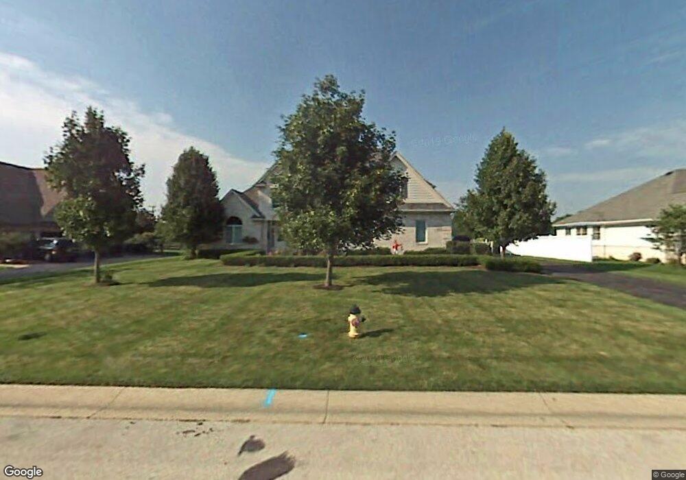
29132 Belmont Farm Rd Perrysburg, OH 43551
Belmont Farms NeighborhoodEstimated Value: $499,000 - $531,000
4
Beds
4
Baths
3,314
Sq Ft
$156/Sq Ft
Est. Value
About This Home
This home is located at 29132 Belmont Farm Rd, Perrysburg, OH 43551 and is currently estimated at $518,281, approximately $156 per square foot. 29132 Belmont Farm Rd is a home located in Wood County with nearby schools including Rossford Elementary School, Rossford Junior High School, and Rossford High School.
Ownership History
Date
Name
Owned For
Owner Type
Purchase Details
Closed on
Jun 5, 2017
Sold by
King Marion L and King Thomas R
Bought by
King Marion L
Current Estimated Value
Purchase Details
Closed on
Jun 17, 2002
Sold by
Burrer Wayne C and Burrer Gayle A
Bought by
King Thomas R and King Marion L
Purchase Details
Closed on
Aug 17, 1999
Sold by
Port Lawrence Title & Trust Co Trustee
Bought by
Burrer Wayne C and Burrer Gayle A
Purchase Details
Closed on
Jan 1, 1990
Bought by
Port Lawrence Title
Create a Home Valuation Report for This Property
The Home Valuation Report is an in-depth analysis detailing your home's value as well as a comparison with similar homes in the area
Home Values in the Area
Average Home Value in this Area
Purchase History
| Date | Buyer | Sale Price | Title Company |
|---|---|---|---|
| King Marion L | -- | None Available | |
| King Thomas R | $345,000 | Northwest Title Agency | |
| Burrer Wayne C | $50,000 | -- | |
| Port Lawrence Title | -- | -- |
Source: Public Records
Tax History Compared to Growth
Tax History
| Year | Tax Paid | Tax Assessment Tax Assessment Total Assessment is a certain percentage of the fair market value that is determined by local assessors to be the total taxable value of land and additions on the property. | Land | Improvement |
|---|---|---|---|---|
| 2024 | $7,405 | $141,050 | $24,115 | $116,935 |
| 2023 | $7,405 | $141,060 | $24,120 | $116,940 |
| 2021 | $7,379 | $115,360 | $21,000 | $94,360 |
| 2020 | $7,433 | $115,360 | $21,000 | $94,360 |
| 2019 | $7,266 | $106,790 | $21,000 | $85,790 |
| 2018 | $7,266 | $106,790 | $21,000 | $85,790 |
| 2017 | $7,066 | $106,790 | $21,000 | $85,790 |
| 2016 | $5,891 | $87,290 | $21,000 | $66,290 |
| 2015 | $5,891 | $87,290 | $21,000 | $66,290 |
| 2014 | $4,550 | $87,290 | $21,000 | $66,290 |
| 2013 | $4,793 | $87,290 | $21,000 | $66,290 |
Source: Public Records
Map
Nearby Homes
- 9886 Ford Rd Unit 9886
- 9627 Sheffield Rd
- 9414 Sheffield Rd
- 9504 Sheffield Rd
- 9853 Mandell Rd
- 28902 Bates Rd
- 30039 Morningside Dr
- 11055 Riverbend Ct E
- 29964 Zachary Ln Unit 28
- 29918 Zachary Ln Unit 12
- 717 W Ironwood Dr
- 727 W Ironwood Dr
- 725 W Ironwood Dr
- 721 W Ironwood Dr
- 11131 Riverbend Ct W Unit 11131
- 28542 Simmons Rd
- 10154 Avenue Rd
- 30332 Jacqueline Place
- 28741 White Rd
- 1269 Grassy Ln
- 29150 Belmont Farm Rd
- 29114 Belmont Farm Rd
- 29168 Belmont Farm Rd
- 29147 Belmont Farm Rd
- 29096 Belmont Farm Rd
- 29099 Belmont Farm Rd
- 29169 Belmont Farm Rd
- 29078 Belmont Farm Rd
- 29015 Belmont Farm Rd
- 29186 Belmont Farm Rd
- 9884 Ford Rd Unit 9884
- 9882 Ford Rd Unit 9882
- 9880 Ford Rd Unit 9880
- 9878 Ford Rd Unit 9878
- 9876 Ford Rd
- 9874 Ford Rd
- 9872 Ford Rd Unit 9872
- 9870 Ford Rd
- 9866 Ford Rd Unit 9866
- 9864 Ford Rd Unit 9864