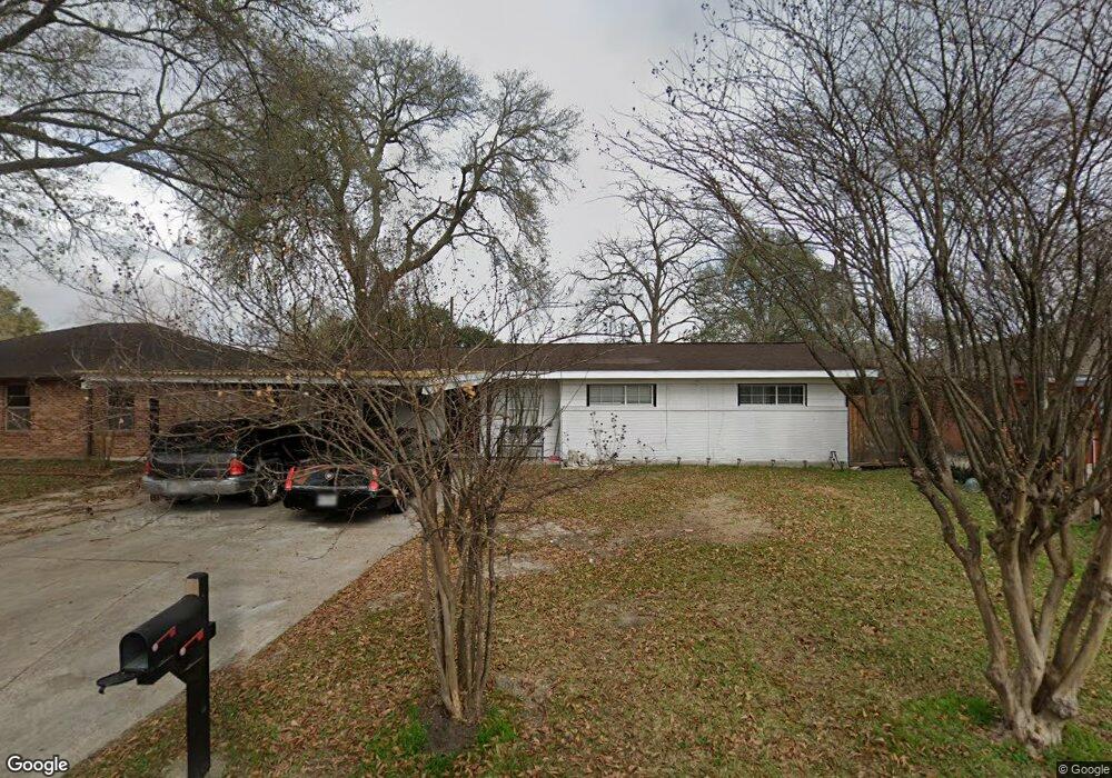
2915 Barksdale Dr Houston, TX 77093
Eastex-Jensen NeighborhoodEstimated Value: $152,121 - $178,000
3
Beds
1
Bath
1,333
Sq Ft
$122/Sq Ft
Est. Value
About This Home
This home is located at 2915 Barksdale Dr, Houston, TX 77093 and is currently estimated at $162,030, approximately $121 per square foot. 2915 Barksdale Dr is a home located in Harris County with nearby schools including Scarborough Elementary School, Patrick Henry Middle School, and Sam Houston Math, Science & Technology Center.
Ownership History
Date
Name
Owned For
Owner Type
Purchase Details
Closed on
Apr 16, 2009
Sold by
Diaz Luis F and Diaz Deysi D
Bought by
Cortez Maria E
Current Estimated Value
Home Financials for this Owner
Home Financials are based on the most recent Mortgage that was taken out on this home.
Original Mortgage
$78,059
Outstanding Balance
$50,135
Interest Rate
5.24%
Mortgage Type
FHA
Estimated Equity
$111,895
Purchase Details
Closed on
Dec 29, 2005
Sold by
Garcia Sandra
Bought by
Diaz Luis F and Diaz Deysi D
Purchase Details
Closed on
Jun 12, 2002
Sold by
Garcia Juana J
Bought by
Garcia Sandra
Create a Home Valuation Report for This Property
The Home Valuation Report is an in-depth analysis detailing your home's value as well as a comparison with similar homes in the area
Home Values in the Area
Average Home Value in this Area
Purchase History
| Date | Buyer | Sale Price | Title Company |
|---|---|---|---|
| Cortez Maria E | -- | First American Title | |
| Diaz Luis F | -- | First American Title | |
| Garcia Sandra | -- | -- |
Source: Public Records
Mortgage History
| Date | Status | Borrower | Loan Amount |
|---|---|---|---|
| Open | Cortez Maria E | $78,059 |
Source: Public Records
Tax History Compared to Growth
Tax History
| Year | Tax Paid | Tax Assessment Tax Assessment Total Assessment is a certain percentage of the fair market value that is determined by local assessors to be the total taxable value of land and additions on the property. | Land | Improvement |
|---|---|---|---|---|
| 2025 | $2,732 | $139,443 | $50,369 | $89,074 |
| 2024 | $2,732 | $130,587 | $41,513 | $89,074 |
| 2023 | $2,732 | $131,226 | $41,513 | $89,713 |
| 2022 | $2,477 | $112,481 | $27,675 | $84,806 |
| 2021 | $2,041 | $87,576 | $17,989 | $69,587 |
| 2020 | $2,019 | $83,380 | $17,989 | $65,391 |
| 2019 | $1,948 | $76,999 | $15,221 | $61,778 |
| 2018 | $1,486 | $58,741 | $15,221 | $43,520 |
| 2017 | $1,485 | $58,741 | $15,221 | $43,520 |
| 2016 | $1,371 | $54,203 | $15,221 | $38,982 |
| 2015 | $1,483 | $54,203 | $15,221 | $38,982 |
| 2014 | $1,483 | $57,706 | $15,221 | $42,485 |
Source: Public Records
Map
Nearby Homes
- 1728 Little York Rd
- 1904 Little York Rd
- 2636 Lone Oak Rd
- 2629 Kowis St
- 2817 Cromwell St
- 4918 Langley Rd
- 3418 Hopper Rd
- 2315 Langley Rd
- 3804 Cedar Hill Ln
- 2332 Margaret St
- 3214 Brea Crest St
- 2415 Goodloe St
- 2915 Brea Crest St
- 2311 Warwick Rd
- 2237 Cromwell St
- 2152 William Tell St
- 2122 Kowis St
- 3202 Parker Rd
- 2326 Sunny Dr
- 11716 Innsbury Dr
- 2919 Barksdale Dr
- 2911 Barksdale Dr
- 2916 Trenton Rd
- 2912 Trenton Rd
- 2923 Barksdale Dr
- 2907 Barksdale Dr
- 2920 Trenton Rd
- 2908 Trenton Rd
- 2916 Barksdale Dr
- 2920 Barksdale Dr
- 2912 Barksdale Dr
- 2924 Trenton Rd
- 2927 Barksdale Dr
- 2924 Barksdale Dr
- 2908 Barksdale Dr
- 2928 Barksdale Dr
- 2928 Trenton Rd
- 2915 Trenton Rd
- 2911 Trenton Rd
- 2932 Barksdale Dr