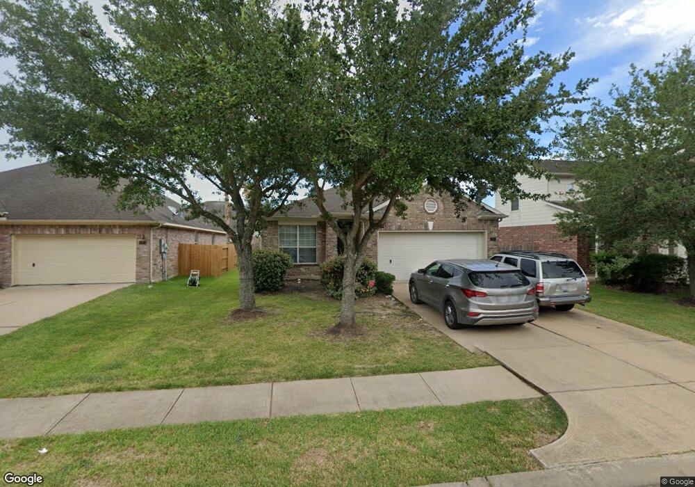
2915 Laurel Brook Ln Pearland, TX 77584
Shadow Creek Ranch NeighborhoodEstimated Value: $301,463 - $317,000
3
Beds
2
Baths
1,651
Sq Ft
$187/Sq Ft
Est. Value
About This Home
This home is located at 2915 Laurel Brook Ln, Pearland, TX 77584 and is currently estimated at $309,116, approximately $187 per square foot. 2915 Laurel Brook Ln is a home located in Brazoria County with nearby schools including Shirley Dill Brothers Elementary School, DR Ronald E McNair Junior High School, and Shadow Creek High School.
Ownership History
Date
Name
Owned For
Owner Type
Purchase Details
Closed on
Jun 24, 2019
Sold by
Wynn Milton T and Foreman Wynn Natalie
Bought by
Ward Jasmine J and Ward Jessie W
Current Estimated Value
Home Financials for this Owner
Home Financials are based on the most recent Mortgage that was taken out on this home.
Original Mortgage
$202,759
Outstanding Balance
$182,545
Interest Rate
5.37%
Mortgage Type
FHA
Estimated Equity
$126,571
Purchase Details
Closed on
Dec 22, 2005
Sold by
Newmark Homes Lp
Bought by
Wynn Milton T
Home Financials for this Owner
Home Financials are based on the most recent Mortgage that was taken out on this home.
Original Mortgage
$108,251
Interest Rate
6.15%
Mortgage Type
Fannie Mae Freddie Mac
Create a Home Valuation Report for This Property
The Home Valuation Report is an in-depth analysis detailing your home's value as well as a comparison with similar homes in the area
Home Values in the Area
Average Home Value in this Area
Purchase History
| Date | Buyer | Sale Price | Title Company |
|---|---|---|---|
| Ward Jasmine J | -- | First American Title | |
| Wynn Milton T | -- | Universal Land Title |
Source: Public Records
Mortgage History
| Date | Status | Borrower | Loan Amount |
|---|---|---|---|
| Open | Ward Jasmine J | $202,759 | |
| Previous Owner | Wynn Milton T | $108,251 |
Source: Public Records
Tax History Compared to Growth
Tax History
| Year | Tax Paid | Tax Assessment Tax Assessment Total Assessment is a certain percentage of the fair market value that is determined by local assessors to be the total taxable value of land and additions on the property. | Land | Improvement |
|---|---|---|---|---|
| 2025 | $4,592 | $265,820 | $36,620 | $229,200 |
| 2023 | $4,592 | $223,663 | $36,620 | $241,820 |
| 2022 | $5,561 | $203,330 | $33,570 | $169,760 |
| 2021 | $6,475 | $192,170 | $30,520 | $161,650 |
| 2020 | $6,937 | $193,980 | $30,520 | $163,460 |
| 2019 | $6,680 | $185,000 | $30,520 | $154,480 |
| 2018 | $6,430 | $179,000 | $30,520 | $148,480 |
| 2017 | $6,406 | $177,130 | $30,520 | $146,610 |
| 2016 | $5,895 | $163,000 | $30,520 | $132,480 |
| 2014 | $4,962 | $134,930 | $30,520 | $104,410 |
Source: Public Records
Map
Nearby Homes
- 12310 Shady Brook Dr
- 12304 Shady Brook Dr
- 3003 Mason Grove Ln
- 12312 Bend Creek Ln
- 12402 Pepper Creek Ln
- 2703 Marble Brook Ln
- 12501 Pepper Creek Ln
- 12503 Pepper Creek Ln
- 12404 Baymeadow Dr
- 2625 Emerald Springs Ct
- 2621 Cypress Springs Dr
- 11610 Cross Spring Dr
- 11812 Sea Shadow Bend
- 11610 Waterwood Ct
- 2710 Sienna Springs Dr
- 12515 Stoney Creek Dr
- 12812 Southport Dr
- 12908 Southern Valley Dr
- 13008 Shoalwater Ln
- 12506 Short Springs Dr
- 2913 Laurel Brook Ln
- 2917 Laurel Brook Ln
- 2911 Laurel Brook Ln
- 2919 Laurel Brook Ln
- 2916 Ashbrook Ln
- 2918 Ashbrook Ln
- 2914 Ashbrook Ln
- 2912 Ashbrook Ln
- 2920 Ashbrook Ln
- 2909 Laurel Brook Ln
- 2921 Laurel Brook Ln
- 2916 Laurel Brook Ln
- 2914 Laurel Brook Ln
- 2918 Laurel Brook Ln
- 2920 Laurel Brook Ln
- 2912 Laurel Brook Ln
- 2922 Ashbrook Ln
- 2910 Ashbrook Ln
- 2907 Laurel Brook Ln
- 2923 Laurel Brook Ln