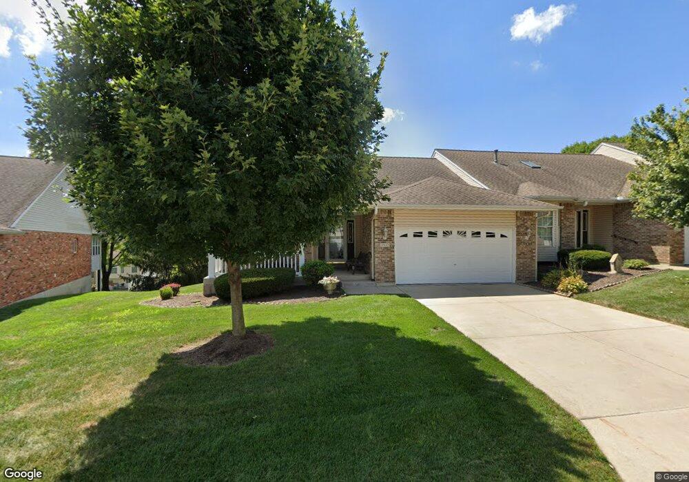
2915 Mac Arthur Dr Saint Charles, MO 63301
Old Town Saint Charles NeighborhoodEstimated Value: $325,837 - $353,000
2
Beds
3
Baths
1,521
Sq Ft
$223/Sq Ft
Est. Value
About This Home
This home is located at 2915 Mac Arthur Dr, Saint Charles, MO 63301 and is currently estimated at $338,709, approximately $222 per square foot. 2915 Mac Arthur Dr is a home located in St. Charles County with nearby schools including Harris Elementary School, Jefferson Intermediate School, and Hardin Middle School.
Ownership History
Date
Name
Owned For
Owner Type
Purchase Details
Closed on
Dec 20, 2005
Sold by
Mallinckrodt Delores K and Mallinckrodt William H
Bought by
Mallinckrodt Delores K
Current Estimated Value
Purchase Details
Closed on
Aug 6, 2004
Sold by
Helm Lowell E and Helm Lillian L
Bought by
William H & Delores K Mallinckrodt Trust
Purchase Details
Closed on
Jul 8, 1999
Sold by
Greater Midwest Builders Ltd
Bought by
Helm Lowell E and Helm Lilliam L
Create a Home Valuation Report for This Property
The Home Valuation Report is an in-depth analysis detailing your home's value as well as a comparison with similar homes in the area
Home Values in the Area
Average Home Value in this Area
Purchase History
| Date | Buyer | Sale Price | Title Company |
|---|---|---|---|
| Mallinckrodt Delores K | -- | None Available | |
| William H & Delores K Mallinckrodt Trust | -- | Davis Title Co | |
| Helm Lowell E | -- | -- |
Source: Public Records
Tax History
| Year | Tax Paid | Tax Assessment Tax Assessment Total Assessment is a certain percentage of the fair market value that is determined by local assessors to be the total taxable value of land and additions on the property. | Land | Improvement |
|---|---|---|---|---|
| 2025 | $3,501 | $60,189 | -- | -- |
| 2023 | $3,495 | $54,574 | $0 | $0 |
| 2022 | $3,116 | $45,348 | $0 | $0 |
| 2021 | $3,120 | $45,348 | $0 | $0 |
| 2020 | $3,161 | $44,182 | $0 | $0 |
| 2019 | $3,134 | $44,182 | $0 | $0 |
| 2018 | $3,022 | $40,510 | $0 | $0 |
| 2017 | $2,981 | $40,510 | $0 | $0 |
| 2016 | $2,765 | $36,182 | $0 | $0 |
| 2015 | $2,760 | $36,182 | $0 | $0 |
| 2014 | $2,761 | $35,717 | $0 | $0 |
Source: Public Records
Map
Nearby Homes
- 3465 Foxborough Cir
- 3508 Truman Terrace Dr Unit 55
- 3430 Riverchase Pkwy
- 3429 Riverchase Pkwy
- 3051 Saint Daphne Dr
- 3079 Shady Oak Dr Unit 15B
- 225 Letham Ct
- 3407 Highgate Ln
- 450 Benton Dr Unit A
- 450 Benton Dr Unit D
- 430 Benton Dr Unit C
- 480 Benton Dr Unit K
- 420 Benton Dr Unit G
- 420 Benton Dr Unit K
- 3031 Bluffwood Dr
- 410 Benton Dr Unit L
- 2605 Kelsey Ln
- 2965 Landau Ct
- 3321 Clemens Dr
- 2876 Danube Way
- 2917 Mac Arthur Dr
- 2911 Mac Arthur Dr
- 2919 Mac Arthur Dr
- 3500 Truman Terrace Dr
- 2909 Mac Arthur Dr
- 3502 Truman Terrace Dr
- 2910 Mac Arthur Dr
- 2914 Mac Arthur Dr
- 2912 Mac Arthur Dr
- 3506 Truman Terrace Dr
- 3506 Truman Terrace Dr Unit 56
- 2905 Mac Arthur Dr
- 3508 Truman Terrace Dr
- 2904 Mac Arthur Dr
- 3510 Truman Terrace Dr
- 3477 Truman Terrace Dr
- 2903 Mac Arthur Dr
- 2903 Mac Arthur Dr Unit 49
- 3481 Truman Terrace Dr
- 3475 Truman Terrace Dr
Your Personal Tour Guide
Ask me questions while you tour the home.