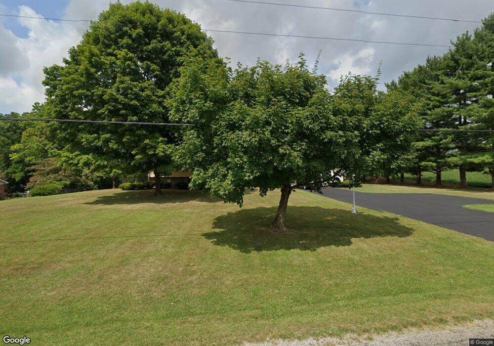
2915 Stringtown Rd NW Lancaster, OH 43130
Estimated Value: $419,000 - $533,000
4
Beds
3
Baths
1,783
Sq Ft
$268/Sq Ft
Est. Value
About This Home
This home is located at 2915 Stringtown Rd NW, Lancaster, OH 43130 and is currently estimated at $478,056, approximately $268 per square foot. 2915 Stringtown Rd NW is a home located in Fairfield County with nearby schools including Bloom Carroll Primary School, Bloom Carroll Intermediate School, and Bloom-Carroll Middle School.
Ownership History
Date
Name
Owned For
Owner Type
Purchase Details
Closed on
Dec 14, 2006
Sold by
Hatmaker Jerry Roger and Hatmaker Jerry R
Bought by
Hatmaker Jerry Roger and Hatmaker Elizabeth Marie
Current Estimated Value
Purchase Details
Closed on
Oct 17, 1994
Sold by
Hurlburt H Douglas
Bought by
Hatmaker Jerry R
Home Financials for this Owner
Home Financials are based on the most recent Mortgage that was taken out on this home.
Original Mortgage
$105,000
Interest Rate
8.55%
Mortgage Type
New Conventional
Create a Home Valuation Report for This Property
The Home Valuation Report is an in-depth analysis detailing your home's value as well as a comparison with similar homes in the area
Home Values in the Area
Average Home Value in this Area
Purchase History
| Date | Buyer | Sale Price | Title Company |
|---|---|---|---|
| Hatmaker Jerry Roger | -- | None Available | |
| Hatmaker Jerry R | $220,000 | -- |
Source: Public Records
Mortgage History
| Date | Status | Borrower | Loan Amount |
|---|---|---|---|
| Closed | Hatmaker Jerry R | $105,000 |
Source: Public Records
Tax History Compared to Growth
Tax History
| Year | Tax Paid | Tax Assessment Tax Assessment Total Assessment is a certain percentage of the fair market value that is determined by local assessors to be the total taxable value of land and additions on the property. | Land | Improvement |
|---|---|---|---|---|
| 2024 | $9,301 | $115,250 | $20,480 | $94,770 |
| 2023 | $5,031 | $115,250 | $20,480 | $94,770 |
| 2022 | $5,067 | $115,250 | $20,480 | $94,770 |
| 2021 | $3,910 | $87,220 | $17,070 | $70,150 |
| 2020 | $3,957 | $87,220 | $17,070 | $70,150 |
| 2019 | $3,973 | $87,220 | $17,070 | $70,150 |
| 2018 | $3,146 | $64,220 | $12,880 | $51,340 |
| 2017 | $2,952 | $70,930 | $12,880 | $58,050 |
| 2016 | $2,863 | $70,930 | $12,880 | $58,050 |
| 2015 | $2,658 | $64,100 | $12,880 | $51,220 |
| 2014 | $2,540 | $64,100 | $12,880 | $51,220 |
| 2013 | $2,540 | $64,100 | $12,880 | $51,220 |
Source: Public Records
Map
Nearby Homes
- 2865 Stringtown Rd NW
- 0 Coonpath Rd NW Unit Tract 4 224028093
- 0 Coonpath Rd NW Unit Tract 7 224028097
- 465 Ginder Rd NW
- 1080 Coonpath Rd NW
- 0 Tschopp Rd NE Unit Lot 17 225027320
- 0 Tschopp Rd NE Unit Lot 33 225027324
- 626 Rainbow Dr NW
- 173 Lakeview Dr NE
- 2149 Pleasantview Dr NE
- 0 Fremar Rd NE Unit Lot1 225007256
- 2195 William T Cir
- 0 Stringtown Rd NW
- 0 Marquette Dr NE Unit Lot 16 225027323
- 0 Marquette Dr NE Unit Lot 4 225007276
- 1801 Pleasantview Dr NE
- 1916 Country Place
- 1470 Hillbrook Dr NE
- 4345 Lancaster Kirkersville Rd NW
- 1750 Coonpath Rd NE Unit Tract 5
- 2873 Stringtown Rd NW
- 2958 Coonpath Rd NE
- 2890 Stringtown Rd NE
- 2 Coonpath Rd NE
- 1 Coonpath Rd NE
- 3 Coonpath Rd NE
- 4 Coonpath Rd NE
- 55 Coonpath Rd NE
- 55 Coonpath Rd NE
- 0 Coonpath Rd NW
- 0 Coonpath Rd NW Unit 2623828
- 0 Coonpath Rd NW Unit 2447344
- 0 Coonpath Rd NW Unit 2432775
- 0 Coonpath Rd NW Unit 2131582
- 0 Coonpath Rd NW Unit 7 9707259
- 0 Coonpath Rd NW Unit 31938
- 0 Coonpath Rd NW Unit 213032705
- 2850 Stringtown Rd NE
- 20 Coonpath Rd NE
- 50 Coonpath Rd NW
