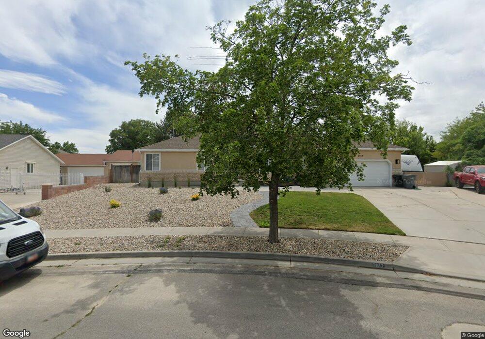
2917 Quintail Ln South Jordan, UT 84095
Estimated Value: $681,000 - $718,741
5
Beds
3
Baths
1,891
Sq Ft
$371/Sq Ft
Est. Value
About This Home
This home is located at 2917 Quintail Ln, South Jordan, UT 84095 and is currently estimated at $701,185, approximately $370 per square foot. 2917 Quintail Ln is a home located in Salt Lake County with nearby schools including Jordan Ridge School, South Jordan Middle School, and Hawthorn Academy.
Ownership History
Date
Name
Owned For
Owner Type
Purchase Details
Closed on
Sep 6, 2011
Sold by
Petrovich Jed Wayne
Bought by
Petrovich Jed Wayne and Petrovich Crystal
Current Estimated Value
Home Financials for this Owner
Home Financials are based on the most recent Mortgage that was taken out on this home.
Original Mortgage
$222,000
Outstanding Balance
$153,612
Interest Rate
4.48%
Mortgage Type
New Conventional
Estimated Equity
$547,573
Purchase Details
Closed on
Jun 30, 2010
Sold by
Folland Richard D
Bought by
Petrovich Jed Wayne
Home Financials for this Owner
Home Financials are based on the most recent Mortgage that was taken out on this home.
Original Mortgage
$220,000
Interest Rate
4.82%
Mortgage Type
New Conventional
Purchase Details
Closed on
Jun 29, 2010
Sold by
Petrovich Jed Wayne
Bought by
Petrovich Jed Wayne and Petrovich Crystal
Home Financials for this Owner
Home Financials are based on the most recent Mortgage that was taken out on this home.
Original Mortgage
$220,000
Interest Rate
4.82%
Mortgage Type
New Conventional
Purchase Details
Closed on
Aug 20, 1998
Sold by
Folland Richard D
Bought by
Folland Richard D
Home Financials for this Owner
Home Financials are based on the most recent Mortgage that was taken out on this home.
Original Mortgage
$144,500
Interest Rate
6.88%
Purchase Details
Closed on
Apr 29, 1997
Sold by
Jeffrey S Osborn Family Ltd Partnership
Bought by
Folland Richard D
Home Financials for this Owner
Home Financials are based on the most recent Mortgage that was taken out on this home.
Original Mortgage
$140,000
Interest Rate
7.96%
Purchase Details
Closed on
Jun 1, 1994
Sold by
Osborn John D and Osborn Jeffrey S
Bought by
Jeffrey S Osborn Family Ltd Partnership
Home Financials for this Owner
Home Financials are based on the most recent Mortgage that was taken out on this home.
Original Mortgage
$135,900
Interest Rate
8.53%
Create a Home Valuation Report for This Property
The Home Valuation Report is an in-depth analysis detailing your home's value as well as a comparison with similar homes in the area
Home Values in the Area
Average Home Value in this Area
Purchase History
| Date | Buyer | Sale Price | Title Company |
|---|---|---|---|
| Petrovich Jed Wayne | -- | Backman Title Services | |
| Petrovich Jed Wayne | -- | Backman Title Services | |
| Petrovich Jed Wayne | -- | First American Title | |
| Petrovich Jed Wayne | -- | Surety Title | |
| Folland Richard D | -- | -- | |
| Folland Richard D | -- | -- | |
| Jeffrey S Osborn Family Ltd Partnership | -- | -- | |
| Osborn John D | -- | -- |
Source: Public Records
Mortgage History
| Date | Status | Borrower | Loan Amount |
|---|---|---|---|
| Open | Petrovich Jed Wayne | $222,000 | |
| Closed | Petrovich Jed Wayne | $220,000 | |
| Previous Owner | Folland Richard D | $144,500 | |
| Previous Owner | Folland Richard D | $140,000 | |
| Previous Owner | Osborn John D | $135,900 |
Source: Public Records
Tax History Compared to Growth
Tax History
| Year | Tax Paid | Tax Assessment Tax Assessment Total Assessment is a certain percentage of the fair market value that is determined by local assessors to be the total taxable value of land and additions on the property. | Land | Improvement |
|---|---|---|---|---|
| 2025 | $3,226 | $648,900 | $206,700 | $442,200 |
| 2024 | $3,226 | $612,500 | $191,800 | $420,700 |
| 2023 | $3,309 | $592,800 | $186,300 | $406,500 |
| 2022 | $3,437 | $603,400 | $182,700 | $420,700 |
| 2021 | $2,837 | $457,100 | $139,500 | $317,600 |
| 2020 | $2,724 | $411,400 | $135,100 | $276,300 |
| 2019 | $2,607 | $387,000 | $135,100 | $251,900 |
| 2018 | $2,436 | $359,800 | $135,100 | $224,700 |
| 2017 | $2,355 | $340,900 | $110,500 | $230,400 |
| 2016 | $2,371 | $325,200 | $110,500 | $214,700 |
| 2015 | $2,282 | $304,300 | $112,500 | $191,800 |
| 2014 | $2,122 | $278,100 | $104,100 | $174,000 |
Source: Public Records
Map
Nearby Homes
- 1558 W Banner Dr Unit 805
- 1574 W Banner Dr Unit 743
- 1556 W Banner Dr Unit 806
- 1548 W Banner Dr Unit 809
- 1552 W Banner Dr Unit 807
- 1553 W Banner Dr Unit 844
- 2551 W Winding Way
- 10177 Statesman Place
- 2439 Bridle Oak Dr
- 10320 S 2700 W
- 3256 Star Fire Rd
- 2375 Bonanza Way
- 10339 S Cold Moon Place
- 3352 W 10235 S
- 1967 W 9350 S
- 2246 Country Bend Dr Unit 25
- 3312 W Harvest Grove Way
- 9294 S 2700 W
- 3274 W Harvest Chase Dr
- 10489 S Harvest Glory Dr
- 2917 W Quintail Ln
- 9866 Quail Brook Ln
- 9866 S Quail Brook Ln
- 2893 Quintail Ln
- 2896 W Lincoln Cove
- 2896 Lincoln Cove
- 2904 Quintail Ln
- 2886 Lincoln Cove
- 9897 Congressional Way
- 9897 S Congressional Way
- 9856 Quail Brook Ln
- 9856 S Quail Brook Ln
- 9891 S Congressional Way
- 9891 Congressional Way
- 9901 Congressional Way
- 2871 Quintail Ln
- 9843 Quail Brook Ln
- 2872 Quintail Ln
- 2872 W Quintail Ln
- 9879 Congressional Way