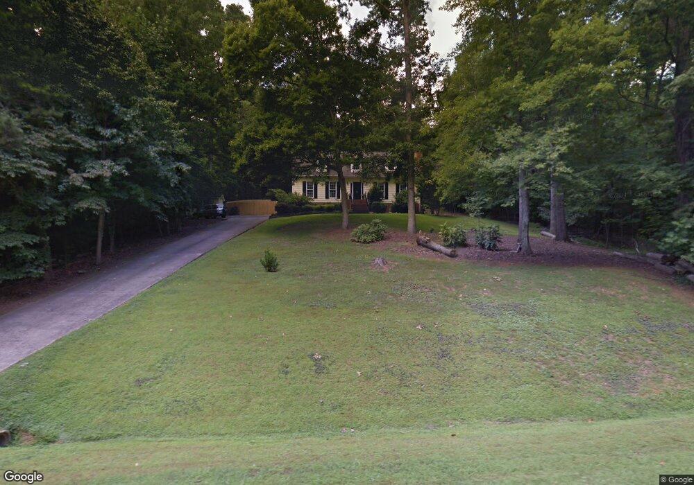
2917 Tavistock Dr Durham, NC 27712
Estimated Value: $459,000 - $529,000
3
Beds
3
Baths
2,573
Sq Ft
$193/Sq Ft
Est. Value
About This Home
This home is located at 2917 Tavistock Dr, Durham, NC 27712 and is currently estimated at $496,141, approximately $192 per square foot. 2917 Tavistock Dr is a home located in Durham County with nearby schools including Eno Valley Elementary, George L Carrington Middle, and Northern High School.
Ownership History
Date
Name
Owned For
Owner Type
Purchase Details
Closed on
May 8, 2023
Sold by
Wilkins Jennifer Bobbitt
Bought by
Jennifer Bobbitt Wilkins Revocable Trust
Current Estimated Value
Purchase Details
Closed on
Apr 25, 2023
Sold by
King William Brinkley and King John Ronald
Bought by
Deer Track Land Corporation
Purchase Details
Closed on
Jul 26, 2022
Sold by
Douglas Davis R
Bought by
County Of Durham
Create a Home Valuation Report for This Property
The Home Valuation Report is an in-depth analysis detailing your home's value as well as a comparison with similar homes in the area
Home Values in the Area
Average Home Value in this Area
Purchase History
| Date | Buyer | Sale Price | Title Company |
|---|---|---|---|
| Jennifer Bobbitt Wilkins Revocable Trust | -- | None Listed On Document | |
| Deer Track Land Corporation | $16,000 | None Listed On Document | |
| Deer Track Land Corporation | $16,000 | None Listed On Document | |
| County Of Durham | $60,000 | None Listed On Document |
Source: Public Records
Tax History Compared to Growth
Tax History
| Year | Tax Paid | Tax Assessment Tax Assessment Total Assessment is a certain percentage of the fair market value that is determined by local assessors to be the total taxable value of land and additions on the property. | Land | Improvement |
|---|---|---|---|---|
| 2025 | $2,393 | $407,881 | $110,625 | $297,256 |
| 2024 | $2,393 | $232,062 | $53,010 | $179,052 |
| 2023 | $2,270 | $232,062 | $53,010 | $179,052 |
| 2022 | $2,179 | $232,062 | $53,010 | $179,052 |
| 2021 | $1,966 | $232,062 | $53,010 | $179,052 |
| 2020 | $1,926 | $232,062 | $53,010 | $179,052 |
| 2019 | $1,926 | $232,062 | $53,010 | $179,052 |
| 2018 | $2,130 | $238,363 | $44,175 | $194,188 |
| 2017 | $2,106 | $238,363 | $44,175 | $194,188 |
| 2016 | $2,017 | $238,363 | $44,175 | $194,188 |
| 2015 | $2,065 | $214,084 | $45,646 | $168,438 |
| 2014 | $2,065 | $214,084 | $45,646 | $168,438 |
Source: Public Records
Map
Nearby Homes
- 5313 Falkirk Dr
- 5807 Craig Rd
- 6208 Craig Rd
- 2609 Heather Glen Rd
- 2418 Mont Haven Dr
- 5802 Lillie Dr
- 5803 Lillie Dr
- 202 Brook Ln
- 727 Soft Tree Ln
- 113 Laurston Ct
- 618 Continental Dr
- 120 Chattleton Ct
- 2423 Bivins Rd
- 2417 Bivins Rd
- 119 November Dr
- 109 November Dr
- 111 November Dr
- 2222 Umstead Rd
- 2020 Stepping Stone Ln Unit 161
- 2100 Stepping Stone Ln Unit 160
- 2911 Tavistock Dr
- 2914 Tavistock Dr
- 2920 Tavistock Dr
- 2926 Tavistock Dr
- 2910 Tavistock Dr
- 2903 Tavistock Dr
- 2903 Tavistock Dr
- 2808 Split Rail Place
- 2927 Tavistock Dr
- 2812 Split Rail Place
- 2928 Tavistock Dr
- 5716 Kith Place
- 2818 Tavistock Dr
- 128 Heather Ridge Ct
- 3003 Tavistock Dr
- 110 Heather Ridge Ct
- 5720 Kith Place
- 134 Heather Ridge Ct
- 2816 Split Rail Place
- 120 Heather Ridge Ct