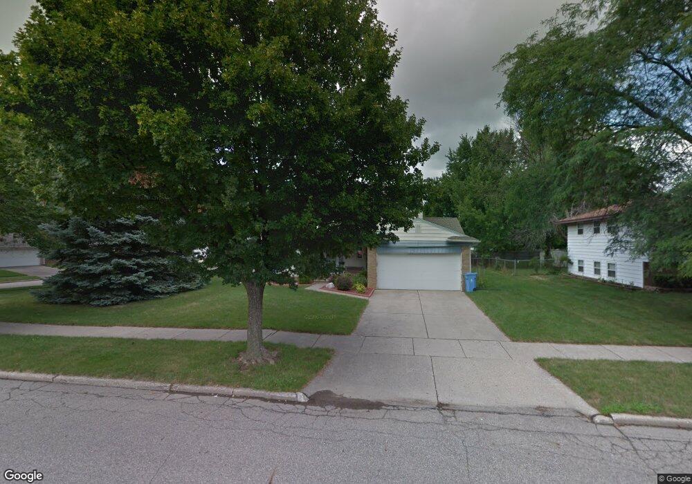
2918 Cumberland Rd Lansing, MI 48906
Northwestside NeighborhoodEstimated Value: $225,221 - $250,000
3
Beds
3
Baths
1,546
Sq Ft
$155/Sq Ft
Est. Value
About This Home
This home is located at 2918 Cumberland Rd, Lansing, MI 48906 and is currently estimated at $239,055, approximately $154 per square foot. 2918 Cumberland Rd is a home located in Ingham County with nearby schools including Cumberland Elementary School, Pattengill Academy, and J.W. Sexton High School.
Ownership History
Date
Name
Owned For
Owner Type
Purchase Details
Closed on
Nov 7, 2006
Sold by
Crips Bryan and Crips Melissa A
Bought by
Crips Bryan and Crips Melissa A
Current Estimated Value
Purchase Details
Closed on
Jun 18, 2004
Sold by
Stevens Benjamin M and Stevens Marilyn H
Bought by
Delleree Melissa and Crips Bryan
Home Financials for this Owner
Home Financials are based on the most recent Mortgage that was taken out on this home.
Original Mortgage
$145,500
Outstanding Balance
$70,505
Interest Rate
5.87%
Mortgage Type
Purchase Money Mortgage
Estimated Equity
$168,550
Purchase Details
Closed on
Sep 12, 2001
Sold by
Mcphilamy Robert E and Mcphilamy Karen R
Bought by
Stevens Benjamin M and Stevens Marilyn H
Home Financials for this Owner
Home Financials are based on the most recent Mortgage that was taken out on this home.
Original Mortgage
$31,000
Interest Rate
7.06%
Mortgage Type
Purchase Money Mortgage
Create a Home Valuation Report for This Property
The Home Valuation Report is an in-depth analysis detailing your home's value as well as a comparison with similar homes in the area
Home Values in the Area
Average Home Value in this Area
Purchase History
| Date | Buyer | Sale Price | Title Company |
|---|---|---|---|
| Crips Bryan | -- | Nta | |
| Delleree Melissa | $150,000 | Trans | |
| Stevens Benjamin M | $130,000 | Metropolitan Title Company |
Source: Public Records
Mortgage History
| Date | Status | Borrower | Loan Amount |
|---|---|---|---|
| Open | Delleree Melissa | $145,500 | |
| Previous Owner | Stevens Benjamin M | $31,000 |
Source: Public Records
Tax History Compared to Growth
Tax History
| Year | Tax Paid | Tax Assessment Tax Assessment Total Assessment is a certain percentage of the fair market value that is determined by local assessors to be the total taxable value of land and additions on the property. | Land | Improvement |
|---|---|---|---|---|
| 2025 | $4,195 | $90,100 | $17,000 | $73,100 |
| 2024 | $34 | $98,900 | $17,000 | $81,900 |
| 2023 | $3,931 | $88,200 | $17,000 | $71,200 |
| 2022 | $3,541 | $77,600 | $14,000 | $63,600 |
| 2021 | $3,467 | $75,100 | $14,300 | $60,800 |
| 2020 | $3,446 | $68,500 | $14,300 | $54,200 |
| 2019 | $3,305 | $65,900 | $14,300 | $51,600 |
| 2018 | $3,095 | $59,900 | $14,300 | $45,600 |
| 2017 | $2,964 | $59,900 | $14,300 | $45,600 |
| 2016 | $2,889 | $53,800 | $14,300 | $39,500 |
| 2015 | $2,889 | $51,700 | $28,657 | $23,043 |
| 2014 | $2,889 | $51,900 | $33,433 | $18,467 |
Source: Public Records
Map
Nearby Homes
- 2400 Beacon Hill Dr
- 2400 Leon Ave
- 2722 Tecumseh River Rd
- 3116 Colchester Rd
- 2316 Barstow Rd
- 2921 Tecumseh River Rd
- 2515 Kuerbitz Dr
- 2524 Newport Dr
- 3314 Sunnylane
- 2601 Newport Dr
- 1649 Boynton Dr
- 1900 Kaplan St
- 2224 Pembroke Rd
- 2220 Delta River Dr
- 3016 Westmont Ave
- 4005 N Grand River Ave
- 3733 Colchester Rd
- 3515 Wilson Ave
- 2111 Delta River Dr
- 3031 Amherst Dr
- 2910 Cumberland Rd
- 2316 Cogswell Dr
- 2301 Cogswell Dr
- 2900 Cumberland Rd
- 2313 Cogswell Dr
- 2324 Cogswell Dr
- 2911 Cumberland Rd
- 2919 Cumberland Rd
- 2319 Cogswell Dr
- 2313 Darby Dr
- 2901 Cumberland Rd
- 2330 Cogswell Dr
- 3010 Cumberland Rd
- 2325 Cogswell Dr
- 2217 Cogswell Dr
- 2208 Cogswell Dr
- 2316 Northwest Ave
- 2211 Darby Dr
- 2324 Northwest Ave