Estimated Value: $331,000 - $353,019
2
Beds
2
Baths
1,333
Sq Ft
$260/Sq Ft
Est. Value
About This Home
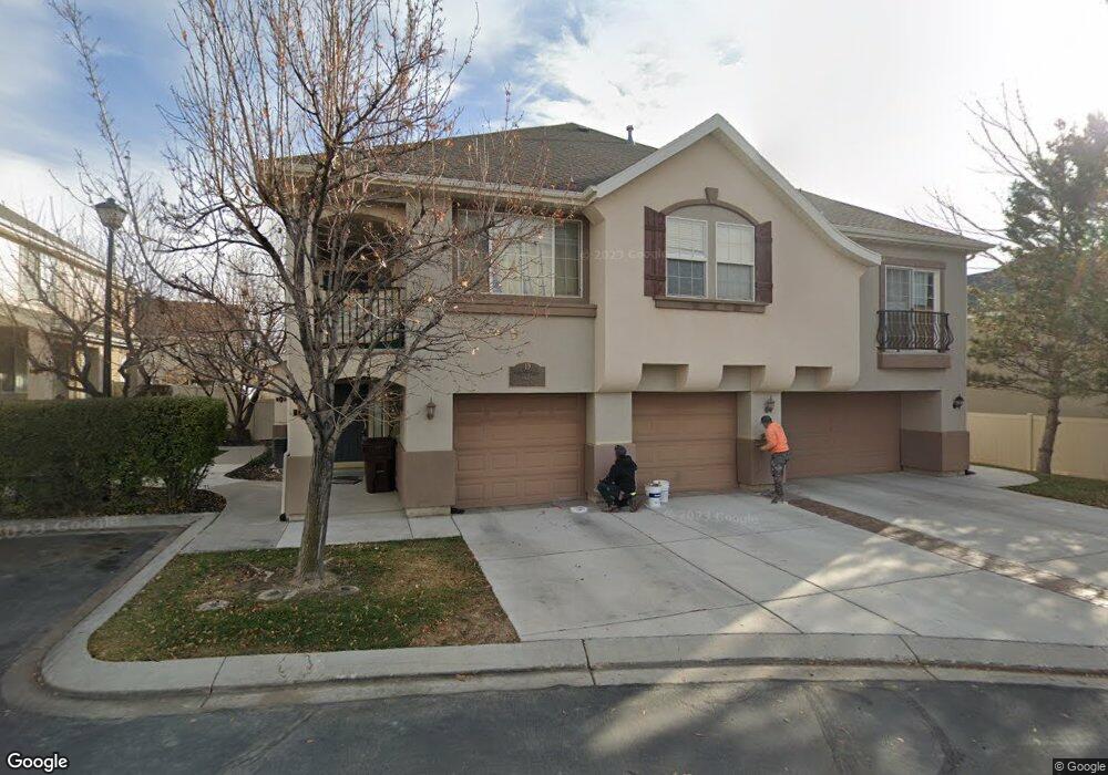
This home is located at 2918 N 1310 W Unit D3, Lehi, UT 84043 and is currently estimated at $346,005, approximately $259 per square foot. 2918 N 1310 W Unit D3 is a home located in Utah County with nearby schools including Fox Hollow Elementary School, Skyridge High School, and Ignite Entrepreneurship Academy.
Ownership History
Date
Name
Owned For
Owner Type
Purchase Details
Closed on
Sep 5, 2024
Sold by
Allred Jim
Bought by
Jimmy K Allred Living Trust and Allred
Current Estimated Value
Purchase Details
Closed on
Sep 14, 2022
Sold by
Stjepan Bzik
Bought by
Allred Jim
Purchase Details
Closed on
May 15, 2017
Sold by
Martin Jeffrey A and Hurst Katherine A
Bought by
Bzik St Jepan
Purchase Details
Closed on
Nov 20, 2006
Sold by
Martin Jeffrey A
Bought by
Martin Jeffrey A and Hurst Katherine A
Home Financials for this Owner
Home Financials are based on the most recent Mortgage that was taken out on this home.
Original Mortgage
$137,200
Interest Rate
6.36%
Mortgage Type
Purchase Money Mortgage
Create a Home Valuation Report for This Property
The Home Valuation Report is an in-depth analysis detailing your home's value as well as a comparison with similar homes in the area
Home Values in the Area
Average Home Value in this Area
Purchase History
| Date | Buyer | Sale Price | Title Company |
|---|---|---|---|
| Jimmy K Allred Living Trust | -- | Pinnacle Title | |
| Allred Jim | -- | North Star Title | |
| Bzik St Jepan | -- | Inwest Title | |
| Martin Jeffrey A | -- | None Available | |
| Martin Jeffrey A | -- | Empire Land Title Company |
Source: Public Records
Mortgage History
| Date | Status | Borrower | Loan Amount |
|---|---|---|---|
| Previous Owner | Martin Jeffrey A | $137,200 |
Source: Public Records
Tax History Compared to Growth
Tax History
| Year | Tax Paid | Tax Assessment Tax Assessment Total Assessment is a certain percentage of the fair market value that is determined by local assessors to be the total taxable value of land and additions on the property. | Land | Improvement |
|---|---|---|---|---|
| 2025 | $1,550 | $184,910 | $37,400 | $298,800 |
| 2024 | $1,550 | $181,390 | $0 | $0 |
| 2023 | $1,454 | $184,690 | $0 | $0 |
| 2022 | $1,335 | $164,505 | $0 | $0 |
| 2021 | $1,226 | $228,300 | $27,400 | $200,900 |
| 2020 | $1,159 | $213,400 | $25,600 | $187,800 |
| 2019 | $1,033 | $197,600 | $22,800 | $174,800 |
| 2018 | $956 | $173,000 | $20,800 | $152,200 |
| 2017 | $898 | $86,350 | $0 | $0 |
| 2016 | $894 | $79,750 | $0 | $0 |
| 2015 | $941 | $79,750 | $0 | $0 |
| 2014 | $888 | $74,800 | $0 | $0 |
Source: Public Records
Map
Nearby Homes
- Rhapsody Plan at Lehi Terrace
- Gallivan Plan at Lehi Terrace
- Concerto Plan at Lehi Terrace
- Grand Plan at Lehi Terrace
- Arietta Plan at Lehi Terrace
- Libby Plan at Lehi Terrace
- Rose Plan at Lehi Terrace
- Capitol Plan at Lehi Terrace
- Metro Plan at Lehi Terrace
- Cantata Plan at Lehi Terrace
- Vieve Plan at Lehi Terrace
- Kilby Plan at Lehi Terrace
- 1179 W 2980 N
- 1167 W 2980 N
- 1155 W 2980 N
- 2946 N 1080 W
- 3080 N 1200 W
- 3130 N Provence Ln Unit K2
- 2687 N 900 W
- 804 W 2700 N
- 2918 N 1310 W Unit D2
- 2918 N 1310 W Unit 1
- 2918 N 1310 W
- 2918 N 1310 W Unit 2
- 2918 N 1310 W Unit D
- 2918 1310 W D3
- 2936 N 1310 W
- 2936 N 1310 W Unit 1
- 2936 N 1310 W Unit C3
- 2936 N 1310 W Unit C2
- 2925 Curtis Ct
- 2895 N Bridalwood Loop Unit 24
- 2917 N Curtis Ct
- 2917 Curtis Ct
- 2889 N Bridalwood Loop Unit 23
- 2889 N Bridalwood Loop
- 1274 W Bridalwood Loop Unit 25
- 1268 W Bridalwood Loop Unit 26
- 1268 W Bridalwood Loop
- 2885 N Bridalwood Loop Unit 22