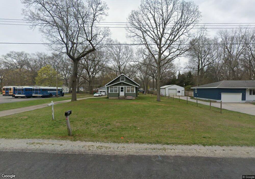
2918 Oak Ln Muskegon, MI 49444
Estimated Value: $147,000 - $224,000
2
Beds
1
Bath
1,020
Sq Ft
$180/Sq Ft
Est. Value
About This Home
This home is located at 2918 Oak Ln, Muskegon, MI 49444 and is currently estimated at $183,436, approximately $179 per square foot. 2918 Oak Ln is a home located in Muskegon County with nearby schools including Fruitport High School, Edgewood Elementary Academy, and Dr. Martin Luther King Academy.
Ownership History
Date
Name
Owned For
Owner Type
Purchase Details
Closed on
Jul 26, 2024
Sold by
Schultz Rollen
Bought by
Schultz Rollen and Schultz Laura
Current Estimated Value
Purchase Details
Closed on
Jul 20, 2011
Sold by
Dial Rodney W
Bought by
Schultz Rollen
Home Financials for this Owner
Home Financials are based on the most recent Mortgage that was taken out on this home.
Original Mortgage
$32,000
Interest Rate
4.52%
Mortgage Type
New Conventional
Create a Home Valuation Report for This Property
The Home Valuation Report is an in-depth analysis detailing your home's value as well as a comparison with similar homes in the area
Home Values in the Area
Average Home Value in this Area
Purchase History
| Date | Buyer | Sale Price | Title Company |
|---|---|---|---|
| Schultz Rollen | -- | None Listed On Document | |
| Schultz Rollen | -- | None Listed On Document | |
| Schultz Rollen | $40,000 | Independent Title Svcs Inc |
Source: Public Records
Mortgage History
| Date | Status | Borrower | Loan Amount |
|---|---|---|---|
| Previous Owner | Schultz Rollen | $32,000 |
Source: Public Records
Tax History Compared to Growth
Tax History
| Year | Tax Paid | Tax Assessment Tax Assessment Total Assessment is a certain percentage of the fair market value that is determined by local assessors to be the total taxable value of land and additions on the property. | Land | Improvement |
|---|---|---|---|---|
| 2025 | $1,872 | $81,500 | $0 | $0 |
| 2024 | $1,510 | $72,500 | $0 | $0 |
| 2023 | $1,443 | $63,900 | $0 | $0 |
| 2022 | $1,652 | $54,400 | $0 | $0 |
| 2021 | $1,603 | $48,100 | $0 | $0 |
| 2020 | $1,584 | $43,000 | $0 | $0 |
| 2019 | $1,555 | $38,400 | $0 | $0 |
| 2018 | $1,519 | $35,900 | $0 | $0 |
| 2017 | $1,487 | $36,200 | $0 | $0 |
| 2016 | $1,110 | $33,400 | $0 | $0 |
| 2015 | -- | $32,300 | $0 | $0 |
| 2014 | -- | $30,300 | $0 | $0 |
| 2013 | -- | $29,300 | $0 | $0 |
Source: Public Records
Map
Nearby Homes
- 1657 E Summit Ave
- 3176 Klug St
- 1510 Canterbury Ave
- 3125 Stratford St
- 1520 Sunbury Ave
- 1442 E Broadway Ave Unit LAND
- 1418 Saskatoon Ave
- 2973 Valk St
- 1312 E Broadway Ave
- 2748 Valk St
- 2982 Mcdermott St
- 2874 Mc Dermott St
- 2871 Bailey St
- 1257 E Sherman Blvd Unit & 2616 Roberts St.
- 2657 Roberts St
- 2338 E Columbia Ave
- 2703 Vulcan St
- 2384 E Columbia Ave
- 3315 Spring Hill Dr
- 2488 E Broadway Ave
- 2934 Oak Ln
- 2948 Oak Ln
- 2923 Oak Ln
- 2883 Vandenberg Rd
- 2909 Vandenberg Rd
- 2899 Vandenberg Rd
- 2927 Vandenberg Rd
- 2895 Vandenberg Rd
- 2951 Oak Ln
- 2895 Oak Ln
- 2968 Oak Ln
- 2875 Vandenberg Rd
- 2951 Vandenberg Rd
- 2865 Vandenberg Rd
- 2875 Oak Ln
- 2969 Oak Ln
- 2855 Vandenberg Rd
- 2855 Oak Ln
- 2900 Kooi St
- 2916 Kooi St