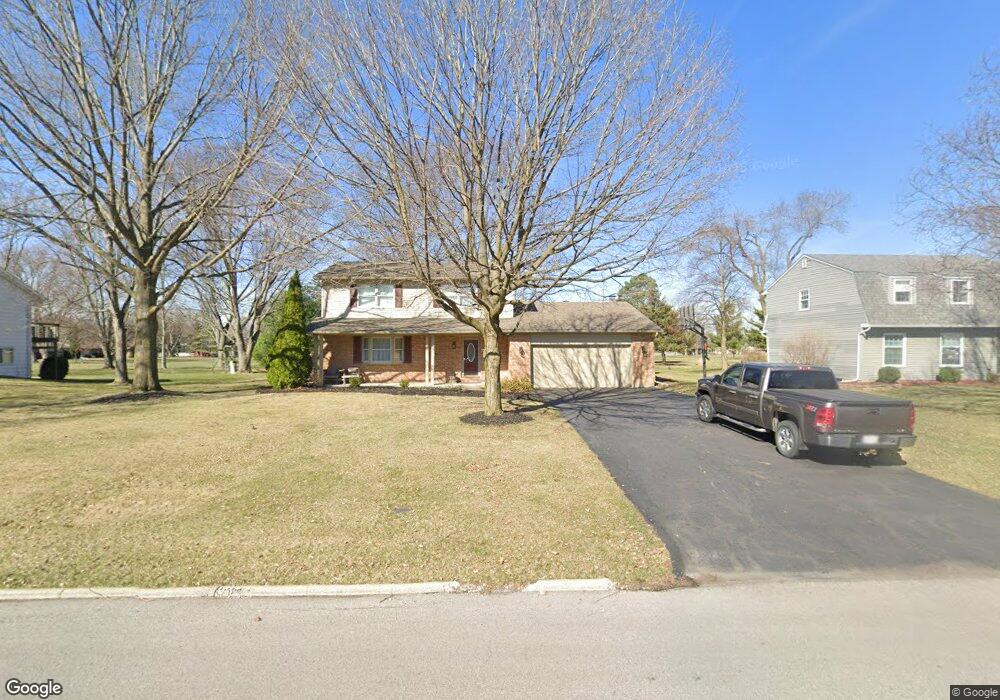
2918 Saint Andrews Dr Findlay, OH 45840
Estimated Value: $298,000 - $335,000
4
Beds
3
Baths
2,068
Sq Ft
$152/Sq Ft
Est. Value
About This Home
This home is located at 2918 Saint Andrews Dr, Findlay, OH 45840 and is currently estimated at $315,223, approximately $152 per square foot. 2918 Saint Andrews Dr is a home located in Hancock County with nearby schools including Liberty-Benton Elementary School, Liberty-Benton Middle School, and Liberty-Benton High School.
Ownership History
Date
Name
Owned For
Owner Type
Purchase Details
Closed on
Aug 9, 2006
Sold by
Rhoton Lois J
Bought by
Lemley Jayne Ann
Current Estimated Value
Purchase Details
Closed on
Apr 27, 1998
Sold by
Brown Paul
Bought by
Lemley Jayne
Create a Home Valuation Report for This Property
The Home Valuation Report is an in-depth analysis detailing your home's value as well as a comparison with similar homes in the area
Home Values in the Area
Average Home Value in this Area
Purchase History
| Date | Buyer | Sale Price | Title Company |
|---|---|---|---|
| Lemley Jayne Ann | $10,666 | None Available | |
| Lemley Jayne Ann | $29,533 | None Available | |
| Lemley Jayne | $149,000 | -- |
Source: Public Records
Tax History Compared to Growth
Tax History
| Year | Tax Paid | Tax Assessment Tax Assessment Total Assessment is a certain percentage of the fair market value that is determined by local assessors to be the total taxable value of land and additions on the property. | Land | Improvement |
|---|---|---|---|---|
| 2024 | $2,784 | $74,880 | $11,740 | $63,140 |
| 2023 | $2,718 | $74,880 | $11,740 | $63,140 |
| 2022 | $2,692 | $74,880 | $11,740 | $63,140 |
| 2021 | $2,458 | $60,360 | $11,710 | $48,650 |
| 2020 | $2,479 | $60,360 | $11,710 | $48,650 |
| 2019 | $2,379 | $60,360 | $11,710 | $48,650 |
| 2018 | $1,878 | $52,590 | $10,180 | $42,410 |
| 2017 | $1,937 | $52,590 | $10,180 | $42,410 |
| 2016 | $2,931 | $53,050 | $10,180 | $42,870 |
| 2015 | $1,870 | $51,030 | $10,180 | $40,850 |
| 2014 | $1,885 | $50,980 | $10,180 | $40,800 |
| 2012 | $1,970 | $50,980 | $10,180 | $40,800 |
Source: Public Records
Map
Nearby Homes
- 3018 Gleneagle Dr
- 3106 Saddlebrook
- 1310 Muirfield Dr
- 1405 Cypress Lake
- 933 Laurel Ln
- 6535 Silver Lake Dr
- 615 Hillcrest Ave
- 3300 Crosshill Dr
- 925 W Melrose Ave
- 506 Hillcrest Ave
- 905 W Melrose Ave
- 643 Edith Ave
- 0 County Road 95 Unit 6097574
- 0 Township Highway 99
- 12325 Township Highway 99
- 0 Allen Township 142
- 126 Hillcrest Ave
- 0 Bushwillow Dr Or Rock Candy Rd Unit Lot 157
- 0 County Road 140
- 0 Rock Candy Rd Or Bushwillow Dr Unit Lot 173
- 2912 Saint Andrews Dr
- 2924 Saint Andrews Dr
- 2906 Saint Andrews Dr
- 2930 Saint Andrews Dr
- 2915 Saint Andrews Dr
- 2927 Saint Andrews Dr
- 2929 St Andrews Dr
- 2907 Saint Andrews Dr
- 1102 Inverness Dr
- 2929 Saint Andrews Dr
- 1112 Inverness Dr
- 2936 Saint Andrews Dr
- 1020 Inverness Dr
- 2939 Saint Andrews Dr
- 1118 Inverness Dr
- 1006 Inverness Dr
- 2940 Saint Andrews Dr
- 1124 Inverness Dr
- 1001 Muirfield Dr
- 1101 Inverness Dr