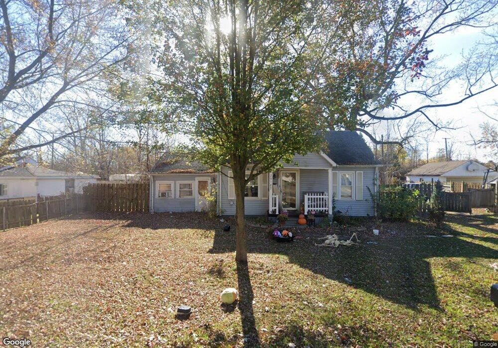
29187 Beverly Rd Romulus, MI 48174
Estimated Value: $89,000 - $137,000
2
Beds
1
Bath
840
Sq Ft
$135/Sq Ft
Est. Value
About This Home
This home is located at 29187 Beverly Rd, Romulus, MI 48174 and is currently estimated at $113,435, approximately $135 per square foot. 29187 Beverly Rd is a home located in Wayne County with nearby schools including Romulus Elementary School, Romulus Middle School, and Romulus Senior High School.
Ownership History
Date
Name
Owned For
Owner Type
Purchase Details
Closed on
May 14, 2008
Sold by
Lemanowicz Paul W
Bought by
Mortgage Electronic Registration Systems
Current Estimated Value
Purchase Details
Closed on
Feb 3, 2006
Sold by
Mills Donald and Mills Sally
Bought by
Lemanowicz Ii Paul W
Purchase Details
Closed on
Jun 20, 2002
Sold by
Ross Dempster A and Ross Gail J
Bought by
Mills Donald
Purchase Details
Closed on
Mar 15, 1997
Sold by
Perone Glenn A
Bought by
Ross Dempster A
Create a Home Valuation Report for This Property
The Home Valuation Report is an in-depth analysis detailing your home's value as well as a comparison with similar homes in the area
Home Values in the Area
Average Home Value in this Area
Purchase History
| Date | Buyer | Sale Price | Title Company |
|---|---|---|---|
| Mortgage Electronic Registration Systems | $95,212 | None Available | |
| Lemanowicz Ii Paul W | $110,000 | Great Lakes Title Of Mi | |
| Mills Donald | $59,900 | -- | |
| Ross Dempster A | $4,000 | Lawyers Title Insurance Corp |
Source: Public Records
Tax History
| Year | Tax Paid | Tax Assessment Tax Assessment Total Assessment is a certain percentage of the fair market value that is determined by local assessors to be the total taxable value of land and additions on the property. | Land | Improvement |
|---|---|---|---|---|
| 2025 | $858 | $46,400 | $0 | $0 |
| 2024 | $862 | $45,900 | $0 | $0 |
| 2023 | $824 | $40,600 | $0 | $0 |
| 2022 | $998 | $38,600 | $0 | $0 |
| 2021 | $960 | $34,100 | $0 | $0 |
| 2020 | $939 | $29,600 | $0 | $0 |
| 2019 | $939 | $25,500 | $0 | $0 |
| 2018 | $596 | $17,000 | $0 | $0 |
| 2017 | $493 | $16,900 | $0 | $0 |
| 2016 | $823 | $17,000 | $0 | $0 |
| 2015 | $1,830 | $18,300 | $0 | $0 |
| 2013 | $2,100 | $22,500 | $0 | $0 |
| 2012 | $587 | $22,100 | $6,100 | $16,000 |
Source: Public Records
Map
Nearby Homes
- 6837 Middlebelt Rd
- 6040 Georgia Unit 225
- 6001 E Maple Unit 86
- 5926 Esther St
- 29120 van Born Rd
- 6005 Frederick St Unit 56
- 28176 Ecorse Rd
- 0 Hanover Blvd
- 29054 Currier Ave
- 28919 Powers St
- 30905 Beverly Rd
- 27620 Newcastle St
- POWERS Powers St
- 4675 Julius Blvd
- 6237 Inkster Rd
- 0 Ecorse Rd Unit 20251029385
- 6851 Merriman Rd
- 29015 York St
- 0 Ecorse Service Rd
- 4331 Bridgeport Ct
- 29169 Beverly Rd
- 29229 Beverly Rd
- 6395 Hyde Park St
- 6405 Middlebelt Rd
- 6384 Hyde Park St
- 6396 Hyde Park St
- 6398 Central St
- Middlebelt Rd
- 6374 Hyde Park St
- 6376 Central St
- 6395 Central St
- 6351 Hyde Park St
- 6483 Middlebelt Rd
- 6354 Central St
- 6350 Hyde Park St
- 6353 Middlebelt Rd
- 6339 Hyde Park St
- 6342 Central St
- 6368 Loraine St
- 6384 Loraine St
Your Personal Tour Guide
Ask me questions while you tour the home.