Estimated Value: $199,000 - $230,000
3
Beds
2
Baths
1,648
Sq Ft
$133/Sq Ft
Est. Value
About This Home
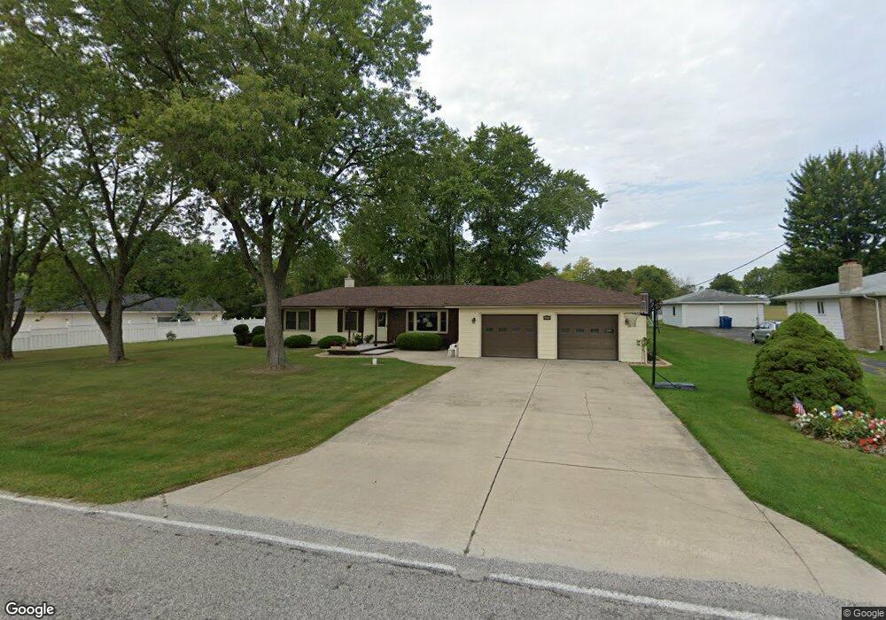
This home is located at 2919 Cr 12-50, Bryan, OH 43506 and is currently estimated at $218,715, approximately $132 per square foot. 2919 Cr 12-50 is a home located in Williams County with nearby schools including Bryan Elementary PK-5, Washington Elementary School, and Bryan Middle School/High School.
Ownership History
Date
Name
Owned For
Owner Type
Purchase Details
Closed on
Aug 3, 2011
Sold by
Headley Thomas Ray and Headley Thomas R
Bought by
Burkholder Jeffrey K and Burkholder Mary E
Current Estimated Value
Home Financials for this Owner
Home Financials are based on the most recent Mortgage that was taken out on this home.
Original Mortgage
$97,200
Outstanding Balance
$67,519
Interest Rate
4.64%
Mortgage Type
New Conventional
Estimated Equity
$151,196
Purchase Details
Closed on
Apr 27, 2001
Sold by
Gullyes Leona M
Bought by
Headley Thomas Ray
Purchase Details
Closed on
Jun 13, 1996
Sold by
Gullyes Harper G Jr And
Bought by
Gullyes Leona M
Purchase Details
Closed on
Jun 1, 1992
Bought by
Gullyes Harper G Jr And
Create a Home Valuation Report for This Property
The Home Valuation Report is an in-depth analysis detailing your home's value as well as a comparison with similar homes in the area
Home Values in the Area
Average Home Value in this Area
Purchase History
| Date | Buyer | Sale Price | Title Company |
|---|---|---|---|
| Burkholder Jeffrey K | $121,500 | None Available | |
| Headley Thomas Ray | $116,500 | -- | |
| Gullyes Leona M | -- | -- | |
| Gullyes Harper G Jr And | $80,000 | -- |
Source: Public Records
Mortgage History
| Date | Status | Borrower | Loan Amount |
|---|---|---|---|
| Open | Burkholder Jeffrey K | $97,200 |
Source: Public Records
Tax History Compared to Growth
Tax History
| Year | Tax Paid | Tax Assessment Tax Assessment Total Assessment is a certain percentage of the fair market value that is determined by local assessors to be the total taxable value of land and additions on the property. | Land | Improvement |
|---|---|---|---|---|
| 2024 | $2,822 | $62,900 | $6,480 | $56,420 |
| 2023 | $2,822 | $50,060 | $6,340 | $43,720 |
| 2022 | $2,495 | $50,060 | $6,340 | $43,720 |
| 2021 | $2,495 | $50,060 | $6,340 | $43,720 |
| 2020 | $3,091 | $43,510 | $5,500 | $38,010 |
| 2019 | $3,077 | $43,510 | $5,500 | $38,010 |
| 2018 | $2,896 | $43,510 | $5,500 | $38,010 |
| 2017 | $2,806 | $38,540 | $5,500 | $33,040 |
| 2016 | $2,719 | $38,540 | $5,500 | $33,040 |
| 2015 | $2,719 | $38,540 | $5,500 | $33,040 |
| 2014 | $2,801 | $38,540 | $5,500 | $33,040 |
| 2013 | $2,809 | $38,540 | $5,500 | $33,040 |
Source: Public Records
Map
Nearby Homes
- 1004 Greystone Dr
- 107 Deerfield Cir
- 917 Wesley Ave
- 726 Crestview Ave
- 311 Connin St
- 118 Townline Rd
- 319 Newdale Dr
- 1006 Fairlawn St
- 630 Center Ridge Rd
- 702 Center St
- 000 Spring Meadow Ln
- 401 Avenue A
- 817 Oakwood Ave
- 826 Parkview Ave
- 000 C R C (East 787)
- 000 C R C (West 828)
- 615 S Portland St
- 723 W High St
- 726 S Lynn St
- 000 N Main St
- 1250 Rays Dr
- 1250 Rays Dr Unit 2919
- 1250 Rays Dr Unit 2855
- 1250 Rays Dr Unit 2833
- 1250 Rays Dr Unit 2771
- 1250 Rays Dr Unit 2051
- 1250 Rays Dr Unit 2969
- 1250 Rays Dr Unit 2945
- 1250 Rays Dr
- 1250 Rays Dr Unit 3895
- 1250 Rays Dr Unit 3961
- 1250 Rays Dr Unit 3693
- 1250 Rays Dr Unit 3739
- 1250 Rays Dr Unit 3683
- 1250 Rays Dr Unit 3619
- 1250 Rays Dr Unit 3573
- 1250 Rays Dr Unit 3543
- 1250 Rays Dr Unit 3411
- 1250 Rays Dr Unit 3341
- 1250 Rays Dr Unit 3207