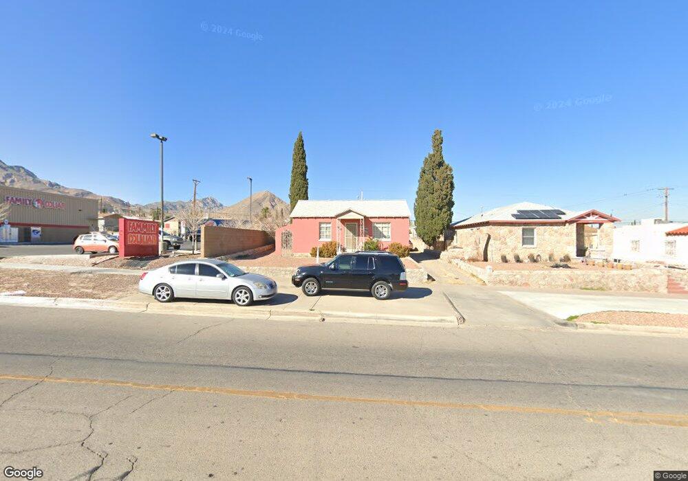
2919 Fort Blvd El Paso, TX 79930
Central NeighborhoodEstimated Value: $181,000 - $221,000
3
Beds
2
Baths
1,425
Sq Ft
$147/Sq Ft
Est. Value
About This Home
This home is located at 2919 Fort Blvd, El Paso, TX 79930 and is currently estimated at $209,653, approximately $147 per square foot. 2919 Fort Blvd is a home located in El Paso County with nearby schools including Rusk Elementary School, Middle School-5 NW Middle, and Austin High School.
Ownership History
Date
Name
Owned For
Owner Type
Purchase Details
Closed on
Jan 31, 2002
Sold by
Bell Alexander and Bell Jamie Rae
Bought by
Martell Alejandro and Martell Gloria I
Current Estimated Value
Home Financials for this Owner
Home Financials are based on the most recent Mortgage that was taken out on this home.
Original Mortgage
$65,482
Outstanding Balance
$27,248
Interest Rate
7.15%
Mortgage Type
FHA
Estimated Equity
$182,405
Purchase Details
Closed on
Jul 1, 1994
Sold by
Seelig Carlos E
Bought by
Bell Alexander and Bell George
Home Financials for this Owner
Home Financials are based on the most recent Mortgage that was taken out on this home.
Original Mortgage
$40,133
Interest Rate
8.52%
Mortgage Type
FHA
Create a Home Valuation Report for This Property
The Home Valuation Report is an in-depth analysis detailing your home's value as well as a comparison with similar homes in the area
Home Values in the Area
Average Home Value in this Area
Purchase History
| Date | Buyer | Sale Price | Title Company |
|---|---|---|---|
| Martell Alejandro | -- | -- | |
| Bell Alexander | -- | -- |
Source: Public Records
Mortgage History
| Date | Status | Borrower | Loan Amount |
|---|---|---|---|
| Open | Martell Alejandro | $65,482 | |
| Previous Owner | Bell Alexander | $40,133 |
Source: Public Records
Tax History Compared to Growth
Tax History
| Year | Tax Paid | Tax Assessment Tax Assessment Total Assessment is a certain percentage of the fair market value that is determined by local assessors to be the total taxable value of land and additions on the property. | Land | Improvement |
|---|---|---|---|---|
| 2025 | $2,792 | $166,612 | -- | -- |
| 2024 | $2,792 | $151,465 | -- | -- |
| 2023 | $2,608 | $137,695 | $0 | $0 |
| 2022 | $3,705 | $125,177 | $0 | $0 |
| 2021 | $3,553 | $127,810 | $15,579 | $112,231 |
| 2020 | $3,180 | $103,452 | $15,579 | $87,873 |
| 2018 | $3,037 | $102,628 | $15,579 | $87,049 |
| 2017 | $2,650 | $94,078 | $15,579 | $78,499 |
| 2016 | $3,103 | $110,156 | $15,579 | $94,577 |
| 2015 | $2,813 | $110,156 | $15,579 | $94,577 |
| 2014 | $2,813 | $111,694 | $15,579 | $96,115 |
Source: Public Records
Map
Nearby Homes
- 3031 Fort Blvd
- 3027 Morehead Ave
- 3125 Hamilton Ave
- 2816 N Piedras St
- 3018 Sacramento Ave
- 2917 Mobile Ave
- 3904 N Piedras St Unit A-B
- 3215 Mobile Ave
- PN-391630 Alabama St
- 3021 Monroe Ave
- 3104 Van Buren Ave
- 3327 Mobile Ave
- PN-258825 Tbd
- 3427 Hamilton Ave
- 3204 Memphis Ave
- 3510 Porter Ave
- 2903 Savannah Ave
- 3009 Savannah Ave
- 2610 Frankfort Ave
- 3606 Morehead Ave
- 2921 Fort Blvd
- 2915 Fort Blvd
- 2927 Fort Blvd
- 2909 Fort Blvd
- 2931 Fort Blvd
- 2916 Morehead Ave
- 2920 Morehead Ave
- 2912 Morehead Ave
- 2908 Morehead Ave
- 2930 Morehead Ave
- 3306 N Piedras St
- 2904 Morehead Ave
- 2920 Fort Blvd
- 2918 Fort Blvd
- 2922 Fort Blvd
- 2924 Fort Blvd
- 3001 Fort Blvd
- 3310 N Piedras St
- 2928 Fort Blvd
- 3307 N Piedras St