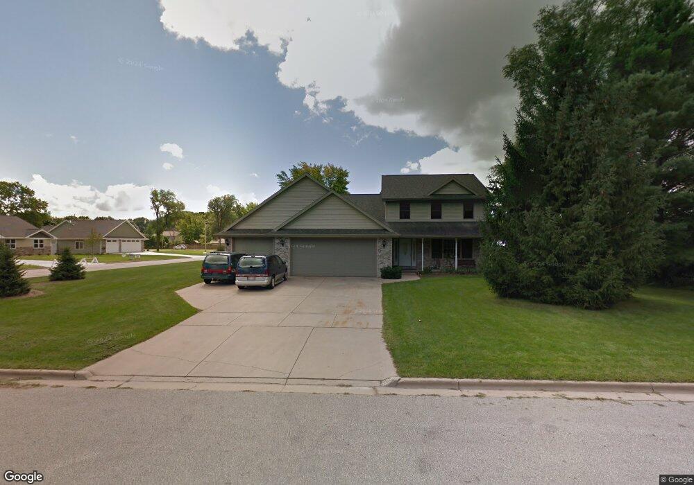
2919 Hornsby Way Green Bay, WI 54313
Westside NeighborhoodEstimated Value: $405,000 - $579,000
--
Bed
--
Bath
--
Sq Ft
0.34
Acres
About This Home
This home is located at 2919 Hornsby Way, Green Bay, WI 54313 and is currently estimated at $473,048. 2919 Hornsby Way is a home located in Brown County with nearby schools including MacArthur Elementary School, Lombardi Middle School, and Southwest High School.
Ownership History
Date
Name
Owned For
Owner Type
Purchase Details
Closed on
Aug 31, 2005
Sold by
Red Fox Development Llc
Bought by
Yakovenko Mykola and Yakovenko Lyubov I
Current Estimated Value
Home Financials for this Owner
Home Financials are based on the most recent Mortgage that was taken out on this home.
Original Mortgage
$41,080
Outstanding Balance
$15,315
Interest Rate
7.87%
Mortgage Type
Fannie Mae Freddie Mac
Estimated Equity
$457,733
Create a Home Valuation Report for This Property
The Home Valuation Report is an in-depth analysis detailing your home's value as well as a comparison with similar homes in the area
Home Values in the Area
Average Home Value in this Area
Purchase History
| Date | Buyer | Sale Price | Title Company |
|---|---|---|---|
| Yakovenko Mykola | $52,000 | Bay Title & Abstract |
Source: Public Records
Mortgage History
| Date | Status | Borrower | Loan Amount |
|---|---|---|---|
| Open | Yakovenko Mykola | $41,080 |
Source: Public Records
Tax History Compared to Growth
Tax History
| Year | Tax Paid | Tax Assessment Tax Assessment Total Assessment is a certain percentage of the fair market value that is determined by local assessors to be the total taxable value of land and additions on the property. | Land | Improvement |
|---|---|---|---|---|
| 2024 | $7,526 | $392,500 | $54,500 | $338,000 |
| 2023 | $7,239 | $392,500 | $54,500 | $338,000 |
| 2022 | $7,041 | $392,500 | $54,500 | $338,000 |
| 2021 | $5,679 | $241,400 | $52,800 | $188,600 |
| 2020 | $5,704 | $241,400 | $52,800 | $188,600 |
| 2019 | $5,544 | $241,400 | $52,800 | $188,600 |
| 2018 | $5,405 | $241,400 | $52,800 | $188,600 |
| 2017 | $5,311 | $241,400 | $52,800 | $188,600 |
| 2016 | $5,233 | $241,400 | $52,800 | $188,600 |
| 2015 | $5,314 | $241,400 | $52,800 | $188,600 |
| 2014 | $5,486 | $239,800 | $52,800 | $187,000 |
| 2013 | $5,486 | $239,800 | $52,800 | $187,000 |
Source: Public Records
Map
Nearby Homes
- 2993 Fleetwood Dr
- 916 Square Terrace
- 516 Country Club Rd
- 3102 Sandstone Ct
- 1000 Rolling Green Dr
- 3112 Birdie Ct
- 618 Night Ct
- 3096 S Sandstone Ct
- 3097 S Sandstone Ct
- 3023 Crusade Ln
- 1433 Baumgart Rd Unit 1435
- 3833 Hillcrest Dr
- 1602 W Crusade Ln
- 2640 He Nis Ra Ln
- 2610 Sumac Place
- 4179 Hillcrest Dr
- 2550 He Nis Ra Ln
- 1940 Renaissance Ct
- 2560 N Trillium Cir
- 2439 W Point Rd
- 1020 Red Fox Dr
- 998 Red Fox Dr
- 1015 Red Fox Dr
- 1007 Red Fox Dr
- 1019 Red Fox Dr
- 1001 Red Fox Dr
- 813 Red Fox Dr
- 920 Red Fox Dr
- 2898 W Mason St
- 2914 Sorenson Dr
- 2926 Sorenson Dr
- 915 Red Fox Dr
- 910 Red Fox Dr
- 2904 Sorenson Dr
- 2932 Sorenson Dr
- 2950 W Mason St
- 2940 Sorenson Dr
- 2898 Sorenson Dr
- 905 Red Fox Dr
- 900 Red Fox Dr