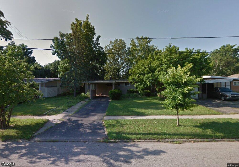
2919 Lafayette Ave Lansing, MI 48906
Northwestside NeighborhoodEstimated Value: $146,977 - $173,000
3
Beds
1
Bath
1,024
Sq Ft
$156/Sq Ft
Est. Value
About This Home
This home is located at 2919 Lafayette Ave, Lansing, MI 48906 and is currently estimated at $159,244, approximately $155 per square foot. 2919 Lafayette Ave is a home located in Ingham County with nearby schools including Cumberland Elementary School, Pattengill Academy, and J.W. Sexton High School.
Ownership History
Date
Name
Owned For
Owner Type
Purchase Details
Closed on
Apr 12, 2012
Sold by
Donovan Shaun
Bought by
Scarlett Gordon and Scarlett James
Current Estimated Value
Purchase Details
Closed on
May 11, 2011
Sold by
Michigan State Housing Development Autho
Bought by
Secretary Of Houisng & Urban Development
Purchase Details
Closed on
Mar 10, 2011
Sold by
Murray Ronald E and Murray Sandra K
Bought by
Michigan State Housing Development Autho
Create a Home Valuation Report for This Property
The Home Valuation Report is an in-depth analysis detailing your home's value as well as a comparison with similar homes in the area
Home Values in the Area
Average Home Value in this Area
Purchase History
| Date | Buyer | Sale Price | Title Company |
|---|---|---|---|
| Scarlett Gordon | $29,200 | None Available | |
| Secretary Of Houisng & Urban Development | -- | None Available | |
| Michigan State Housing Development Autho | $37,412 | None Available |
Source: Public Records
Tax History
| Year | Tax Paid | Tax Assessment Tax Assessment Total Assessment is a certain percentage of the fair market value that is determined by local assessors to be the total taxable value of land and additions on the property. | Land | Improvement |
|---|---|---|---|---|
| 2025 | $3,172 | $62,400 | $12,300 | $50,100 |
| 2024 | $26 | $57,200 | $12,300 | $44,900 |
| 2023 | $2,985 | $54,400 | $12,300 | $42,100 |
| 2022 | $2,725 | $51,200 | $11,500 | $39,700 |
| 2021 | $2,662 | $46,300 | $8,200 | $38,100 |
| 2020 | $2,643 | $43,000 | $8,200 | $34,800 |
| 2019 | $2,554 | $38,600 | $8,200 | $30,400 |
| 2018 | $2,422 | $34,300 | $8,200 | $26,100 |
| 2017 | $2,331 | $34,300 | $8,200 | $26,100 |
| 2016 | $2,238 | $32,500 | $8,200 | $24,300 |
| 2015 | $2,238 | $30,600 | $16,432 | $14,168 |
| 2014 | $2,238 | $29,800 | $17,746 | $12,054 |
Source: Public Records
Map
Nearby Homes
- 4221 N Grand River Ave
- 3017 Alfred Ave
- 3116 Colchester Rd
- 4005 N Grand River Ave
- 2302 Northwest Ave
- 2300 Byrnes Rd
- 2601 Newport Dr
- 3230 Sheffer Ave
- 2313 Kuerbitz Dr
- 3304 Sheffer Ave
- 2206 Kuerbitz Dr
- 3500 Colchester Rd
- 3601 N Grand River Ave
- 2800 Tecumseh River Rd
- 2111 Delta River Dr
- 3336 Tecumseh River Rd
- 3733 Colchester Rd
- 3021 N Grand River Ave
- 1805 Boynton Dr
- 1515 Biltmore Blvd
- 2913 Lafayette Ave
- 2923 Lafayette Ave
- 2807 Gatsby Ct
- 3005 Lafayette Ave
- 2907 Lafayette Ave
- 2817 Gatsby Ct
- 2801 Gatsby Ct
- 3009 Lafayette Ave
- 2901 Lafayette Ave
- 2920 Lafayette Ave
- 2914 Lafayette Ave
- 2821 Gatsby Ct
- 2825 Lafayette Ave
- 2907 Paul Ave
- 2727 Gatsby Ct
- 3015 Lafayette Ave
- 2827 Gatsby Ct
- 2812 Northwest Ave
- 2913 Alsand Cir
Your Personal Tour Guide
Ask me questions while you tour the home.