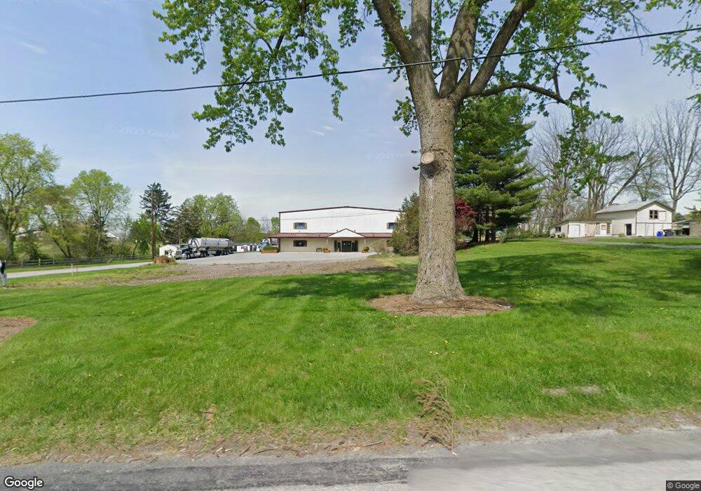
2919 Lincoln Hwy E Gordonville, PA 17529
Estimated Value: $1,690,713
--
Bed
--
Bath
18,940
Sq Ft
$89/Sq Ft
Est. Value
About This Home
This home is located at 2919 Lincoln Hwy E, Gordonville, PA 17529 and is currently estimated at $1,690,713, approximately $89 per square foot. 2919 Lincoln Hwy E is a home located in Lancaster County with nearby schools including Smoketown Elementary School, Gerald G. Huesken Middle School, and Conestoga Valley High School.
Ownership History
Date
Name
Owned For
Owner Type
Purchase Details
Closed on
Mar 22, 2023
Sold by
Mast Caleb J and Mast Lisa J
Bought by
King A Lamar
Current Estimated Value
Purchase Details
Closed on
Sep 7, 2022
Sold by
Mast Caleb J and Mast Lisa J
Bought by
Commonwealth Of Pennsylvania Through The Depa
Purchase Details
Closed on
Jan 1, 2016
Sold by
King Miriam M
Bought by
Mast Caleb J and Mast Lisa J
Home Financials for this Owner
Home Financials are based on the most recent Mortgage that was taken out on this home.
Original Mortgage
$850,000
Interest Rate
3.96%
Mortgage Type
Seller Take Back
Create a Home Valuation Report for This Property
The Home Valuation Report is an in-depth analysis detailing your home's value as well as a comparison with similar homes in the area
Home Values in the Area
Average Home Value in this Area
Purchase History
| Date | Buyer | Sale Price | Title Company |
|---|---|---|---|
| King A Lamar | -- | -- | |
| Commonwealth Of Pennsylvania Through The Depa | -- | -- | |
| Mast Caleb J | $850,000 | Attorney |
Source: Public Records
Mortgage History
| Date | Status | Borrower | Loan Amount |
|---|---|---|---|
| Previous Owner | Mast Caleb J | $850,000 |
Source: Public Records
Tax History Compared to Growth
Tax History
| Year | Tax Paid | Tax Assessment Tax Assessment Total Assessment is a certain percentage of the fair market value that is determined by local assessors to be the total taxable value of land and additions on the property. | Land | Improvement |
|---|---|---|---|---|
| 2025 | $27,463 | $1,356,500 | $792,400 | $564,100 |
| 2024 | $27,463 | $1,356,500 | $792,400 | $564,100 |
| 2023 | $26,828 | $1,356,500 | $792,400 | $564,100 |
| 2022 | $26,160 | $1,356,500 | $792,400 | $564,100 |
| 2021 | $25,238 | $1,356,500 | $792,400 | $564,100 |
| 2020 | $25,238 | $1,356,500 | $792,400 | $564,100 |
| 2019 | $24,695 | $1,356,500 | $792,400 | $564,100 |
| 2018 | $36,338 | $1,356,500 | $792,400 | $564,100 |
| 2017 | $20,577 | $950,500 | $319,800 | $630,700 |
| 2016 | $20,330 | $950,500 | $319,800 | $630,700 |
| 2015 | $5,194 | $950,500 | $319,800 | $630,700 |
| 2014 | $14,099 | $950,500 | $319,800 | $630,700 |
Source: Public Records
Map
Nearby Homes
- 26 Ruth Dr
- 31 Jere Rd
- 0 - Lot #2 Paradise Ln
- 3088 Lincoln Hwy E
- 15 S Singer Ave
- 129 Creekview Dr
- 2472 Leaman Rd
- 323 Enterprise Dr
- 202 N Decatur St
- 339 Enterprise Dr
- 2453 Lincoln Hwy E
- 2596 Old Philadelphia Pike
- 3474 Old Philadelphia Unit 2
- 180 S Shenk Ave
- 0 W Franklin St
- 98 Lancaster Ave
- 7 Pleasant Dr
- 4 Wickerberry Place
- 25 Evergreen St
- 22 Miller St
- 2931 Lincoln Hwy E
- 2925 Lincoln Hwy E
- 2929 Lincoln Hwy E
- 2924 E Lincoln Hwy
- 2922 Lincoln Hwy E
- 2935 Lincoln Hwy E
- 2920 Lincoln Hwy E
- 2939 Lincoln Hwy E
- 2924 Lincoln Hwy E
- 2926 Lincoln Hwy E
- 2918 Lincoln Hwy E
- 2930 Lincoln Hwy E
- 2934 Lincoln Hwy E
- 2909 Lincoln Hwy E
- 2928 Lincoln Hwy E
- 2937 Lincoln Hwy E
- 2914 Lincoln Hwy E
- 2936 Lincoln Hwy E
- 2941 Lincoln Hwy E
- 2908 Lincoln Hwy E