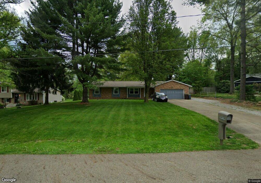
2919 Linden St NW Uniontown, OH 44685
Estimated Value: $258,733 - $283,000
3
Beds
2
Baths
1,524
Sq Ft
$177/Sq Ft
Est. Value
About This Home
This home is located at 2919 Linden St NW, Uniontown, OH 44685 and is currently estimated at $270,183, approximately $177 per square foot. 2919 Linden St NW is a home located in Stark County with nearby schools including Lake Middle/High School and Lake Center Christian School.
Ownership History
Date
Name
Owned For
Owner Type
Purchase Details
Closed on
Jul 3, 2007
Sold by
Anderson Mary B
Bought by
Brown Gilbert A
Current Estimated Value
Home Financials for this Owner
Home Financials are based on the most recent Mortgage that was taken out on this home.
Original Mortgage
$131,490
Outstanding Balance
$81,150
Interest Rate
6.26%
Mortgage Type
Purchase Money Mortgage
Estimated Equity
$189,033
Purchase Details
Closed on
Nov 29, 2004
Sold by
Trares Coleen K and Trares Bernard J
Bought by
Allison James B and Metz Mariele A
Purchase Details
Closed on
Aug 25, 2004
Sold by
Allison James B and Battit Allison Alison G
Bought by
Trares Bernard J and Trares Coleen K
Purchase Details
Closed on
Jul 30, 2004
Sold by
Metz Mariele A
Bought by
Allison James B
Create a Home Valuation Report for This Property
The Home Valuation Report is an in-depth analysis detailing your home's value as well as a comparison with similar homes in the area
Home Values in the Area
Average Home Value in this Area
Purchase History
| Date | Buyer | Sale Price | Title Company |
|---|---|---|---|
| Brown Gilbert A | $146,100 | Bond & Associates Title Agen | |
| Allison James B | -- | -- | |
| Trares Bernard J | $125,000 | -- | |
| Allison James B | -- | -- |
Source: Public Records
Mortgage History
| Date | Status | Borrower | Loan Amount |
|---|---|---|---|
| Open | Brown Gilbert A | $131,490 |
Source: Public Records
Tax History Compared to Growth
Tax History
| Year | Tax Paid | Tax Assessment Tax Assessment Total Assessment is a certain percentage of the fair market value that is determined by local assessors to be the total taxable value of land and additions on the property. | Land | Improvement |
|---|---|---|---|---|
| 2025 | -- | $80,500 | $19,810 | $60,690 |
| 2024 | -- | $80,500 | $19,810 | $60,690 |
| 2023 | $3,730 | $60,700 | $14,460 | $46,240 |
| 2022 | $3,741 | $60,700 | $14,460 | $46,240 |
| 2021 | $3,775 | $60,700 | $14,460 | $46,240 |
| 2020 | $3,649 | $52,050 | $12,460 | $39,590 |
| 2019 | $3,626 | $52,050 | $12,460 | $39,590 |
| 2018 | $3,632 | $52,050 | $12,460 | $39,590 |
| 2017 | $3,487 | $45,860 | $10,750 | $35,110 |
| 2016 | $3,493 | $45,860 | $10,750 | $35,110 |
| 2015 | $3,493 | $45,860 | $10,750 | $35,110 |
| 2014 | $1,300 | $43,890 | $10,290 | $33,600 |
| 2013 | $1,650 | $43,890 | $10,290 | $33,600 |
Source: Public Records
Map
Nearby Homes
- 2944 Pontius St NW
- 3100 Linden St NW
- 91 Pontius Rd
- 3310 Linden St NW
- 13341 Sugar Bush Ave NW
- 2498 Foxfire St NW
- 2025 Portage Line Rd
- 0 Pontius Rd Unit 5163828
- 13792 Amodio Ave NW
- 3796 Sweitzer St NW
- 0 Pine St NW
- 3221 Killian Rd
- 3420 Overlook Dr
- 2693 Ledgestone Dr NW
- 12494 Bridgemont Ave NW
- 835 Brodie Ct
- 843 Brodie Ct
- 13025 Sunset Cir NW
- 2399 Ledgestone Dr NW
- 2455 Ledgestone Dr NW
- 2929 Linden St NW
- 2895 Linden St NW
- 13601 Mogadore Ave NW
- 13579 Mogadore Ave NW
- 2945 Linden St NW
- 13619 Mogadore Ave NW
- 2930 Linden St NW
- 13559 Mogadore Ave NW
- 2904 Linden St NW
- 2963 Linden St NW
- 2962 Linden St NW
- 2888 Linden St NW
- 13665 Mogadore Ave NW
- 2880 Linden St NW
- 13527 Mogadore Ave NW
- 2975 Sweitzer St NW
- 13544 Theeland Ave NW
- 2988 Linden St NW
- 2985 Linden St NW
- 13620 Mogadore Ave NW