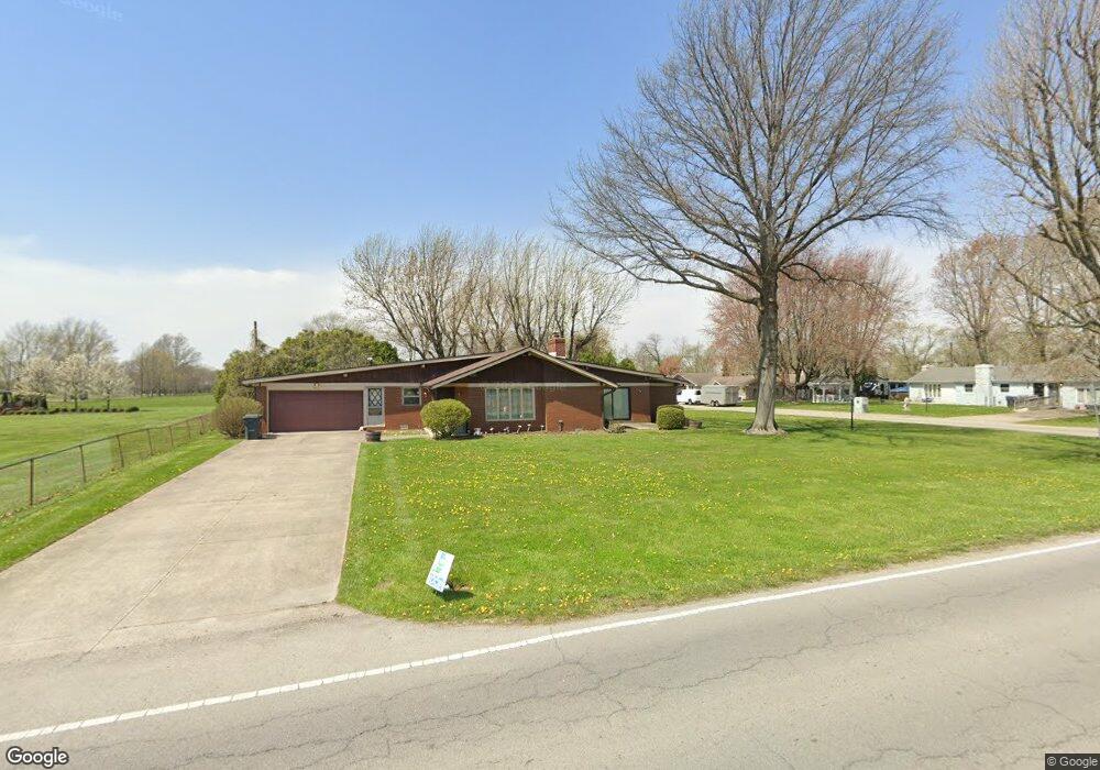
2919 N 100 W Anderson, IN 46011
Estimated Value: $224,000 - $292,000
3
Beds
3
Baths
2,021
Sq Ft
$127/Sq Ft
Est. Value
About This Home
This home is located at 2919 N 100 W, Anderson, IN 46011 and is currently estimated at $257,646, approximately $127 per square foot. 2919 N 100 W is a home with nearby schools including Frankton Elementary School, Frankton Junior/Senior High School, and Excel Center - Anderson.
Ownership History
Date
Name
Owned For
Owner Type
Purchase Details
Closed on
Mar 10, 2021
Sold by
Fratercognata Llc
Bought by
Borgo Jessica
Current Estimated Value
Home Financials for this Owner
Home Financials are based on the most recent Mortgage that was taken out on this home.
Original Mortgage
$188,180
Outstanding Balance
$168,690
Interest Rate
2.7%
Mortgage Type
New Conventional
Estimated Equity
$88,956
Purchase Details
Closed on
Dec 17, 2020
Sold by
2919 Gads Llc
Bought by
Fratercognata Llc
Purchase Details
Closed on
May 12, 2016
Sold by
Wendling Gerard J and Caroffino Ann M
Bought by
2919 Gads Llc
Create a Home Valuation Report for This Property
The Home Valuation Report is an in-depth analysis detailing your home's value as well as a comparison with similar homes in the area
Home Values in the Area
Average Home Value in this Area
Purchase History
| Date | Buyer | Sale Price | Title Company |
|---|---|---|---|
| Borgo Jessica | -- | None Available | |
| Fratercognata Llc | -- | Indiana Land Title | |
| 2919 Gads Llc | -- | -- |
Source: Public Records
Mortgage History
| Date | Status | Borrower | Loan Amount |
|---|---|---|---|
| Open | Borgo Jessica | $188,180 |
Source: Public Records
Tax History Compared to Growth
Tax History
| Year | Tax Paid | Tax Assessment Tax Assessment Total Assessment is a certain percentage of the fair market value that is determined by local assessors to be the total taxable value of land and additions on the property. | Land | Improvement |
|---|---|---|---|---|
| 2024 | $1,323 | $147,500 | $18,400 | $129,100 |
| 2023 | $1,228 | $134,800 | $17,500 | $117,300 |
| 2022 | $1,363 | $133,400 | $16,100 | $117,300 |
| 2021 | $800 | $95,100 | $16,100 | $79,000 |
| 2020 | $1,963 | $96,800 | $15,400 | $81,400 |
| 2019 | $1,917 | $94,500 | $15,400 | $79,100 |
| 2018 | $1,766 | $86,900 | $15,400 | $71,500 |
| 2017 | $1,726 | $86,200 | $15,400 | $70,800 |
| 2016 | $1,721 | $85,500 | $15,400 | $70,100 |
| 2014 | $674 | $89,500 | $15,400 | $74,100 |
| 2013 | $674 | $89,500 | $15,400 | $74,100 |
Source: Public Records
Map
Nearby Homes
- 1053 W 300 N
- 601 Belzer Dr
- 2915 Harbur Blvd
- 2413 Silver St
- 143 E School St
- 2334 Poplar St
- 391 W 375 N
- 305 Mohawk St
- 1907 Lowell Ave
- 2717 Apache Dr
- 1820 Whittier Ave
- 2132 Poplar St
- 2722 Dakota Dr
- 2030 Broadway St
- 2976 N Scatterfield Rd
- 718 Hawthorne Ave
- 1905 E Balsam Ct
- 2003 Crystal St
- 724 Iroquois St
- 724 Iroquois Dr