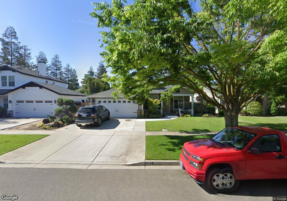
292 Memory Ln Turlock, CA 95382
Estimated Value: $428,000 - $551,000
3
Beds
2
Baths
1,661
Sq Ft
$299/Sq Ft
Est. Value
About This Home
This home is located at 292 Memory Ln, Turlock, CA 95382 and is currently estimated at $496,677, approximately $299 per square foot. 292 Memory Ln is a home located in Stanislaus County with nearby schools including Sandra Tovar Medeiros Elementary School, Turlock Junior High School, and Marvin A. Dutcher Middle School.
Ownership History
Date
Name
Owned For
Owner Type
Purchase Details
Closed on
Feb 5, 2019
Sold by
Alldrin Vickie Lynn
Bought by
Alldrin Galen and Alldrin Vickie L
Current Estimated Value
Purchase Details
Closed on
Apr 11, 2006
Sold by
Cain Victor L and Cain Peggy R
Bought by
Cain Victor L and Cain Peggy R
Purchase Details
Closed on
Dec 17, 1999
Sold by
Florsheim Bros
Bought by
Cain Victor L and Cain Peggy R
Create a Home Valuation Report for This Property
The Home Valuation Report is an in-depth analysis detailing your home's value as well as a comparison with similar homes in the area
Purchase History
| Date | Buyer | Sale Price | Title Company |
|---|---|---|---|
| Alldrin Galen | -- | None Available | |
| Alldrin Vickie Lynn | -- | None Available | |
| Cain Victor L | -- | None Available | |
| Cain Victor L | $163,000 | Chicago Title |
Source: Public Records
Tax History
| Year | Tax Paid | Tax Assessment Tax Assessment Total Assessment is a certain percentage of the fair market value that is determined by local assessors to be the total taxable value of land and additions on the property. | Land | Improvement |
|---|---|---|---|---|
| 2025 | $2,937 | $258,957 | $53,781 | $205,176 |
| 2024 | $3,103 | $253,880 | $52,727 | $201,153 |
| 2023 | $3,375 | $248,903 | $51,694 | $197,209 |
| 2022 | $3,331 | $244,024 | $50,681 | $193,343 |
| 2021 | $3,207 | $239,240 | $49,688 | $189,552 |
| 2020 | $3,174 | $236,788 | $49,179 | $187,609 |
| 2019 | $3,098 | $232,146 | $48,215 | $183,931 |
| 2018 | $3,015 | $227,595 | $47,270 | $180,325 |
| 2017 | $2,927 | $223,134 | $46,344 | $176,790 |
| 2016 | $2,762 | $218,760 | $45,436 | $173,324 |
| 2015 | $2,726 | $215,475 | $44,754 | $170,721 |
| 2014 | $2,690 | $211,255 | $43,878 | $167,377 |
Source: Public Records
Map
Nearby Homes
- 4666 Treasure Ct
- 4185 Pathway Ln
- 1901 Geer Rd
- 4184 Horizon Ct
- 5333 Geer Rd
- 1232 Paseo Belleza
- 3661 La Mancha Place
- 3632 La Mancha Place
- 862 Moonbeam Way
- 2061 Zane Way
- 2041 Zane Way
- 4093 Heartland Way
- 1463 Estrella Way
- 1360 Shady Ln Unit 923
- 1360 Shady Ln Unit 1022
- 4002 Heartland Way
- 785 Fullerton Dr
- 3491 Santos Ct
- 4640 Colorado Ave
- 3148 Andre Ln
Your Personal Tour Guide
Ask me questions while you tour the home.