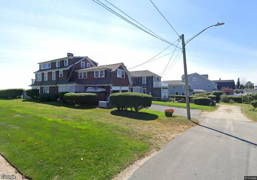
292 Old Kelsey Point Rd Westbrook, CT 06498
Estimated Value: $595,000 - $1,340,357
6
Beds
2
Baths
2,070
Sq Ft
$488/Sq Ft
Est. Value
About This Home
This home is located at 292 Old Kelsey Point Rd, Westbrook, CT 06498 and is currently estimated at $1,009,589, approximately $487 per square foot. 292 Old Kelsey Point Rd is a home located in Middlesex County with nearby schools including Daisy Ingraham School, Westbrook Middle School, and Westbrook High School.
Ownership History
Date
Name
Owned For
Owner Type
Purchase Details
Closed on
Jan 12, 2022
Sold by
Obrien Barbara L
Bought by
Andrews Stephen and Andrews Virginia L
Current Estimated Value
Purchase Details
Closed on
Sep 10, 2021
Sold by
Langer Donald F
Bought by
D F & Ellen F Langler Ret and Langler
Purchase Details
Closed on
Sep 28, 2016
Sold by
Langler Ft and Obrien
Bought by
Obrien Barbara L and Andrews Virginia L
Create a Home Valuation Report for This Property
The Home Valuation Report is an in-depth analysis detailing your home's value as well as a comparison with similar homes in the area
Home Values in the Area
Average Home Value in this Area
Purchase History
| Date | Buyer | Sale Price | Title Company |
|---|---|---|---|
| Andrews Stephen | $400,000 | None Available | |
| Andrews Stephen | $400,000 | None Available | |
| D F & Ellen F Langler Ret | -- | None Available | |
| D F & Ellen F Langler Ret | -- | None Available | |
| Obrien Barbara L | -- | -- | |
| Obrien Barbara L | -- | -- |
Source: Public Records
Tax History Compared to Growth
Tax History
| Year | Tax Paid | Tax Assessment Tax Assessment Total Assessment is a certain percentage of the fair market value that is determined by local assessors to be the total taxable value of land and additions on the property. | Land | Improvement |
|---|---|---|---|---|
| 2025 | $13,011 | $578,260 | $450,500 | $127,760 |
| 2024 | $12,548 | $578,260 | $450,500 | $127,760 |
| 2023 | $12,329 | $578,260 | $450,500 | $127,760 |
| 2022 | $12,005 | $578,260 | $450,500 | $127,760 |
| 2021 | $14,688 | $587,500 | $493,920 | $93,580 |
| 2020 | $14,688 | $587,500 | $493,920 | $93,580 |
| 2019 | $14,494 | $587,500 | $493,920 | $93,580 |
| 2018 | $14,317 | $587,500 | $493,920 | $93,580 |
| 2017 | $14,317 | $587,500 | $493,920 | $93,580 |
| 2016 | $15,295 | $660,960 | $570,750 | $90,210 |
| 2015 | $14,878 | $660,960 | $570,750 | $90,210 |
| 2014 | $14,402 | $660,960 | $570,750 | $90,210 |
Source: Public Records
Map
Nearby Homes
- 83 Sagamore Terrace E
- 19 Sagamore Terrace E
- 17 Woodsedge Ln
- 13 Green Acres Park Dr
- 133 Sandy Point Rd Unit 133
- 143 Sandy Point Rd Unit 143
- 118 Sandy Point Rd
- 254 Hidden Cove Rd
- 96 Chalker Beach Rd
- 14 Denmore Ln
- 1469 Boston Post Rd Unit 19
- 1 Clark Ave
- 52 Chalker Beach Rd
- 174 Nehantic Trail
- 207 Salt Island Rd
- 140 Salt Island Rd
- 26 Meadowood Ln
- 155 Fawn Hill Dr
- 166 Fiske Ln
- 29 Salt Island Rd
- 288 Old Kelsey Point Rd
- 49 Sagamore Terrace S
- 280 Old Kelsey Point Rd
- 45 Sagamore Terrace Rd
- 45 Sagamore Terrace S
- 274 Old Kelsey Point Rd
- 39 Sagamore Terrace S
- 39 Sagamore Terrace Rd
- 270 Old Kelsey Point Rd
- 277 Old Kelsey Point Rd
- 37 Sagamore Terrace Dr
- 266 Old Kelsey Point Rd
- 271 Old Kelsey Point Rd
- 29 Sagamore Terrace S
- 40 Sagamore Terrace S
- 262 Old Kelsey Point Rd
- 36 Sagamore Terrace Dr
- 25 Sagamore Terrace Dr
- 19 Sagamore Terrace S
- 254 Old Kelsey Point Rd