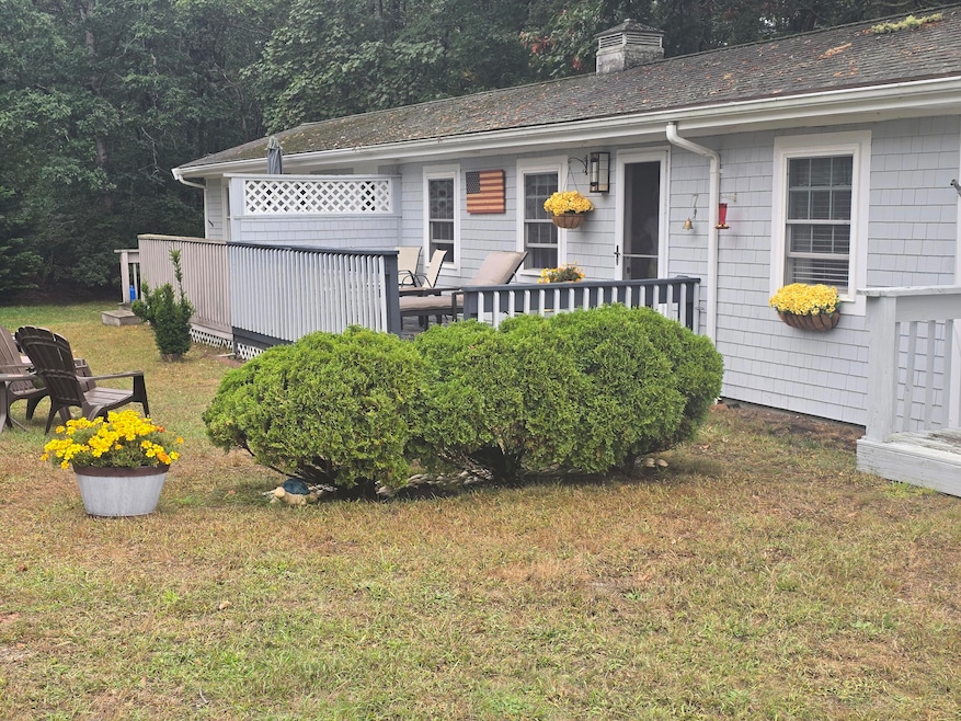
292 Route 28 Unit 7 West Harwich, MA 02671
Northwest Harwich NeighborhoodEstimated payment $1,607/month
Highlights
- Cooling Available
- Landscaped
- Heating Available
- Chatham Elementary School Rated A-
About This Home
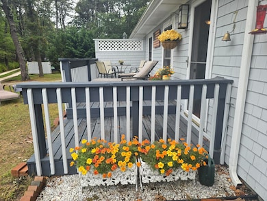
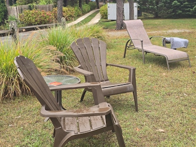
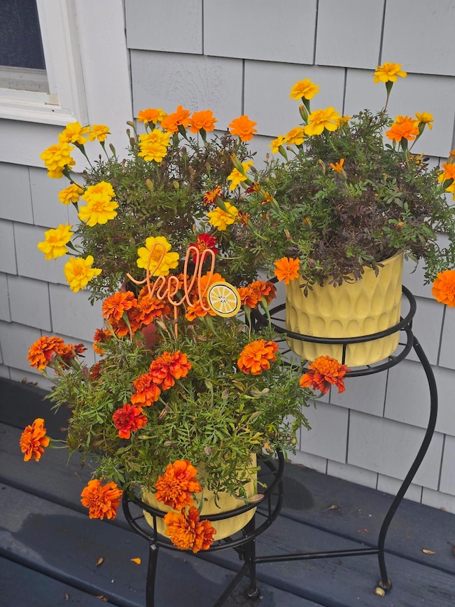
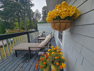
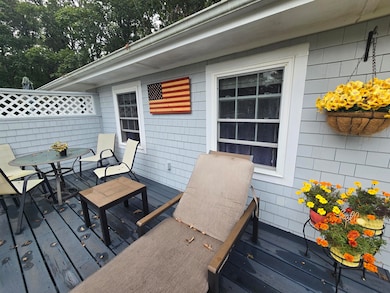
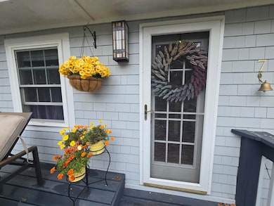
Don't be fooled by the Route 28 address--this charming seasonal condo in West Harwich is set on a quiet dirt road just off the main street! Impeccably maintained and move-in ready, it's the perfect Cape Cod retreat.The property features a spacious front deck, a brand-new private back deck, and a new outdoor shower. Inside, you'll find a generous bedroom, full bath, and an open-concept living, kitchen, and dining area. Recent updates include the new deck, outdoor shower, never-used stove, refrigerator, newer windows, roof, and brand-new (2024) shingles. Just bring your bags and enjoy all that Harwich has to offer!
Property Details
Home Type
- Condominium
Est. Annual Taxes
- $1,326
Year Built
- Built in 1920 | Remodeled
Lot Details
- Street terminates at a dead end
- Landscaped
HOA Fees
- $22 Monthly HOA Fees
Parking
- 1 Parking Space
Interior Spaces
- 412 Sq Ft Home
- 1-Story Property
- Laminate Flooring
Bedrooms and Bathrooms
- 1 Bedroom
- 1 Full Bathroom
Utilities
- Cooling Available
- Heating Available
- Electric Water Heater
- Septic Tank
Listing and Financial Details
- Assessor Parcel Number 12G3B7
Community Details
Overview
- 9 Units
Pet Policy
- Pets Allowed
Map
Home Values in the Area
Average Home Value in this Area
Tax History
| Year | Tax Paid | Tax Assessment Tax Assessment Total Assessment is a certain percentage of the fair market value that is determined by local assessors to be the total taxable value of land and additions on the property. | Land | Improvement |
|---|---|---|---|---|
| 2025 | $1,326 | $224,400 | $0 | $224,400 |
| 2024 | $1,327 | $220,100 | $0 | $220,100 |
| 2023 | $1,220 | $183,700 | $0 | $183,700 |
| 2022 | $1,302 | $160,500 | $0 | $160,500 |
| 2021 | $1,290 | $150,000 | $0 | $150,000 |
| 2020 | $1,260 | $144,300 | $0 | $144,300 |
| 2019 | $1,212 | $139,800 | $0 | $139,800 |
| 2018 | $1,191 | $135,300 | $0 | $135,300 |
| 2017 | $1,201 | $133,900 | $0 | $133,900 |
| 2016 | $1,182 | $130,300 | $0 | $130,300 |
| 2015 | $1,145 | $127,700 | $0 | $127,700 |
| 2014 | $1,088 | $124,100 | $0 | $124,100 |
Property History
| Date | Event | Price | List to Sale | Price per Sq Ft |
|---|---|---|---|---|
| 09/18/2025 09/18/25 | For Sale | $279,000 | -- | $677 / Sq Ft |
Purchase History
| Date | Type | Sale Price | Title Company |
|---|---|---|---|
| Deed | -- | -- | |
| Deed | $95,000 | -- | |
| Deed | $65,000 | -- |
Mortgage History
| Date | Status | Loan Amount | Loan Type |
|---|---|---|---|
| Previous Owner | $75,000 | Purchase Money Mortgage | |
| Previous Owner | $35,000 | Purchase Money Mortgage |
Source: Cape Cod & Islands Association of REALTORS®
MLS Number: 22504653
APN: HARW-000012-000000-G000003-B000000-7
Disclaimer: Certain information contained herein is derived from information provided by parties other than Homes.com. All information provided is deemed reliable, but is not guaranteed to be accurate and should be independently verified.
![]() All data relating to real estate for sale on this page comes from the Broker Reciprocity (BR) of the Cape Cod & Islands Multiple Listing Service, Inc. Detailed information about real estate listings held by brokerage firms other than CC&I Assoc. of REALTORS®, Inc. includes the name of the listing company. Neither the listing company nor CC&I Assoc. of REALTORS®, Inc. shall be responsible for any typographical errors, misinformation, misprints and shall be held totally harmless. The Broker providing this data believes it to be correct, but advises interested parties to confirm any item before relying on it in a purchase decision. All properties are subject to prior sale, changes, or withdrawal. Copyright 2025 © Cape Cod & Islands Multiple Listing Service, Inc. All rights reserved.
All data relating to real estate for sale on this page comes from the Broker Reciprocity (BR) of the Cape Cod & Islands Multiple Listing Service, Inc. Detailed information about real estate listings held by brokerage firms other than CC&I Assoc. of REALTORS®, Inc. includes the name of the listing company. Neither the listing company nor CC&I Assoc. of REALTORS®, Inc. shall be responsible for any typographical errors, misinformation, misprints and shall be held totally harmless. The Broker providing this data believes it to be correct, but advises interested parties to confirm any item before relying on it in a purchase decision. All properties are subject to prior sale, changes, or withdrawal. Copyright 2025 © Cape Cod & Islands Multiple Listing Service, Inc. All rights reserved.
- 297 Massachusetts 28
- 297 Massachusetts 28 Unit 1
- 264 Massachusetts 28
- 231 Route 28 Unit 20
- 231 Route 28 Unit 8
- 231 Route 28 Unit 15
- 231 Roue 28 Unit 20
- 292 Massachusetts 28 Unit 1
- 292 Massachusetts 28 Unit 7
- 16 Mirasol Ln
- 188 Massachusetts 28
- 7 Dunes Rd
- 28 Patricia Ln
- 161 Route 28 Unit 5
- 74 Shore Rd
- 161 Massachusetts 28 Unit 7
- 405 Lower County Rd Unit 21
- 405 Lower County Rd Unit 23
- 18 Old Campground
- 12 Old Campground Rd
- 20 Trumet Rd
- 5 Elwood Rd
- 41 Bank St Unit 13
- 141 Division St Unit 4
- 4 Summer St
- 576 Main St Unit 3
- 328 Bank St Unit 1
- 328 Bank St Unit 4
- 328 Bank St Unit 5
- 328 Bank St Unit 21
- 328 Bank St
- 110 Depot St
- 26 Cranwood Rd
- 26 Lone Tree Rd Unit A
- 173 Captain Chase Rd Unit A
- 173 Captain Chase Rd Unit B
- 24 Church St Unit A
- 873 Harwich Rd
- 6 Lauries Ln
- 175 Sam Ryder Rd
