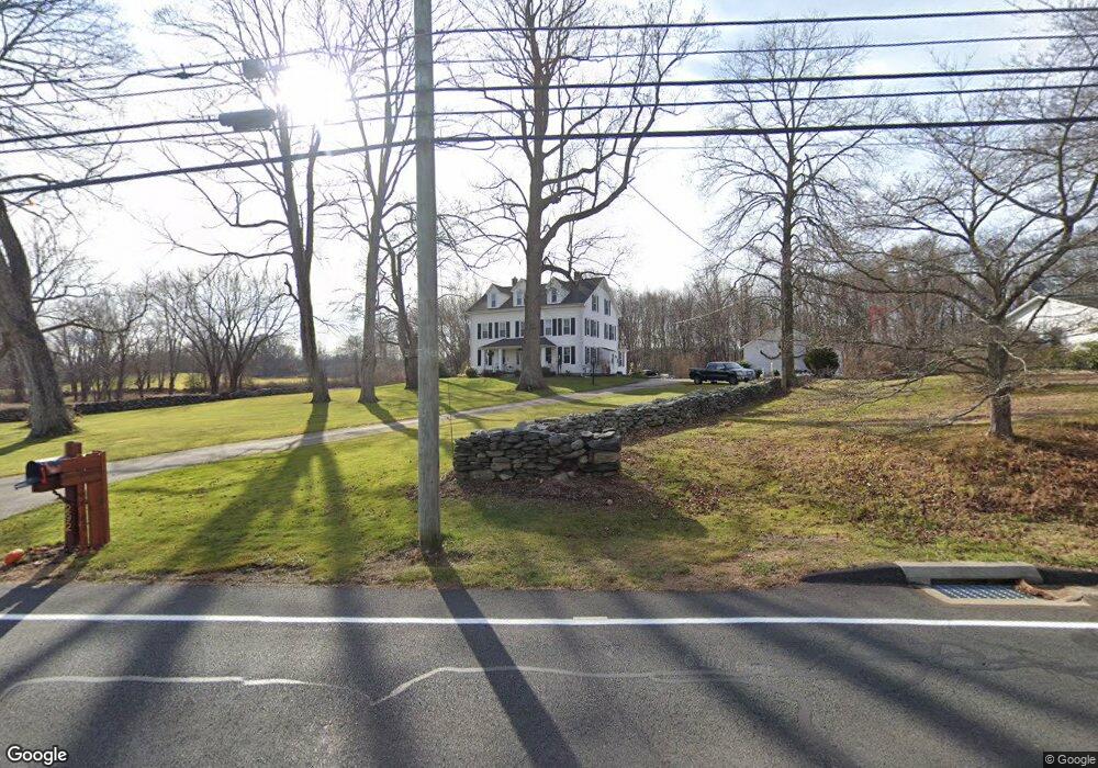
292 Route 87 Columbia, CT 06237
Estimated Value: $491,362 - $774,000
5
Beds
2
Baths
3,340
Sq Ft
$185/Sq Ft
Est. Value
About This Home
This home is located at 292 Route 87, Columbia, CT 06237 and is currently estimated at $618,591, approximately $185 per square foot. 292 Route 87 is a home located in Tolland County with nearby schools including Horace W. Porter School.
Ownership History
Date
Name
Owned For
Owner Type
Purchase Details
Closed on
Nov 1, 2001
Sold by
Willerford Theodore and Willerford Lois
Bought by
Therrien Alfred and Therrien Diane
Current Estimated Value
Home Financials for this Owner
Home Financials are based on the most recent Mortgage that was taken out on this home.
Original Mortgage
$375,000
Interest Rate
6.82%
Create a Home Valuation Report for This Property
The Home Valuation Report is an in-depth analysis detailing your home's value as well as a comparison with similar homes in the area
Home Values in the Area
Average Home Value in this Area
Purchase History
| Date | Buyer | Sale Price | Title Company |
|---|---|---|---|
| Therrien Alfred | $275,000 | -- |
Source: Public Records
Mortgage History
| Date | Status | Borrower | Loan Amount |
|---|---|---|---|
| Open | Therrien Alfred | $285,000 | |
| Closed | Therrien Alfred | $336,000 | |
| Closed | Therrien Alfred | $375,000 |
Source: Public Records
Tax History Compared to Growth
Tax History
| Year | Tax Paid | Tax Assessment Tax Assessment Total Assessment is a certain percentage of the fair market value that is determined by local assessors to be the total taxable value of land and additions on the property. | Land | Improvement |
|---|---|---|---|---|
| 2025 | $8,163 | $278,880 | $39,970 | $238,910 |
| 2024 | $7,842 | $278,880 | $39,970 | $238,910 |
| 2023 | $7,226 | $278,880 | $39,970 | $238,910 |
| 2022 | $7,215 | $278,880 | $39,970 | $238,910 |
| 2021 | $6,546 | $223,200 | $36,200 | $187,000 |
| 2020 | $6,546 | $223,200 | $36,200 | $187,000 |
| 2019 | $6,546 | $223,200 | $36,200 | $187,000 |
| 2018 | $6,546 | $223,200 | $36,200 | $187,000 |
| 2017 | $6,446 | $223,200 | $36,200 | $187,000 |
| 2016 | $6,023 | $219,500 | $36,200 | $183,300 |
| 2015 | $5,955 | $219,500 | $36,200 | $183,300 |
| 2014 | $5,841 | $215,300 | $36,200 | $179,100 |
Source: Public Records
Map
Nearby Homes
- 290 Route 87
- 275 Route 87 Unit lot 3
- 291 Jonathan Trumbull Hwy
- 291 Route 87
- 286 Route 87
- 284 Jonathan Trumbull Hwy
- 284 Route 87
- 302 Route 87
- 288 Route 87
- 303 Route 87
- 280 Route 87
- 279 Route 87
- 307 Jonathan Trumbull Hwy
- 307 Route 87 (Jonathan Trumbull Hwy
- 307 Route 87
- 309 Route 87
- 277 Route 87
- 310 Route 87
- 276 Route 87
- 311 Route 87