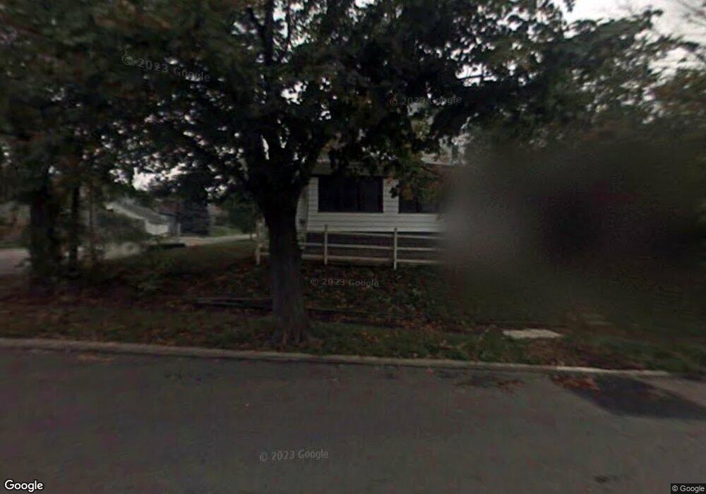
292 Sturges Ave Mansfield, OH 44903
Estimated Value: $87,000 - $135,000
3
Beds
2
Baths
1,446
Sq Ft
$72/Sq Ft
Est. Value
About This Home
This home is located at 292 Sturges Ave, Mansfield, OH 44903 and is currently estimated at $103,748, approximately $71 per square foot. 292 Sturges Ave is a home located in Richland County with nearby schools including St. Peter's Elementary/Montessori School, Discovery School, and St. Peter's Junior High / High School.
Ownership History
Date
Name
Owned For
Owner Type
Purchase Details
Closed on
Jun 17, 1999
Sold by
Hamilton Vernon L
Bought by
Kirkpatrick Ii Ralph B Sara J
Current Estimated Value
Home Financials for this Owner
Home Financials are based on the most recent Mortgage that was taken out on this home.
Original Mortgage
$49,000
Outstanding Balance
$12,934
Interest Rate
7.06%
Mortgage Type
New Conventional
Estimated Equity
$90,814
Create a Home Valuation Report for This Property
The Home Valuation Report is an in-depth analysis detailing your home's value as well as a comparison with similar homes in the area
Home Values in the Area
Average Home Value in this Area
Purchase History
| Date | Buyer | Sale Price | Title Company |
|---|---|---|---|
| Kirkpatrick Ii Ralph B Sara J | $49,000 | -- |
Source: Public Records
Mortgage History
| Date | Status | Borrower | Loan Amount |
|---|---|---|---|
| Open | Kirkpatrick Ii Ralph B Sara J | $49,000 |
Source: Public Records
Tax History
| Year | Tax Paid | Tax Assessment Tax Assessment Total Assessment is a certain percentage of the fair market value that is determined by local assessors to be the total taxable value of land and additions on the property. | Land | Improvement |
|---|---|---|---|---|
| 2024 | $924 | $19,290 | $3,260 | $16,030 |
| 2023 | $1,651 | $19,290 | $3,260 | $16,030 |
| 2022 | $617 | $10,800 | $2,640 | $8,160 |
| 2021 | $621 | $10,800 | $2,640 | $8,160 |
| 2020 | $635 | $10,800 | $2,640 | $8,160 |
| 2019 | $704 | $10,800 | $2,640 | $8,160 |
| 2018 | $695 | $10,800 | $2,640 | $8,160 |
| 2017 | $709 | $10,800 | $2,640 | $8,160 |
| 2016 | $743 | $11,500 | $3,510 | $7,990 |
| 2015 | $709 | $11,500 | $3,510 | $7,990 |
| 2014 | $700 | $11,500 | $3,510 | $7,990 |
| 2012 | $282 | $12,110 | $3,700 | $8,410 |
Source: Public Records
Map
Nearby Homes
- 0 Cline Ave Hedeen Abbeyfeale Unit 9066362
- 219 Lexington Ave
- 74 & 78 Lexington Ave
- 27 Dunbilt Ct
- 172 Crouse St
- 286 S Main St
- 183 Carpenter Rd
- 212 S Main St
- 120 Distl Ave
- 135 Wood St
- 394 S Main St
- 22 Small Ave
- 273 Hammond Ave
- 507 Townview Cir E
- 310 Townview Cir N
- 530 Wood St
- 188 S Franklin Ave
- 320 Bartley Ave
- 51 Lind Ave
- 466 Lexington Ave
- 290 Sturges Ave
- 304 Sturges Ave
- 208 Richland Ave
- 306 Sturges Ave
- 212 Richland Ave
- 209 Richland Ave
- 295 Sturges Ave
- 277 Sturges Ave
- 312 Sturges Ave
- 297 Sturges Ave
- 307 Sturges Ave
- 291 Sturges Ave
- 287 Sturges Ave
- 218 Richland Ave
- 285 Sturges Ave
- 213 Richland Ave
- 303 Sturges Ave
- 222 Richland Ave
- 168 W Blanche St
- 168 W Blanche St
Your Personal Tour Guide
Ask me questions while you tour the home.