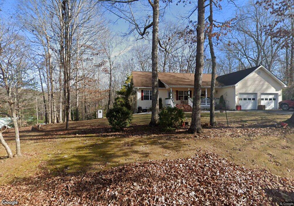
292 Talon Trace Unit 28 Blairsville, GA 30512
Ivylog NeighborhoodEstimated Value: $475,000 - $574,000
4
Beds
3
Baths
1,435
Sq Ft
$355/Sq Ft
Est. Value
About This Home
This home is located at 292 Talon Trace Unit 28, Blairsville, GA 30512 and is currently estimated at $510,122, approximately $355 per square foot. 292 Talon Trace Unit 28 is a home located in Union County with nearby schools including Union County Primary School, Union County Elementary School, and Union County Middle School.
Ownership History
Date
Name
Owned For
Owner Type
Purchase Details
Closed on
Oct 30, 2018
Sold by
Rogers Richard
Bought by
Stockman Ronald J and Stockman Susan M
Current Estimated Value
Home Financials for this Owner
Home Financials are based on the most recent Mortgage that was taken out on this home.
Original Mortgage
$150,000
Outstanding Balance
$131,625
Interest Rate
4.7%
Mortgage Type
New Conventional
Estimated Equity
$378,497
Purchase Details
Closed on
Sep 3, 2009
Sold by
Sebright Lyle Russell
Bought by
Rogers Richard and Rogers Cynthia
Home Financials for this Owner
Home Financials are based on the most recent Mortgage that was taken out on this home.
Original Mortgage
$220,050
Interest Rate
5.15%
Mortgage Type
New Conventional
Purchase Details
Closed on
Nov 11, 1996
Sold by
Frances A
Bought by
Sebright Lyle Russel
Purchase Details
Closed on
Aug 23, 1988
Bought by
Upper Hiawassee Land
Create a Home Valuation Report for This Property
The Home Valuation Report is an in-depth analysis detailing your home's value as well as a comparison with similar homes in the area
Home Values in the Area
Average Home Value in this Area
Purchase History
| Date | Buyer | Sale Price | Title Company |
|---|---|---|---|
| Stockman Ronald J | $285,000 | -- | |
| Rogers Richard | $244,500 | -- | |
| Sebright Lyle Russel | $16,500 | -- | |
| Upper Hiawassee Land | -- | -- |
Source: Public Records
Mortgage History
| Date | Status | Borrower | Loan Amount |
|---|---|---|---|
| Open | Stockman Ronald J | $150,000 | |
| Previous Owner | Rogers Richard | $220,050 |
Source: Public Records
Tax History Compared to Growth
Tax History
| Year | Tax Paid | Tax Assessment Tax Assessment Total Assessment is a certain percentage of the fair market value that is determined by local assessors to be the total taxable value of land and additions on the property. | Land | Improvement |
|---|---|---|---|---|
| 2024 | $1,866 | $159,980 | $8,760 | $151,220 |
| 2023 | $1,958 | $149,064 | $8,760 | $140,304 |
| 2022 | $1,602 | $122,344 | $12,000 | $110,344 |
| 2021 | $1,568 | $101,524 | $12,000 | $89,524 |
| 2020 | $1,677 | $90,622 | $17,000 | $73,622 |
| 2019 | $1,604 | $89,670 | $17,000 | $72,670 |
| 2018 | $1,575 | $89,670 | $17,000 | $72,670 |
| 2017 | $1,540 | $89,670 | $17,000 | $72,670 |
| 2016 | $1,541 | $89,670 | $17,000 | $72,670 |
| 2015 | $1,554 | $89,670 | $17,000 | $72,670 |
| 2013 | -- | $89,670 | $17,000 | $72,670 |
Source: Public Records
Map
Nearby Homes
- 292 Talon Trace
- 332 Talon Trace
- Lot 25 Talon Trace
- 94 Kingfisher Ln
- 0 The Landing Unit 415661
- LOT 228 the Cove at Thirteen Hundred
- 11 Falcon Dr
- 8 Eagle Bend Rd
- 60 Oxford Trail
- 98 Oxford Trail
- 137 Oxford Trail
- 67 Lake Shore Dr S
- 135 Adams Farm Dr
- Lot 8AB Lake Breeze Ln
- 600 Lakeside Dr
- 102 Captains Cove
- 292 Talon Trace Unit 28
- 292 Talon Trace
- 1886 Talon Trace
- 272 Talon Trace
- 326 Talon Trace
- 326 Talon Trace Unit 210/223
- 1900 Talon Trace
- LOT 36 the Arbor
- 283 Talon Trace
- 283 Talon Trace
- LT 24 Arbor Ln
- LOT 40 the Arbor
- LOT 16 The Grove
- 46 The Orchard Unit Lot 46
- LOT 68 The Orchard
- LOT17 The Grove
- LOT 43 & 45 the Arbor
- LT 41 the Arbor
- 327 Talon Trace
- L23 the Farm @ Highland Park
