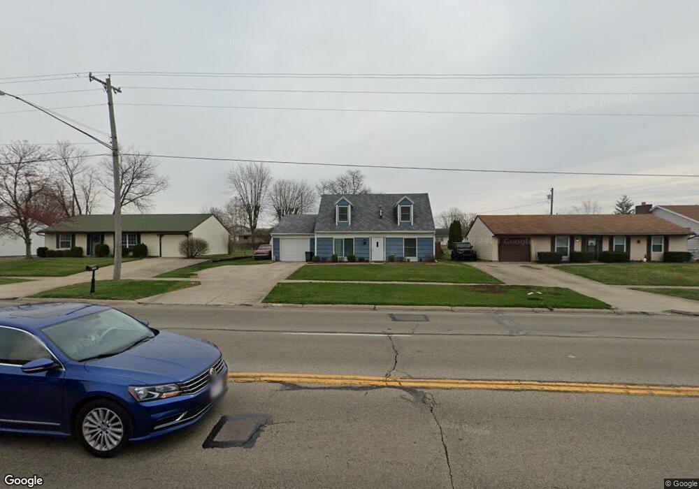
2920 Derr Rd Springfield, OH 45503
Estimated Value: $181,000 - $185,000
4
Beds
2
Baths
1,120
Sq Ft
$163/Sq Ft
Est. Value
About This Home
This home is located at 2920 Derr Rd, Springfield, OH 45503 and is currently estimated at $182,935, approximately $163 per square foot. 2920 Derr Rd is a home located in Clark County with nearby schools including Kenton Elementary School, Roosevelt Middle School, and Springfield High School.
Ownership History
Date
Name
Owned For
Owner Type
Purchase Details
Closed on
Aug 29, 2025
Sold by
Sheppeard Garry R and Sheppeard Patricia
Bought by
Sheppeard Zavier
Current Estimated Value
Home Financials for this Owner
Home Financials are based on the most recent Mortgage that was taken out on this home.
Original Mortgage
$181,625
Outstanding Balance
$181,345
Interest Rate
11.75%
Mortgage Type
New Conventional
Estimated Equity
$1,590
Purchase Details
Closed on
Jul 22, 2016
Sold by
Kleen Leslie Ann
Bought by
Sheppeard Garry R
Home Financials for this Owner
Home Financials are based on the most recent Mortgage that was taken out on this home.
Original Mortgage
$93,180
Interest Rate
3.6%
Mortgage Type
FHA
Purchase Details
Closed on
Dec 2, 1994
Sold by
Long Carol
Bought by
Kleen Leslie A
Purchase Details
Closed on
Apr 15, 1988
Create a Home Valuation Report for This Property
The Home Valuation Report is an in-depth analysis detailing your home's value as well as a comparison with similar homes in the area
Home Values in the Area
Average Home Value in this Area
Purchase History
| Date | Buyer | Sale Price | Title Company |
|---|---|---|---|
| Sheppeard Zavier | $183,000 | None Listed On Document | |
| Sheppeard Garry R | $94,900 | Team Title & Closing Service | |
| Kleen Leslie A | $77,000 | -- | |
| -- | $65,000 | -- |
Source: Public Records
Mortgage History
| Date | Status | Borrower | Loan Amount |
|---|---|---|---|
| Open | Sheppeard Zavier | $181,625 | |
| Previous Owner | Sheppeard Garry R | $93,180 |
Source: Public Records
Tax History
| Year | Tax Paid | Tax Assessment Tax Assessment Total Assessment is a certain percentage of the fair market value that is determined by local assessors to be the total taxable value of land and additions on the property. | Land | Improvement |
|---|---|---|---|---|
| 2025 | $1,845 | $54,930 | $9,790 | $45,140 |
| 2024 | $1,797 | $37,280 | $9,300 | $27,980 |
| 2023 | $1,797 | $37,280 | $9,300 | $27,980 |
| 2022 | $1,840 | $37,280 | $9,300 | $27,980 |
| 2021 | $1,832 | $34,250 | $6,990 | $27,260 |
| 2020 | $1,837 | $34,250 | $6,990 | $27,260 |
| 2019 | $1,841 | $34,250 | $6,990 | $27,260 |
| 2018 | $1,743 | $31,150 | $7,410 | $23,740 |
| 2017 | $1,742 | $30,835 | $7,413 | $23,422 |
| 2016 | $1,744 | $30,835 | $7,413 | $23,422 |
| 2015 | $1,757 | $30,415 | $6,993 | $23,422 |
| 2014 | $1,749 | $30,415 | $6,993 | $23,422 |
| 2013 | $1,731 | $30,415 | $6,993 | $23,422 |
Source: Public Records
Map
Nearby Homes
- 1225 Vester Ave
- 1516 Hyannis Dr
- 3124 El Camino Dr
- 2553 Derr Rd
- 3135 Imperial Blvd
- 2439 Greystone Ln
- 1032 Armsgate Rd
- 1046 Fruitland Rd
- 1315 Greystone Dr
- 1323 Greystone Dr
- 615 Villa Rd Unit K
- 1924 Marinette Dr
- 2824 Balsam Dr
- 1811 Devon Dr
- 1040 Carson Ln
- 1139 Bradford Dr
- 3250 Argonne Ln N
- 3153 Argonne Ln N
- 1948 Falmouth Ave
- 3247 Argonne Ln N Unit 3247
Your Personal Tour Guide
Ask me questions while you tour the home.