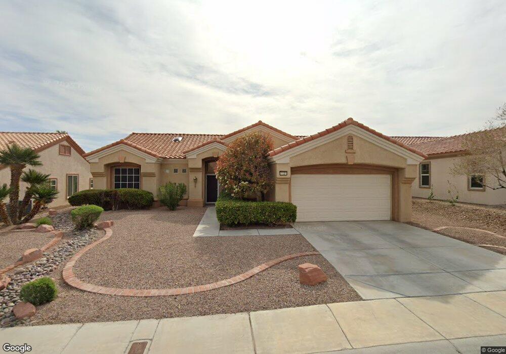
2920 Hawksdale Dr Las Vegas, NV 89134
Sun City Summerlin NeighborhoodEstimated Value: $603,000 - $656,807
2
Beds
2
Baths
1,842
Sq Ft
$348/Sq Ft
Est. Value
About This Home
This home is located at 2920 Hawksdale Dr, Las Vegas, NV 89134 and is currently estimated at $641,702, approximately $348 per square foot. 2920 Hawksdale Dr is a home located in Clark County with nearby schools including William Lummis Elementary School, Ernest Becker Middle School, and Palo Verde High School.
Ownership History
Date
Name
Owned For
Owner Type
Purchase Details
Closed on
Jan 31, 2002
Sold by
Carmody James M
Bought by
Carmody James M and James M Carmody Living Trust
Current Estimated Value
Purchase Details
Closed on
Jul 31, 2000
Sold by
Conte Carol R
Bought by
Carmody James M
Purchase Details
Closed on
Jul 26, 2000
Sold by
Sharp Barbara A and Hutcheson Patricia A
Bought by
Carmody James M
Purchase Details
Closed on
Apr 8, 2000
Sold by
White Robert E
Bought by
White Robert E and Robert E White Living Trust
Purchase Details
Closed on
Dec 18, 1998
Sold by
Malasoma Larry J and Malasoma Constance W
Bought by
White Robert E and White Barbara G
Purchase Details
Closed on
Jun 23, 1997
Sold by
Del Webb Communities Inc
Bought by
Malasoma Larry J and Malasoma Constance W
Home Financials for this Owner
Home Financials are based on the most recent Mortgage that was taken out on this home.
Original Mortgage
$148,450
Interest Rate
7.91%
Create a Home Valuation Report for This Property
The Home Valuation Report is an in-depth analysis detailing your home's value as well as a comparison with similar homes in the area
Home Values in the Area
Average Home Value in this Area
Purchase History
| Date | Buyer | Sale Price | Title Company |
|---|---|---|---|
| Carmody James M | -- | -- | |
| Carmody James M | -- | Old Republic Title Company | |
| Carmody James M | $280,000 | Old Republic Title Company | |
| White Robert E | -- | -- | |
| White Robert E | $255,000 | Ati Title | |
| Malasoma Larry J | $272,000 | First American Title Co |
Source: Public Records
Mortgage History
| Date | Status | Borrower | Loan Amount |
|---|---|---|---|
| Previous Owner | Malasoma Larry J | $148,450 |
Source: Public Records
Tax History Compared to Growth
Tax History
| Year | Tax Paid | Tax Assessment Tax Assessment Total Assessment is a certain percentage of the fair market value that is determined by local assessors to be the total taxable value of land and additions on the property. | Land | Improvement |
|---|---|---|---|---|
| 2025 | $3,599 | $143,157 | $69,650 | $73,507 |
| 2024 | $3,494 | $143,157 | $69,650 | $73,507 |
| 2023 | $3,494 | $130,941 | $61,250 | $69,691 |
| 2022 | $3,393 | $111,901 | $47,950 | $63,951 |
| 2021 | $3,294 | $107,152 | $46,200 | $60,952 |
| 2020 | $3,195 | $106,722 | $46,200 | $60,522 |
| 2019 | $3,102 | $101,402 | $41,650 | $59,752 |
| 2018 | $3,012 | $95,507 | $37,800 | $57,707 |
| 2017 | $3,093 | $93,495 | $35,700 | $57,795 |
| 2016 | $2,852 | $88,075 | $30,100 | $57,975 |
| 2015 | $2,846 | $84,551 | $27,300 | $57,251 |
| 2014 | $2,763 | $80,908 | $25,550 | $55,358 |
Source: Public Records
Map
Nearby Homes
- 2916 Hawksdale Dr
- 2925 Lotus Hill Dr
- 3004 Lotus Hill Dr
- 3012 Hawksdale Dr
- 2837 Billy Casper Dr
- 3016 Lotus Hill Dr
- 2937 Billy Casper Dr
- 2821 Tumble Brook Dr
- 3016 High Range Dr
- 9525 Salem Hills Ct
- 9800 Rosamond Dr
- 3109 Hawksdale Dr Unit 27
- 9536 Ruby Hills Dr
- 9445 January Dr
- 3109 Bangor Ct
- 3112 Haddon Dr
- 9428 January Dr
- 3104 Hayden Ct
- 9816 Gerald Ct
- 9424 Gold Mountain Dr
- 2924 Hawksdale Dr
- 2928 Hawksdale Dr
- 2912 Hawksdale Dr
- 2921 Hawksdale Dr
- 2917 Hawksdale Dr
- 2925 Hawksdale Dr
- 2932 Hawksdale Dr
- 2929 Hawksdale Dr
- 2908 Hawksdale Dr
- 2920 Lotus Hill Dr
- 2916 Lotus Hill Dr
- 2909 Hawksdale Dr
- 2933 Hawksdale Dr
- 2924 Lotus Hill Dr
- 2912 Lotus Hill Dr
- 2936 Hawksdale Dr
- 2904 Hawksdale Dr
- 2928 Lotus Hill Dr
- 2905 Hawksdale Dr
- 2908 Lotus Hill Dr