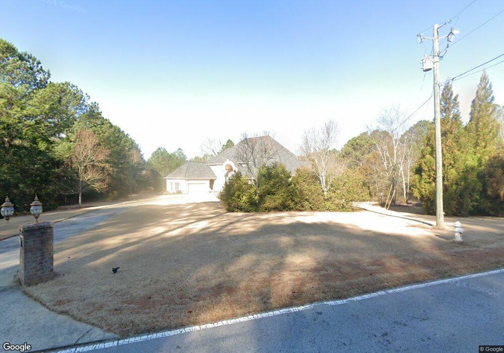
2920 NE Miller Bottom Rd Loganville, GA 30052
Estimated Value: $703,000 - $1,144,000
5
Beds
7
Baths
6,254
Sq Ft
$145/Sq Ft
Est. Value
About This Home
This home is located at 2920 NE Miller Bottom Rd, Loganville, GA 30052 and is currently estimated at $905,325, approximately $144 per square foot. 2920 NE Miller Bottom Rd is a home located in Rockdale County with nearby schools including Hightower Trail Elementary School, Conyers Middle School, and Rockdale County High School.
Ownership History
Date
Name
Owned For
Owner Type
Purchase Details
Closed on
Jun 10, 2009
Sold by
Cwalt Inc Trust 2007-Hy6
Bought by
Hutcherson Donald A and Hutcherson Deborah F
Current Estimated Value
Home Financials for this Owner
Home Financials are based on the most recent Mortgage that was taken out on this home.
Original Mortgage
$360,000
Interest Rate
5.36%
Mortgage Type
New Conventional
Purchase Details
Closed on
Mar 4, 2008
Sold by
Persaud Raveena
Bought by
Cwalt Inc Trust 2007-Hy6
Create a Home Valuation Report for This Property
The Home Valuation Report is an in-depth analysis detailing your home's value as well as a comparison with similar homes in the area
Home Values in the Area
Average Home Value in this Area
Purchase History
| Date | Buyer | Sale Price | Title Company |
|---|---|---|---|
| Hutcherson Donald A | $450,000 | -- | |
| Cwalt Inc Trust 2007-Hy6 | $774,000 | -- |
Source: Public Records
Mortgage History
| Date | Status | Borrower | Loan Amount |
|---|---|---|---|
| Previous Owner | Hutcherson Donald A | $360,000 |
Source: Public Records
Tax History Compared to Growth
Tax History
| Year | Tax Paid | Tax Assessment Tax Assessment Total Assessment is a certain percentage of the fair market value that is determined by local assessors to be the total taxable value of land and additions on the property. | Land | Improvement |
|---|---|---|---|---|
| 2024 | $8,335 | $350,640 | $106,560 | $244,080 |
| 2023 | $7,994 | $321,960 | $106,560 | $215,400 |
| 2022 | $7,661 | $308,960 | $106,560 | $202,400 |
| 2021 | $8,252 | $308,960 | $106,560 | $202,400 |
| 2020 | $6,179 | $220,920 | $57,960 | $162,960 |
| 2019 | $4,168 | $150,520 | $19,120 | $131,400 |
| 2018 | $4,107 | $147,680 | $19,120 | $128,560 |
| 2017 | $3,735 | $134,040 | $19,120 | $114,920 |
| 2016 | $3,447 | $134,040 | $19,120 | $114,920 |
| 2015 | $3,423 | $133,000 | $19,120 | $113,880 |
| 2014 | $3,050 | $133,000 | $19,120 | $113,880 |
| 2013 | -- | $137,560 | $22,480 | $115,080 |
Source: Public Records
Map
Nearby Homes
- 3250 Miller Bottom Rd
- 0 Salem Church Rd NE Unit 10167606
- 0 Stream View Dr Unit LOT 19
- 135 Little Haynes Dr
- 0 E Hightower Trail
- 2528 Stream View Dr
- 3150 Haverhill Cove NE Unit 2
- 3449 Highway 138 NE
- 00 E Hightower Trail
- 3070 N Tower Way NE
- 0 Kent Rock Rd Unit Tract 3 CM1025514
- 0 Kent Rock Rd Unit 1025511
- 0 Kent Rock Rd Unit TRACT 3 10511414
- 0 Kent Rock Rd Unit 23453234
- 0 Kent Rock Rd Unit Tract 5 CM1025517
- 0 Kent Rock Rd Unit TRACT 5 10511440
- 0 Kent Rock Rd Unit 10511296
- 3295 Highway 138 NE
- 90 Kent Rock Rd
- 110 Kent Rock Rd
- 3011 NE Miller Bottom Rd
- 2101 Adel Dr Unit 2
- 2101 Adel Dr
- 2105 Adel Dr
- 2940 Miller Bottom Rd
- 2995 NE Miller Bottom Rd
- 3013 NE Miller Bottom Rd
- 2113 Adel Dr
- 2115 Adel Dr
- 2115 NE Adel Rd
- 2115 Adel Rd
- 0 Adel Dr Unit 8827211
- 0 Adel Dr Unit 2994620
- 3099 Miller Bottom Rd Unit 188
- 3099 Miller Bottom Rd
- 2100 Adel Dr
- 2119 Adel Dr
- 3040 Miller Bottom Rd
- 2104 Adel Dr
- 2955 NE Miller Bottom Rd