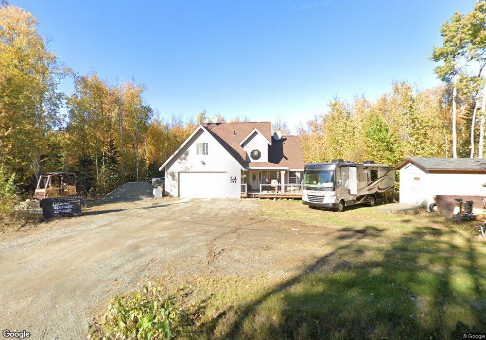
2920 S Donovan Dr Wasilla, AK 99623
Estimated Value: $449,000 - $502,000
3
Beds
3
Baths
2,560
Sq Ft
$183/Sq Ft
Est. Value
About This Home
This home is located at 2920 S Donovan Dr, Wasilla, AK 99623 and is currently estimated at $469,397, approximately $183 per square foot. 2920 S Donovan Dr is a home located in Matanuska-Susitna Borough with nearby schools including Goose Bay Elementary School, Wasilla Middle School, and Wasilla High School.
Ownership History
Date
Name
Owned For
Owner Type
Purchase Details
Closed on
May 23, 2007
Sold by
Meyer Kent and Meyer Carol
Bought by
Skelton Mysti and Meehan Steve
Current Estimated Value
Home Financials for this Owner
Home Financials are based on the most recent Mortgage that was taken out on this home.
Original Mortgage
$274,900
Outstanding Balance
$167,304
Interest Rate
6.18%
Mortgage Type
Purchase Money Mortgage
Estimated Equity
$302,093
Purchase Details
Closed on
Aug 17, 2005
Sold by
Mattox Shirley and Mattox Dudley
Bought by
Renner Dustin A and Renner Jacqueline E
Home Financials for this Owner
Home Financials are based on the most recent Mortgage that was taken out on this home.
Original Mortgage
$12,640
Interest Rate
5.56%
Mortgage Type
Purchase Money Mortgage
Create a Home Valuation Report for This Property
The Home Valuation Report is an in-depth analysis detailing your home's value as well as a comparison with similar homes in the area
Home Values in the Area
Average Home Value in this Area
Purchase History
| Date | Buyer | Sale Price | Title Company |
|---|---|---|---|
| Skelton Mysti | -- | None Available | |
| Renner Dustin A | -- | Mat Su Title Ins Agency Inc |
Source: Public Records
Mortgage History
| Date | Status | Borrower | Loan Amount |
|---|---|---|---|
| Open | Skelton Mysti | $274,900 | |
| Previous Owner | Renner Dustin A | $12,640 |
Source: Public Records
Tax History Compared to Growth
Tax History
| Year | Tax Paid | Tax Assessment Tax Assessment Total Assessment is a certain percentage of the fair market value that is determined by local assessors to be the total taxable value of land and additions on the property. | Land | Improvement |
|---|---|---|---|---|
| 2025 | $5,818 | $462,600 | $34,000 | $428,600 |
| 2024 | $5,818 | $441,600 | $34,000 | $407,600 |
| 2023 | $5,480 | $425,400 | $34,000 | $391,400 |
| 2022 | $5,394 | $386,100 | $34,000 | $352,100 |
| 2021 | $5,168 | $334,600 | $34,000 | $300,600 |
| 2020 | $4,995 | $314,100 | $34,000 | $280,100 |
| 2019 | $4,895 | $305,400 | $34,000 | $271,400 |
| 2018 | $4,820 | $301,400 | $34,000 | $267,400 |
| 2017 | $4,826 | $302,600 | $34,000 | $268,600 |
| 2016 | $4,683 | $300,600 | $32,000 | $268,600 |
| 2015 | $4,343 | $288,400 | $32,000 | $256,400 |
| 2014 | $4,343 | $285,700 | $32,000 | $253,700 |
Source: Public Records
Map
Nearby Homes
- 2851 S Old Knik Cir
- 2745 S Hatcher Pass St
- 2534 S Saindon St
- 3590 S Caryshea St
- 4668 W New Larkspur Loop
- 2840 S Red Birch Dr
- 3161 W Sakai St
- 2755 S Avalon Cir
- 4190 W Overby St
- 3762 S Lansing Rd
- 2205 S Grand Birch Dr
- 3140 S Heritage Farm Rd
- 1958 Laurie Meadows Dr
- 3452 W Charlies Ridge Dr
- 4570 W Yundt Dr
- 4336 W Ridge Line Dr
- 4402 W Ridge Line Dr
- 4436 W Ridge Line Dr
- 2385 S Forest Cir
- 5035 Mollies Cir
- 2940 S Donovan Dr
- 2900 S Donovan Dr
- 2990 S Donovan Dr
- L26 B3 Teeland
- 000 Herndon Ave
- 2880 S Donovan Dr
- 2821 S Teeland St
- 2960 S Donovan Dr
- 2961 S Donovan Ct
- 2921 S Donovan Ct
- 2954 S Donovan Ct
- L11 B5 Donovan Dr
- 2980 S Donovan Dr
- 2801 S Teeland St
- 2781 S Teeland St
- 2841 S Teeland St
- 2901 S Donovan Dr
- 2901 S Donovan Dr Unit 10
- 2901 S Donovan Dr
- 2901 S Donovan Dr Unit 1