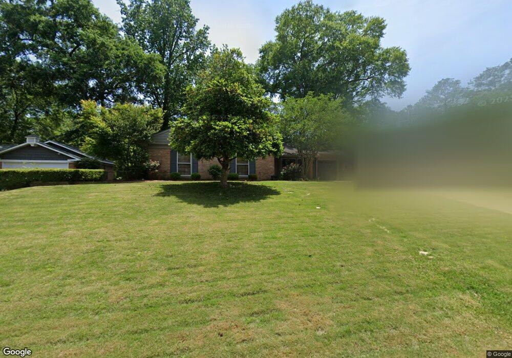
2920 Wakefield Way Columbus, GA 31906
Hilton Heights-Clubview Heights NeighborhoodEstimated Value: $270,000 - $329,000
4
Beds
3
Baths
2,196
Sq Ft
$133/Sq Ft
Est. Value
About This Home
This home is located at 2920 Wakefield Way, Columbus, GA 31906 and is currently estimated at $291,381, approximately $132 per square foot. 2920 Wakefield Way is a home located in Muscogee County with nearby schools including Clubview Elementary School, Richards Middle School, and Hardaway High School.
Ownership History
Date
Name
Owned For
Owner Type
Purchase Details
Closed on
Sep 23, 2015
Sold by
Chenoweth Chad P
Bought by
Carter Mary T and Carter Andrew H
Current Estimated Value
Home Financials for this Owner
Home Financials are based on the most recent Mortgage that was taken out on this home.
Original Mortgage
$147,000
Outstanding Balance
$115,340
Interest Rate
3.88%
Mortgage Type
New Conventional
Estimated Equity
$176,041
Purchase Details
Closed on
Feb 19, 2010
Sold by
Smith Ralph H and Smith Geraldine C
Bought by
Chenoweth Chad P and Chenoweth Kelli J
Home Financials for this Owner
Home Financials are based on the most recent Mortgage that was taken out on this home.
Original Mortgage
$149,600
Interest Rate
5.07%
Mortgage Type
New Conventional
Create a Home Valuation Report for This Property
The Home Valuation Report is an in-depth analysis detailing your home's value as well as a comparison with similar homes in the area
Home Values in the Area
Average Home Value in this Area
Purchase History
| Date | Buyer | Sale Price | Title Company |
|---|---|---|---|
| Carter Mary T | $197,000 | -- | |
| Chenoweth Chad P | $187,000 | None Available |
Source: Public Records
Mortgage History
| Date | Status | Borrower | Loan Amount |
|---|---|---|---|
| Open | Carter Mary T | $147,000 | |
| Previous Owner | Chenoweth Chad P | $149,600 |
Source: Public Records
Tax History Compared to Growth
Tax History
| Year | Tax Paid | Tax Assessment Tax Assessment Total Assessment is a certain percentage of the fair market value that is determined by local assessors to be the total taxable value of land and additions on the property. | Land | Improvement |
|---|---|---|---|---|
| 2025 | $257 | $93,500 | $17,716 | $75,784 |
| 2024 | $2,567 | $93,500 | $17,716 | $75,784 |
| 2023 | $1,889 | $93,500 | $17,716 | $75,784 |
| 2022 | $2,677 | $77,932 | $17,716 | $60,216 |
| 2021 | $2,685 | $75,436 | $17,716 | $57,720 |
| 2020 | $2,672 | $75,436 | $17,716 | $57,720 |
| 2019 | $2,682 | $75,436 | $17,716 | $57,720 |
| 2018 | $2,682 | $75,436 | $17,716 | $57,720 |
| 2017 | $2,692 | $75,436 | $17,716 | $57,720 |
| 2016 | $2,703 | $78,800 | $11,797 | $67,003 |
| 2015 | $1,321 | $79,966 | $11,797 | $68,169 |
| 2014 | $1,323 | $79,966 | $11,797 | $68,169 |
| 2013 | -- | $79,966 | $11,797 | $68,169 |
Source: Public Records
Map
Nearby Homes
- 2917 Edgewood Rd
- 2930 Sue MacK Dr
- 3402 Cambridge Dr
- 3224 Carden Dr
- 2820 Nancy St
- 3337 Coweta Dr
- 3515 Clubview Dr
- 3335 Junaluska Dr
- 2645 Edgewood Rd
- 3346 Junaluska Dr
- 3328 College Ave
- 3129 Avon Dr
- 2722 E Lindsay Dr
- 2637 Sue MacK Dr
- 3409 Hiawatha Dr
- 3200 Tip Top Dr
- 3604 Norris Rd
- 3425 Tomahawk Dr
- 2817 Carson Dr
- 2604 Sue MacK Dr
- 2926 Wakefield Way
- 2912 Wakefield Way
- 2925 Mary Ann Dr
- 2917 Mary Ann Dr
- 2931 Mary Ann Dr
- 2911 Mary Ann Dr
- 2934 Wakefield Way
- 3309 Hilton Woods Dr
- 2900 Wakefield Way
- 2905 Wakefield Way
- 2937 Mary Ann Dr
- 0 Mary Ann Dr
- 2905 Mary Ann Dr
- 3317 Hilton Woods Dr
- 2943 Mary Ann Dr
- 3306 Hilton Woods Dr
- 2940 Wakefield Way
- 2901 Wakefield Way
- 3300 Hilton Woods Dr
- 2922 Mary Ann Dr