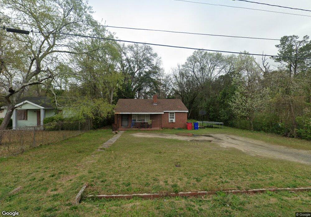
2921 Alfred Dr Macon, GA 31206
Estimated Value: $65,000 - $102,000
2
Beds
1
Bath
1,020
Sq Ft
$81/Sq Ft
Est. Value
About This Home
This home is located at 2921 Alfred Dr, Macon, GA 31206 and is currently estimated at $82,814, approximately $81 per square foot. 2921 Alfred Dr is a home located in Bibb County with nearby schools including Veterans Elementary School, Southwest High School, and Gilead Christian Academy.
Ownership History
Date
Name
Owned For
Owner Type
Purchase Details
Closed on
Sep 3, 2019
Sold by
Network Investments Llc
Bought by
Greene Darryl and Hill Nelson
Current Estimated Value
Purchase Details
Closed on
Apr 16, 2008
Sold by
Chester Mark and Chester Marcus
Bought by
Network Investments Llc
Purchase Details
Closed on
Mar 26, 2007
Sold by
Tbrown & Co
Bought by
Chester Mark E and Chester Marcus
Purchase Details
Closed on
Mar 23, 2007
Sold by
Sinclair Upton M
Bought by
Tbrown & Co Llc
Create a Home Valuation Report for This Property
The Home Valuation Report is an in-depth analysis detailing your home's value as well as a comparison with similar homes in the area
Home Values in the Area
Average Home Value in this Area
Purchase History
| Date | Buyer | Sale Price | Title Company |
|---|---|---|---|
| Greene Darryl | $2,800 | None Available | |
| Network Investments Llc | -- | -- | |
| Chester Mark E | $49,500 | None Available | |
| Tbrown & Co Llc | $37,000 | None Available |
Source: Public Records
Tax History Compared to Growth
Tax History
| Year | Tax Paid | Tax Assessment Tax Assessment Total Assessment is a certain percentage of the fair market value that is determined by local assessors to be the total taxable value of land and additions on the property. | Land | Improvement |
|---|---|---|---|---|
| 2025 | $651 | $26,511 | $3,300 | $23,211 |
| 2024 | $673 | $26,511 | $3,300 | $23,211 |
| 2023 | $510 | $20,100 | $2,640 | $17,460 |
| 2022 | $519 | $14,978 | $3,286 | $11,692 |
| 2021 | $422 | $11,101 | $2,300 | $8,801 |
| 2020 | $308 | $7,929 | $1,643 | $6,286 |
| 2019 | $310 | $7,929 | $1,643 | $6,286 |
| 2018 | $700 | $8,681 | $1,643 | $7,038 |
| 2017 | $325 | $8,681 | $1,643 | $7,038 |
| 2016 | $300 | $8,682 | $1,643 | $7,038 |
| 2015 | $425 | $8,682 | $1,643 | $7,038 |
| 2014 | $489 | $8,682 | $1,643 | $7,038 |
Source: Public Records
Map
Nearby Homes
- 2972 Richard Dr
- 3078 Alfred Dr
- 2770 Bonnie Ave
- 2769 Nancy Dr
- 2995 Virginia Dr
- 2768 Nancy Dr
- 2868 Barrett Ave
- 2801 Deeb Dr
- 2704 Reynolds Dr
- 2960 Jadan Place
- 5711 Sterling Place
- 5746 Sterling Place
- 5756 Edwina Dr
- 5780 Edwina Dr
- 2830 Village Green Dr
- 2824 Village Green Dr
- 2841 Shamrock Dr
- 5771 Satterfield Dr
- 2775 Village Green Ln
- 2929 Alfred Dr
- 2913 Alfred Dr
- 2937 Alfred Dr
- 5345 Nisbet Dr
- 5349 Nisbet Dr
- 2945 Alfred Dr
- 2924 Alfred Dr
- 2916 Alfred Dr
- 2932 Alfred Dr
- 2918 Emerson Cir
- 2922 Emerson Cir
- 2914 Emerson Cir
- 2940 Alfred Dr
- 2910 Alfred Dr
- 5341 Nisbet Dr
- 2926 Emerson Cir
- 2957 Alfred Dr
- 2930 Emerson Cir
- 2946 Alfred Dr
- 2904 Alfred Dr