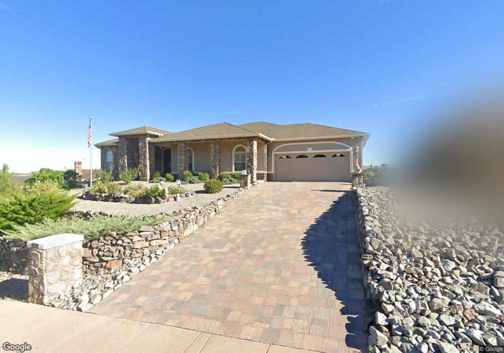
2921 Brooks Range Unit 1 Prescott, AZ 86301
Prescott Lakes NeighborhoodEstimated Value: $719,165 - $778,000
About This Home
This home is located at 2921 Brooks Range Unit 1, Prescott, AZ 86301 and is currently estimated at $753,041, approximately $341 per square foot. 2921 Brooks Range Unit 1 is a home located in Yavapai County with nearby schools including Granite Mountain Middle School, Abia Judd Elementary School, and Prescott Mile High Middle School.
Ownership History
We collect this data history from publicly available records. To have your information removed, we recommend requesting removal directly through your county’s website.
Purchase Details
Purchase Details
Purchase Details
Purchase Details
Purchase Details
Home Values in the Area
Average Home Value in this Area
Purchase History
We collect this data history from publicly available records. To have your information removed, we recommend requesting removal directly through your county’s website.
| Date | Buyer | Sale Price | Title Company |
|---|---|---|---|
| $455,000 | Yavapai Title | ||
| $445,900 | Pioneer Title Agency | ||
| $350,000 | Yavapai Title Agency Inc | ||
| -- | None Available | ||
| $50,000 | First American Title |
Tax History
We collect this data history from publicly available records. To have your information removed, we recommend requesting removal directly through your county’s website.
| Year | Tax Paid | Tax Assessment Tax Assessment Total Assessment is a certain percentage of the fair market value that is determined by local assessors to be the total taxable value of land and additions on the property. | Land | Improvement |
|---|---|---|---|---|
| 2027 | $1,967 | $63,831 | -- | -- |
| 2026 | $1,908 | $60,829 | -- | -- |
| 2024 | $1,867 | $65,787 | -- | -- |
| 2023 | $1,867 | $52,029 | $6,841 | $45,188 |
| 2022 | $1,842 | $43,895 | $5,826 | $38,069 |
| 2021 | $1,976 | $43,123 | $5,184 | $37,939 |
| 2020 | $1,985 | $0 | $0 | $0 |
| 2019 | $1,971 | $0 | $0 | $0 |
| 2018 | $1,883 | $0 | $0 | $0 |
| 2017 | $1,815 | $0 | $0 | $0 |
| 2016 | $1,807 | $0 | $0 | $0 |
| 2015 | $1,753 | $0 | $0 | $0 |
| 2014 | -- | $0 | $0 | $0 |
Map
- 2945 Noble Star Dr
- 2973 Noble Star Dr
- 708 Mines Pass
- 696 Mines Pass
- 865 Cameron Pass
- 842 Westin Pass
- 2792 Brooks Range
- 850 Cameron Pass
- 715 N Lakeview Dr
- 3096 Adobe Springs Dr
- 2680 Trail Walk
- 3120 Trail Walk
- 3144 Trail Walk
- 855 Flaming Arrow
- 3059 Smokey Rd Unit 21E
- 3079 Montana Terrace Rd Unit 12f
- 3161 Dome Rock Place Unit 7B
- 3160 Cascade Dr Unit G16
- 5919 W Cir
- 6053 W Vesta (Lot 263) Cir
- 2921 Brooks Range
- 2917 Brooks Range Unit 1
- 2933 Brooks Range
- 803 Hoosier Pass
- 809 Hoosier Pass Unit 1
- 809 Hoosier Pass
- 2918 Brooks Range
- 2913 Brooks Range Unit 1
- 2913 Brooks Range
- 828 Trail Walk Cir
- 2922 Brooks Range
- 815 Hoosier Pass
- 815 Hoosier Pass Unit 1
- 2914 Brooks Range
- 2934 Brooks Range
- 2905 Brooks Range
- 835 Trail Walk Cir
- 2910 Brooks Range Unit 19
- 2910 Brooks Range
- 836 Trail Walk Cir
Ask me questions while you tour the home.