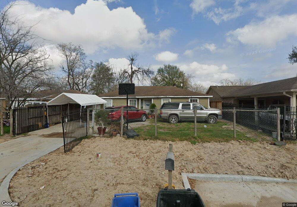
2921 Kowis St Houston, TX 77093
East Aldine NeighborhoodEstimated Value: $158,074 - $193,000
3
Beds
1
Bath
1,204
Sq Ft
$144/Sq Ft
Est. Value
About This Home
This home is located at 2921 Kowis St, Houston, TX 77093 and is currently estimated at $173,019, approximately $143 per square foot. 2921 Kowis St is a home located in Harris County with nearby schools including Scarborough Elementary School, Patrick Henry Middle School, and Sam Houston Math, Science & Technology Center.
Ownership History
Date
Name
Owned For
Owner Type
Purchase Details
Closed on
Sep 21, 2012
Sold by
Uvario Guillermo and Uvario Maria Cristina
Bought by
Silva Jose H and Silva Anna A
Current Estimated Value
Home Financials for this Owner
Home Financials are based on the most recent Mortgage that was taken out on this home.
Original Mortgage
$30,000
Interest Rate
3.38%
Mortgage Type
New Conventional
Purchase Details
Closed on
Nov 22, 2005
Sold by
Manhas Aditi
Bought by
Uvario Guillermo
Purchase Details
Closed on
Aug 3, 2001
Sold by
Center Of Life Baptist Church
Bought by
Manhas Aditi
Create a Home Valuation Report for This Property
The Home Valuation Report is an in-depth analysis detailing your home's value as well as a comparison with similar homes in the area
Home Values in the Area
Average Home Value in this Area
Purchase History
| Date | Buyer | Sale Price | Title Company |
|---|---|---|---|
| Silva Jose H | -- | None Available | |
| Uvario Guillermo | -- | Stewart Title Houston Div | |
| Manhas Aditi | -- | -- |
Source: Public Records
Mortgage History
| Date | Status | Borrower | Loan Amount |
|---|---|---|---|
| Previous Owner | Silva Jose H | $30,000 |
Source: Public Records
Tax History Compared to Growth
Tax History
| Year | Tax Paid | Tax Assessment Tax Assessment Total Assessment is a certain percentage of the fair market value that is determined by local assessors to be the total taxable value of land and additions on the property. | Land | Improvement |
|---|---|---|---|---|
| 2025 | $2,468 | $140,387 | $40,308 | $100,079 |
| 2024 | $2,468 | $140,387 | $40,308 | $100,079 |
| 2023 | $2,468 | $155,302 | $40,308 | $114,994 |
| 2022 | $2,136 | $114,857 | $28,685 | $86,172 |
| 2021 | $1,841 | $93,261 | $28,685 | $64,576 |
| 2020 | $1,677 | $81,682 | $28,685 | $52,997 |
| 2019 | $1,750 | $81,682 | $28,685 | $52,997 |
| 2018 | $1,296 | $60,510 | $30,844 | $29,666 |
| 2017 | $1,296 | $60,510 | $30,844 | $29,666 |
| 2016 | $1,296 | $60,510 | $30,844 | $29,666 |
| 2015 | $1,265 | $59,109 | $19,278 | $39,831 |
| 2014 | $1,265 | $59,109 | $19,278 | $39,831 |
Source: Public Records
Map
Nearby Homes
- 2629 Kowis St
- 2817 Cromwell St
- 2636 Lone Oak Rd
- 1728 Little York Rd
- 1904 Little York Rd
- 3418 Hopper Rd
- 2915 Brea Crest St
- 3214 Brea Crest St
- 2311 Warwick Rd
- 2237 Cromwell St
- 3804 Cedar Hill Ln
- 11716 Innsbury Dr
- 2152 William Tell St
- 3111 Hartwick Rd
- 2326 Sunny Dr
- 2306 Wardmont St
- 2122 Kowis St
- 11746 Somerset Ln
- 2723 Castledale Dr
- 2315 Langley Rd
- 2925 Kowis St
- 2917 Kowis St
- 3001 Kowis St
- 2922 Cedar Hill Ln
- 2918 Cedar Hill Ln
- 2926 Cedar Hill Ln
- 3005 Kowis St
- 3002 Cedar Hill Ln
- 2914 Cedar Hill Ln
- 3006 Cedar Hill Ln
- 2910 Cedar Hill Ln
- 3009 Kowis St
- 3010 Cedar Hill Ln
- 2906 Cedar Hill Ln
- 3013 Kowis St
- 3014 Cedar Hill Ln
- 3017 Kowis St
- 2902 Cedar Hill Ln
- 2921 Cedar Hill Ln
- 2917 Cedar Hill Ln