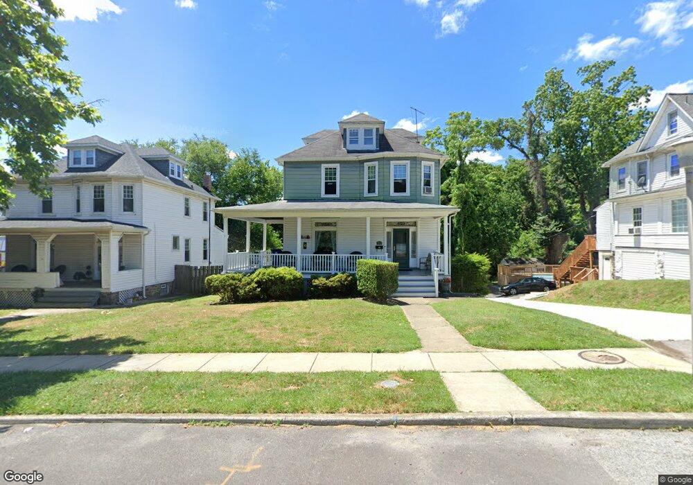
2921 Overland Ave Baltimore, MD 21214
Lauraville NeighborhoodEstimated Value: $287,653 - $328,000
--
Bed
1
Bath
2,256
Sq Ft
$136/Sq Ft
Est. Value
About This Home
This home is located at 2921 Overland Ave, Baltimore, MD 21214 and is currently estimated at $307,827, approximately $136 per square foot. 2921 Overland Ave is a home located in Baltimore City with nearby schools including Garrett Heights Elementary School, Booker T. Washington Middle School, and Paul Laurence Dunbar High School.
Ownership History
Date
Name
Owned For
Owner Type
Purchase Details
Closed on
Mar 25, 2022
Sold by
Forte Frances T and Forte Louis G
Bought by
Forte Anthony C
Current Estimated Value
Home Financials for this Owner
Home Financials are based on the most recent Mortgage that was taken out on this home.
Original Mortgage
$225,000
Interest Rate
4.42%
Create a Home Valuation Report for This Property
The Home Valuation Report is an in-depth analysis detailing your home's value as well as a comparison with similar homes in the area
Home Values in the Area
Average Home Value in this Area
Purchase History
| Date | Buyer | Sale Price | Title Company |
|---|---|---|---|
| Forte Anthony C | $250,000 | Bell Michael P | |
| Forte Anthony C | $250,000 | None Listed On Document |
Source: Public Records
Mortgage History
| Date | Status | Borrower | Loan Amount |
|---|---|---|---|
| Previous Owner | Forte Anthony C | $225,000 |
Source: Public Records
Tax History Compared to Growth
Tax History
| Year | Tax Paid | Tax Assessment Tax Assessment Total Assessment is a certain percentage of the fair market value that is determined by local assessors to be the total taxable value of land and additions on the property. | Land | Improvement |
|---|---|---|---|---|
| 2025 | $5,185 | $242,100 | $61,200 | $180,900 |
| 2024 | $5,185 | $220,767 | $0 | $0 |
| 2023 | $4,684 | $199,433 | $0 | $0 |
| 2022 | $4,203 | $178,100 | $61,200 | $116,900 |
| 2021 | $4,127 | $174,867 | $0 | $0 |
| 2020 | $3,570 | $171,633 | $0 | $0 |
| 2019 | $3,434 | $168,400 | $61,200 | $107,200 |
| 2018 | $3,349 | $168,400 | $61,200 | $107,200 |
| 2017 | $3,252 | $168,400 | $0 | $0 |
| 2016 | $2,801 | $174,000 | $0 | $0 |
| 2015 | $2,801 | $174,000 | $0 | $0 |
| 2014 | $2,801 | $174,000 | $0 | $0 |
Source: Public Records
Map
Nearby Homes
- 3004 Weaver Ave
- 2810 Montebello Terrace
- 3122 Grindon Ave
- 3205 Beverly Rd
- 4601 Hampnett Ave
- 4526 Arabia Ave
- 3220 Montebello Terrace
- 4610 Hampnett Ave
- 4525 Mainfield Ave
- 4503 Mainfield Ave
- 4604 Arabia Ave
- 4406 Mainfield Ave
- 2700 Grindon Ave
- 3202 Cedarhurst Rd
- 4308 Mainfield Ave
- 4704 Grindon Ave
- 4653 Harcourt Rd
- 3801 Parkside Dr
- 4801 Holder Ave
- 2326 Ivy Ave
- 2923 Overland Ave
- 2919 Overland Ave
- 4226 Harford Terrace
- 4224 Harford Terrace
- 2917 Overland Ave
- 4222 Harford Terrace
- 2915 Overland Ave
- 2920 Overland Ave Unit 1
- 2920 Overland Ave
- 2920 Overland Ave Unit 2
- 2920 Overland Ave Unit 4
- 2916 Overland Ave
- 4220 Harford Rd
- 4220 Harford Terrace
- 2913 Overland Ave
- 2914 Overland Ave
- 4218 Harford Terrace
- 4218 Harford Rd
- 2911 Overland Ave
- 2910 Overland Ave