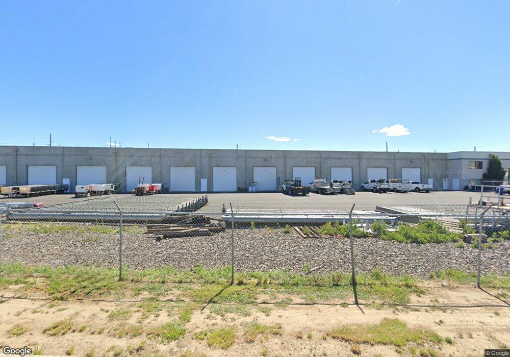
2921 Sutherland Dr Unit East Bldg Yakima, WA 98903
Estimated Value: $8,097,212
--
Bed
--
Bath
39,120
Sq Ft
$207/Sq Ft
Est. Value
About This Home
This home is located at 2921 Sutherland Dr Unit East Bldg, Yakima, WA 98903 and is currently estimated at $8,097,212, approximately $206 per square foot. 2921 Sutherland Dr Unit East Bldg is a home located in Yakima County with nearby schools including Union Gap School, Grace Lutheran School, and La Salle High School.
Ownership History
Date
Name
Owned For
Owner Type
Purchase Details
Closed on
Jan 25, 2012
Sold by
Sutherland Business Park Llc
Bought by
Kcd Properties Llc
Current Estimated Value
Home Financials for this Owner
Home Financials are based on the most recent Mortgage that was taken out on this home.
Original Mortgage
$2,487,500
Outstanding Balance
$1,703,375
Interest Rate
3.88%
Mortgage Type
Seller Take Back
Estimated Equity
$6,393,837
Create a Home Valuation Report for This Property
The Home Valuation Report is an in-depth analysis detailing your home's value as well as a comparison with similar homes in the area
Home Values in the Area
Average Home Value in this Area
Purchase History
| Date | Buyer | Sale Price | Title Company |
|---|---|---|---|
| Kcd Properties Llc | $2,664,950 | Fidelity Title Company |
Source: Public Records
Mortgage History
| Date | Status | Borrower | Loan Amount |
|---|---|---|---|
| Open | Kcd Properties Llc | $2,487,500 |
Source: Public Records
Tax History Compared to Growth
Tax History
| Year | Tax Paid | Tax Assessment Tax Assessment Total Assessment is a certain percentage of the fair market value that is determined by local assessors to be the total taxable value of land and additions on the property. | Land | Improvement |
|---|---|---|---|---|
| 2025 | $29,381 | $3,677,000 | $1,651,800 | $2,025,200 |
| 2024 | $24,712 | $3,596,600 | $1,651,800 | $1,944,800 |
| 2023 | $27,898 | $3,670,500 | $1,651,800 | $2,018,700 |
| 2022 | $35,598 | $3,543,600 | $1,651,800 | $1,891,800 |
| 2021 | $37,384 | $3,534,700 | $1,651,800 | $1,882,900 |
| 2019 | $30,808 | $3,131,600 | $1,651,800 | $1,479,800 |
| 2018 | $32,994 | $2,997,800 | $1,651,800 | $1,346,000 |
| 2017 | $27,822 | $2,684,600 | $1,376,500 | $1,308,100 |
| 2016 | -- | $2,698,700 | $1,376,500 | $1,322,200 |
| 2015 | -- | $2,937,600 | $1,328,500 | $1,609,100 |
| 2014 | -- | $2,937,600 | $1,328,500 | $1,609,100 |
| 2013 | -- | $2,937,600 | $1,328,500 | $1,609,100 |
Source: Public Records
Map
Nearby Homes
- 2007 Longfibre Rd
- 500 Richards Rd
- 403 W Ahtanum Rd
- 207 W Oak St
- 0 Goodman Rd
- 2214&2216 Landon Ave
- 2005 Ledwich Ave
- 308 W California St
- 1914 Landon Ave
- 2203 S 5th Ave
- 55 W Washington Ave Unit 153
- 55 W Washington Ave Unit 174
- 55 W Washington Ave Unit 80
- 55 W Washington Ave Unit 202
- 55 W Washington Ave Unit 76
- 18 W Washington Ave Unit 61
- 18 W Washington Ave Unit 76
- 18 W Washington Ave Unit 69
- 2802 S 5th Ave Unit 31
- 2802 S 5th Ave Unit 30
- 22502 W Ahtanum Rd
- 1211 Ahtanum Ridge Dr Unit 7
- 1008 W Ahtanum Rd Unit 8
- 1008 W Ahtanum Rd Unit 3
- 1008 W Ahtanum Rd Unit 4
- 3301 Bay St
- 1601 Ahtanum Ridge Dr Unit 1
- 1251 Ahtanum Ridge Dr Unit 5
- 1231 Ahtanum Ridge Dr Unit 6
- 1411 Ahtanum Ridge Dr Unit 4
- 1431 Ahtanum Ridge Dr Unit 3
- 1451 Ahtanum Ridge Dr Unit 2
- 1236 Ahtanum Ridge Dr Unit Lot 23
- 1236 Ahtanum Ridge Dr Unit Lot 4
- 1236 Ahtanum Ridge Dr Unit Lot 3
- 1236 Ahtanum Ridge Dr Unit Lot 2
- 1236 Ahtanum Ridge Dr Unit Lot 29
- 1236 Ahtanum Ridge Dr Unit Lots 27 & 28
- 1236 Ahtanum Ridge Dr Unit Lot 27
- 1236 Ahtanum Ridge Dr Unit Lot 27