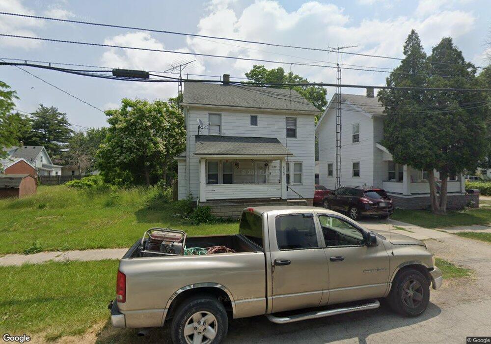
2922 D St Toledo, OH 43608
Lagrange NeighborhoodEstimated Value: $61,009 - $78,000
3
Beds
1
Bath
1,248
Sq Ft
$53/Sq Ft
Est. Value
About This Home
This home is located at 2922 D St, Toledo, OH 43608 and is currently estimated at $66,252, approximately $53 per square foot. 2922 D St is a home located in Lucas County with nearby schools including Spring Elementary School, Woodward High School, and Imagine Environmental Science Academy.
Ownership History
Date
Name
Owned For
Owner Type
Purchase Details
Closed on
Apr 15, 2025
Sold by
Fathom Deep Llc
Bought by
Riparian Vpc Ohio Sfr Portfolio Llc
Current Estimated Value
Home Financials for this Owner
Home Financials are based on the most recent Mortgage that was taken out on this home.
Original Mortgage
$35,000,000
Interest Rate
6.86%
Mortgage Type
Credit Line Revolving
Purchase Details
Closed on
Nov 10, 2017
Sold by
Independent Investments Inc
Bought by
Fathom Deep Llc
Purchase Details
Closed on
Apr 17, 2009
Sold by
Port Lawrence Title & Trust Company
Bought by
Independent Investments Inc
Purchase Details
Closed on
Jun 23, 1992
Sold by
Smith Joan
Create a Home Valuation Report for This Property
The Home Valuation Report is an in-depth analysis detailing your home's value as well as a comparison with similar homes in the area
Home Values in the Area
Average Home Value in this Area
Purchase History
| Date | Buyer | Sale Price | Title Company |
|---|---|---|---|
| Riparian Vpc Ohio Sfr Portfolio Llc | $2,316,300 | None Listed On Document | |
| Fathom Deep Llc | $115,000 | None Available | |
| Independent Investments Inc | -- | Port Lawrence Title | |
| -- | -- | -- |
Source: Public Records
Mortgage History
| Date | Status | Borrower | Loan Amount |
|---|---|---|---|
| Previous Owner | Riparian Vpc Ohio Sfr Portfolio Llc | $35,000,000 |
Source: Public Records
Tax History Compared to Growth
Tax History
| Year | Tax Paid | Tax Assessment Tax Assessment Total Assessment is a certain percentage of the fair market value that is determined by local assessors to be the total taxable value of land and additions on the property. | Land | Improvement |
|---|---|---|---|---|
| 2024 | $2,067 | $12,985 | $1,855 | $11,130 |
| 2023 | $717 | $6,790 | $1,015 | $5,775 |
| 2022 | $564 | $6,790 | $1,015 | $5,775 |
| 2021 | $585 | $6,790 | $1,015 | $5,775 |
| 2020 | $624 | $6,265 | $910 | $5,355 |
| 2019 | $602 | $6,265 | $910 | $5,355 |
| 2018 | $656 | $6,265 | $910 | $5,355 |
| 2017 | $458 | $4,375 | $1,610 | $2,765 |
| 2016 | $475 | $12,500 | $4,600 | $7,900 |
| 2015 | $712 | $12,500 | $4,600 | $7,900 |
| 2014 | $283 | $4,380 | $1,610 | $2,770 |
| 2013 | $283 | $4,380 | $1,610 | $2,770 |
Source: Public Records
Map
Nearby Homes
- 1303 Saint John Ave
- 2815 E St
- 926 Saint John Ave
- 2816 A St
- 3150 Doyle St
- 1105 Ketcham Ave
- 3250 Brigham St
- 3256 Jeannette Ave
- 3308 Blackstone Dr
- 3316 Jeannette Ave
- 3250 Otto St
- 3324 Buckeye St
- 1817 Ridgewood Ave
- 1821 Ridgewood Ave
- 1816 Clay Ave
- 616 E Park St
- 3020 Mulberry St
- 1809 Clay Ave
- 1541 Booth Ave
- 3405 Beaumont Dr
- 2918 D St
- 1212 Bronson Ave
- 1204 Bronson Ave
- 1214 Bronson Ave
- 1209 Saint John Ave
- 1205 Saint John Ave
- 1218 Bronson Ave
- 1219 Saint John Ave
- 1201 Saint John Ave
- 1221 Saint John Ave
- 2915 E St
- 1220 Bronson Ave
- 1217 Saint John Ave
- 1131 Saint John Ave
- 1222 Bronson Ave
- 2911 D St
- 2919 D St
- 1127 Saint John Ave
- 2931 E St
- 1227 Saint John Ave