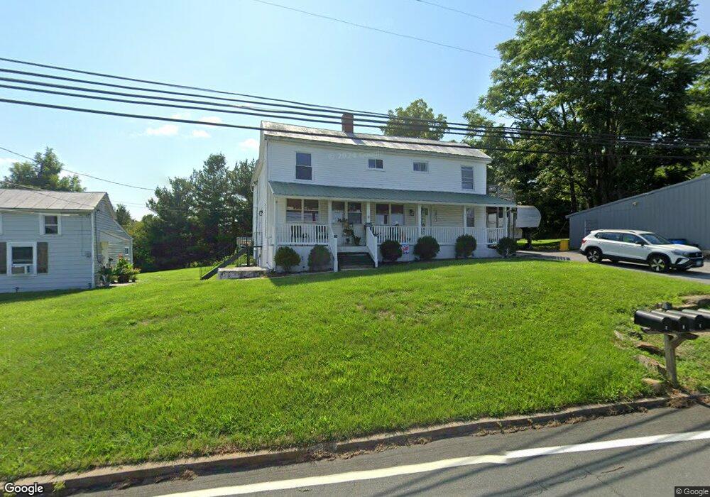
2922 Marston Rd Unit D New Windsor, MD 21776
Estimated Value: $517,000 - $678,000
4
Beds
1
Bath
1,776
Sq Ft
$336/Sq Ft
Est. Value
About This Home
This home is located at 2922 Marston Rd Unit D, New Windsor, MD 21776 and is currently estimated at $595,971, approximately $335 per square foot. 2922 Marston Rd Unit D is a home located in Carroll County with nearby schools including Winfield Elementary School, Mount Airy Middle School, and South Carroll High School.
Ownership History
Date
Name
Owned For
Owner Type
Purchase Details
Closed on
Jul 15, 2020
Sold by
Nationstar Mtg Llc Dba Mr Cooper Sucsr B
Bought by
Flipping Sykesville Llc
Current Estimated Value
Purchase Details
Closed on
May 21, 2018
Sold by
Osullinvan Laura and Brown Chasity
Bought by
Pacific Union Financial Llc
Purchase Details
Closed on
Jul 27, 2012
Sold by
102 George Street Llc
Bought by
Abed Jordan A
Home Financials for this Owner
Home Financials are based on the most recent Mortgage that was taken out on this home.
Original Mortgage
$282,262
Interest Rate
3.75%
Mortgage Type
FHA
Purchase Details
Closed on
May 30, 2002
Sold by
Stultz Murwin M
Bought by
Stultz Murwin M L E and Stultz Catherine V L E
Create a Home Valuation Report for This Property
The Home Valuation Report is an in-depth analysis detailing your home's value as well as a comparison with similar homes in the area
Purchase History
| Date | Buyer | Sale Price | Title Company |
|---|---|---|---|
| Flipping Sykesville Llc | $218,000 | Servicelink Llc | |
| Pacific Union Financial Llc | $247,000 | None Available | |
| Abed Jordan A | $292,500 | Blue Ridge Title Company | |
| Stultz Murwin M L E | -- | -- |
Source: Public Records
Mortgage History
| Date | Status | Borrower | Loan Amount |
|---|---|---|---|
| Previous Owner | Abed Jordan A | $282,262 |
Source: Public Records
Tax History
| Year | Tax Paid | Tax Assessment Tax Assessment Total Assessment is a certain percentage of the fair market value that is determined by local assessors to be the total taxable value of land and additions on the property. | Land | Improvement |
|---|---|---|---|---|
| 2025 | $4,816 | $424,733 | $0 | $0 |
| 2024 | $4,509 | $391,900 | $134,000 | $257,900 |
| 2023 | $4,400 | $387,600 | $0 | $0 |
| 2022 | $4,352 | $383,300 | $0 | $0 |
| 2021 | $4,304 | $379,000 | $134,000 | $245,000 |
| 2020 | $4,063 | $357,500 | $0 | $0 |
| 2019 | $3,420 | $336,000 | $0 | $0 |
| 2018 | $3,618 | $314,500 | $134,000 | $180,500 |
| 2017 | $3,582 | $314,500 | $0 | $0 |
| 2016 | -- | $314,500 | $0 | $0 |
| 2015 | -- | $331,700 | $0 | $0 |
| 2014 | -- | $331,700 | $0 | $0 |
Source: Public Records
Map
Nearby Homes
- 2900 Marston Rd
- 3026 Marston Rd
- PARCEL 198 Dennings Rd
- Lot 15 Westview Dr
- 2315 Sandel Ln
- 4047 Ridge Rd
- 1658 Sams Creek Rd
- 2514 W Liberty Rd
- 2613 Liberty Rd
- 4328 Ridge Rd Unit 13
- 3501 Sams Creek Rd
- 4505 Gray Horse Dr
- 3816 A Jim Smith Ln
- 15539 Liberty Rd
- 1802 Ridge Rd
- 1810 Stone Chapel Rd
- 970 Oak Tree Rd
- 0 Bear Branch Rd
- 2810 Town View Cir
- 2833 Town View Cir
- 2922 Marston Rd Unit 2
- 2922 Marston Rd
- 3002 Glenvue Dr
- 3004 Glenvue Dr
- 2918 Marston Rd
- 3006 Glenvue Dr
- 2230 Dennings Rd
- 3009 Glenvue Dr
- 2943 Marston Rd
- 3010 Glenvue Dr
- 3008 Glenvue Dr
- 3011 Glenvue Dr
- Dennings Rd
- 2224 Dennings Rd
- 3012 Glenvue Dr
- 2218 Dennings Rd
- 3010 Marston Rd
- 2307 Doctor Stitely Rd
- 2225 Doctor Stitely Rd
Your Personal Tour Guide
Ask me questions while you tour the home.