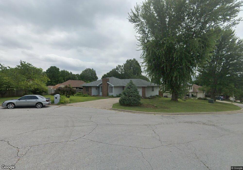
2922 S Jonathan Ct Springfield, MO 65807
Southwest Springfield NeighborhoodEstimated Value: $252,530 - $271,000
3
Beds
2
Baths
1,564
Sq Ft
$170/Sq Ft
Est. Value
About This Home
This home is located at 2922 S Jonathan Ct, Springfield, MO 65807 and is currently estimated at $266,133, approximately $170 per square foot. 2922 S Jonathan Ct is a home located in Greene County with nearby schools including Sherwood Elementary School, Carver Middle School, and Parkview High School.
Ownership History
Date
Name
Owned For
Owner Type
Purchase Details
Closed on
Jun 8, 2020
Sold by
Mulkey Carolyn S
Bought by
King Victor and King Sandra
Current Estimated Value
Home Financials for this Owner
Home Financials are based on the most recent Mortgage that was taken out on this home.
Original Mortgage
$82,400
Outstanding Balance
$72,880
Interest Rate
3.2%
Mortgage Type
New Conventional
Estimated Equity
$193,253
Purchase Details
Closed on
May 21, 2008
Sold by
Brendler Reinhold G and Brendler Doris L
Bought by
Mulkey Carolyn S
Home Financials for this Owner
Home Financials are based on the most recent Mortgage that was taken out on this home.
Original Mortgage
$63,000
Interest Rate
5.86%
Mortgage Type
New Conventional
Create a Home Valuation Report for This Property
The Home Valuation Report is an in-depth analysis detailing your home's value as well as a comparison with similar homes in the area
Home Values in the Area
Average Home Value in this Area
Purchase History
| Date | Buyer | Sale Price | Title Company |
|---|---|---|---|
| King Victor | -- | None Available | |
| Mulkey Carolyn S | -- | None Available |
Source: Public Records
Mortgage History
| Date | Status | Borrower | Loan Amount |
|---|---|---|---|
| Open | King Victor | $82,400 | |
| Previous Owner | Mulkey Carolyn S | $63,000 |
Source: Public Records
Tax History
| Year | Tax Paid | Tax Assessment Tax Assessment Total Assessment is a certain percentage of the fair market value that is determined by local assessors to be the total taxable value of land and additions on the property. | Land | Improvement |
|---|---|---|---|---|
| 2025 | $1,774 | $34,430 | $7,600 | $26,830 |
| 2024 | $1,695 | $30,610 | $6,650 | $23,960 |
| 2023 | $1,686 | $30,610 | $6,650 | $23,960 |
| 2022 | $1,445 | $26,890 | $6,650 | $20,240 |
| 2021 | $1,445 | $26,890 | $6,650 | $20,240 |
| 2020 | $1,046 | $18,450 | $6,650 | $11,800 |
| 2019 | $1,015 | $18,450 | $6,650 | $11,800 |
| 2018 | $991 | $17,970 | $6,650 | $11,320 |
| 2017 | $982 | $17,970 | $6,650 | $11,320 |
| 2016 | $982 | $17,970 | $6,650 | $11,320 |
| 2015 | $974 | $17,970 | $6,650 | $11,320 |
| 2014 | $946 | $17,310 | $6,650 | $10,660 |
Source: Public Records
Map
Nearby Homes
- 2721 S Timbercreek Ave
- 3021 S Palisades Dr
- 3057 S Suburban Ave
- 3977 W Beechwood St
- 3350 S Farm Road 123
- 3350 Farm Road 123
- 3086 S Suburban Ave
- 000 W Farm Road 156
- 3550 W Morningside Place
- 2518 S Pembrook Ave
- 3800 W Broadmoor St
- 3789 W Overland St
- 3864 W Overland St
- 3812 W Broadmoor St
- 3813 W Broadmoor St
- 2314 S Farm Road 123
- 3466 W Beechwood St
- 3692 W Overland St
- 3701 W Broadmoor St
- 3990 W Wayland St
- 2942 S Jonathan Ct
- 2917 S Scotts Ln
- 2901 S Scotts Ln
- 2910 S Jonathan Ct
- 2929 S Scotts Ln
- 2919 S Jonathan Ct
- 2946 S Jonathan Ct
- 2933 S Jonathan Ct
- 2945 S Jonathan Ct
- 2911 S Jonathan Ct
- 2867 S Scotts Ln
- 2935 S Scotts Ln
- 2957 S Jonathan Ct
- 2958 S Jonathan Ct
- 2851 S Scotts Ln
- 2910 S Scotts Ln
- 2945 S Scotts Ln
- 2920 S Scotts Ln
- 2918 S Timbercreek Ave
- 2904 S Scotts Ln
Your Personal Tour Guide
Ask me questions while you tour the home.