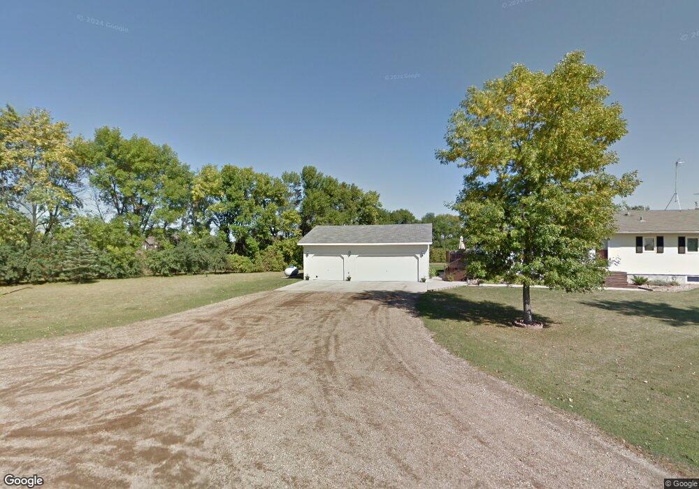
2924 Highway 81 Manvel, ND 58256
Estimated Value: $297,016 - $431,000
3
Beds
2
Baths
2,508
Sq Ft
$142/Sq Ft
Est. Value
About This Home
This home is located at 2924 Highway 81, Manvel, ND 58256 and is currently estimated at $357,004, approximately $142 per square foot. 2924 Highway 81 is a home located in Grand Forks County with nearby schools including Manvel Elementary School.
Ownership History
Date
Name
Owned For
Owner Type
Purchase Details
Closed on
Sep 16, 2019
Sold by
Casichek Autumn J and Vasichek Scott R
Bought by
Loraas Jason and Loraas Jennifer
Current Estimated Value
Home Financials for this Owner
Home Financials are based on the most recent Mortgage that was taken out on this home.
Original Mortgage
$263,636
Outstanding Balance
$230,925
Interest Rate
3.6%
Mortgage Type
FHA
Estimated Equity
$126,079
Purchase Details
Closed on
Oct 11, 2013
Sold by
Johnson Mark S and Johnson Laureen C
Bought by
Stoik Autumn J and Vasichek Scott R
Home Financials for this Owner
Home Financials are based on the most recent Mortgage that was taken out on this home.
Original Mortgage
$220,500
Interest Rate
4.5%
Mortgage Type
New Conventional
Create a Home Valuation Report for This Property
The Home Valuation Report is an in-depth analysis detailing your home's value as well as a comparison with similar homes in the area
Home Values in the Area
Average Home Value in this Area
Purchase History
| Date | Buyer | Sale Price | Title Company |
|---|---|---|---|
| Loraas Jason | $268,500 | -- | |
| Stoik Autumn J | $245,000 | None Available |
Source: Public Records
Mortgage History
| Date | Status | Borrower | Loan Amount |
|---|---|---|---|
| Open | Loraas Jason | $263,636 | |
| Previous Owner | Stoik Autumn J | $220,500 |
Source: Public Records
Tax History Compared to Growth
Tax History
| Year | Tax Paid | Tax Assessment Tax Assessment Total Assessment is a certain percentage of the fair market value that is determined by local assessors to be the total taxable value of land and additions on the property. | Land | Improvement |
|---|---|---|---|---|
| 2024 | $2,265 | $146,400 | $0 | $0 |
| 2023 | $2,799 | $142,000 | $9,650 | $132,350 |
| 2022 | $2,575 | $133,150 | $9,650 | $123,500 |
| 2021 | $2,406 | $127,250 | $8,850 | $118,400 |
| 2020 | $2,347 | $123,500 | $8,550 | $114,950 |
| 2018 | $1,836 | $85,500 | $7,000 | $78,500 |
| 2017 | $1,774 | $85,500 | $7,000 | $78,500 |
| 2016 | $1,724 | $0 | $0 | $0 |
| 2015 | $1,612 | $0 | $0 | $0 |
| 2014 | $1,557 | $85,500 | $0 | $0 |
Source: Public Records
Map
Nearby Homes
- 48106 150th St St NW
- 0 Tbd 20th St NE Unit LotWP001
- 403 Marshall St
- 303 4th Ave E
- 403 Lake St
- 4237 72nd Ave N
- 4399 N Columbia Rd
- 6801 27th Ave N
- 4350 N Columbia Rd
- 1530 55th St N
- 1784 16th St NE
- 1759 18th St NE
- RURAL Falconer Twp
- 5370 Myron Ave
- 5380 Myron Ave
- 2515 N 39th St
- 2545 N 39th St
- 5450 Gateway Dr
- 4252 16th Ave N
- 5201 Gateway Dr
- 2924 Highway 81
- 2922 81st
- 2920 Highway 81
- 2920 Highway 81
- 2912 Highway 81
- 1703 Annies Ln NE
- 2913 17th St NE
- 1713 Annies Ln NE
- 1705 Annies Ln NE
- 1717 Annies Ln NE
- LOT 3 Annies Ln NE
- LOT 2 Annies Ln NE
- LOT 10 Annies Ln NE
- 1712 Annies Ln NE
- 1704 Annies Ln NE
- 1718 Annies Ln NE
- 1735 Annies Ln NE
- 1740 Annies Ln NE
- 3002 17th St NE
- 1680 30th Ave NE