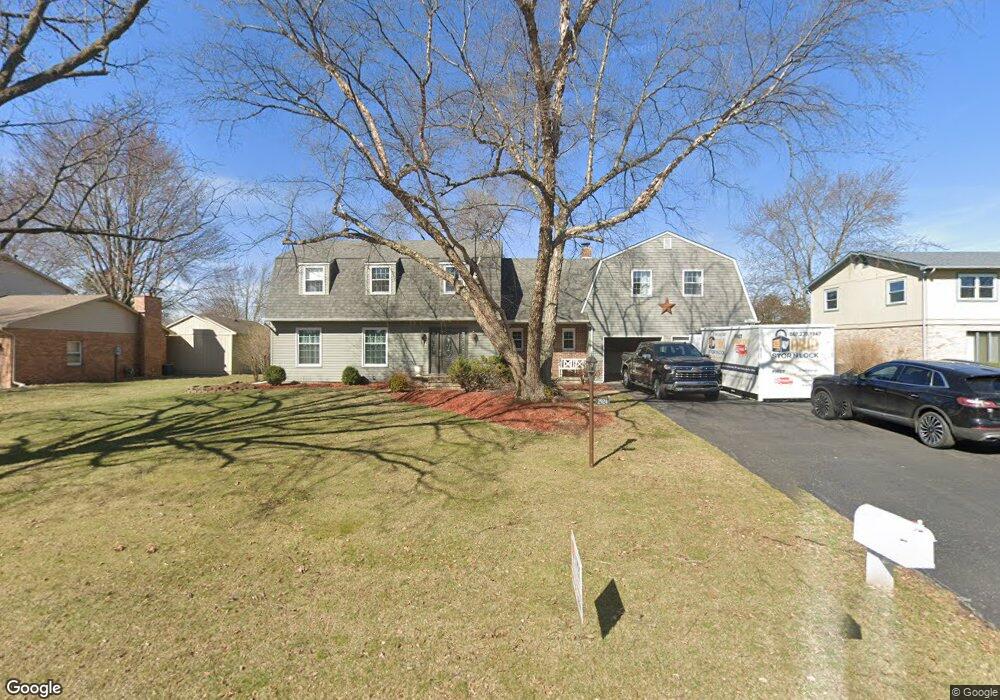
2924 Saint Andrews Dr Findlay, OH 45840
Estimated Value: $342,889 - $429,000
--
Bed
3
Baths
2,830
Sq Ft
$136/Sq Ft
Est. Value
About This Home
This home is located at 2924 Saint Andrews Dr, Findlay, OH 45840 and is currently estimated at $384,722, approximately $135 per square foot. 2924 Saint Andrews Dr is a home located in Hancock County with nearby schools including Liberty-Benton Elementary School, Liberty-Benton Middle School, and Liberty-Benton High School.
Ownership History
Date
Name
Owned For
Owner Type
Purchase Details
Closed on
Jun 28, 2000
Sold by
Coleman Don O
Bought by
Haseley Roger R and Haseley Susan A
Current Estimated Value
Home Financials for this Owner
Home Financials are based on the most recent Mortgage that was taken out on this home.
Original Mortgage
$170,000
Outstanding Balance
$71,040
Interest Rate
10.63%
Mortgage Type
New Conventional
Estimated Equity
$313,682
Create a Home Valuation Report for This Property
The Home Valuation Report is an in-depth analysis detailing your home's value as well as a comparison with similar homes in the area
Home Values in the Area
Average Home Value in this Area
Purchase History
| Date | Buyer | Sale Price | Title Company |
|---|---|---|---|
| Haseley Roger R | $190,000 | -- |
Source: Public Records
Mortgage History
| Date | Status | Borrower | Loan Amount |
|---|---|---|---|
| Open | Haseley Roger R | $170,000 |
Source: Public Records
Tax History Compared to Growth
Tax History
| Year | Tax Paid | Tax Assessment Tax Assessment Total Assessment is a certain percentage of the fair market value that is determined by local assessors to be the total taxable value of land and additions on the property. | Land | Improvement |
|---|---|---|---|---|
| 2024 | $3,490 | $93,880 | $12,200 | $81,680 |
| 2023 | $3,408 | $93,880 | $12,200 | $81,680 |
| 2022 | $3,374 | $93,880 | $12,200 | $81,680 |
| 2021 | $3,297 | $80,970 | $12,170 | $68,800 |
| 2020 | $3,325 | $80,970 | $12,170 | $68,800 |
| 2019 | $3,190 | $80,970 | $12,170 | $68,800 |
| 2018 | $2,512 | $70,400 | $10,580 | $59,820 |
| 2017 | $1,296 | $70,400 | $10,580 | $59,820 |
| 2016 | $2,517 | $70,400 | $10,580 | $59,820 |
| 2015 | $2,608 | $71,230 | $10,580 | $60,650 |
| 2014 | $2,632 | $71,230 | $10,580 | $60,650 |
| 2012 | $2,749 | $71,230 | $10,580 | $60,650 |
Source: Public Records
Map
Nearby Homes
- 3018 Gleneagle Dr
- 1310 Muirfield Dr
- 3106 Saddlebrook
- 1405 Cypress Lake
- 933 Laurel Ln
- 6535 Silver Lake Dr
- 3300 Crosshill Dr
- 615 Hillcrest Ave
- 506 Hillcrest Ave
- 925 W Melrose Ave
- 905 W Melrose Ave
- 643 Edith Ave
- 0 County Road 95 Unit 6097574
- 0 Township Highway 99
- 12325 Township Highway 99
- 0 Allen Township 142
- 126 Hillcrest Ave
- 0 Bushwillow Dr Or Rock Candy Rd Unit Lot 157
- 0 Rock Candy Rd Or Bushwillow Dr Unit Lot 173
- 0 County Road 140
- 2930 Saint Andrews Dr
- 2918 Saint Andrews Dr
- 2912 Saint Andrews Dr
- 2927 Saint Andrews Dr
- 2929 St Andrews Dr
- 2929 Saint Andrews Dr
- 2936 Saint Andrews Dr
- 2915 Saint Andrews Dr
- 2939 Saint Andrews Dr
- 2906 Saint Andrews Dr
- 2940 Saint Andrews Dr
- 2907 Saint Andrews Dr
- 1001 Muirfield Dr
- 1102 Inverness Dr
- 1112 Inverness Dr
- 3000 Saint Andrews Dr
- 1020 Inverness Dr
- 1005 Muirfield Dr
- 1118 Inverness Dr
- 1006 Inverness Dr