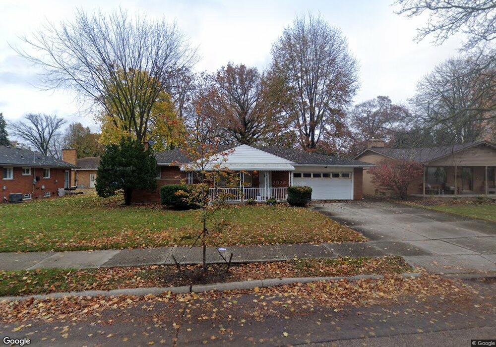
2925 Westpoint St Dearborn, MI 48124
Southwestern Outer Drive NeighborhoodEstimated Value: $251,000 - $322,831
3
Beds
3
Baths
1,462
Sq Ft
$193/Sq Ft
Est. Value
About This Home
This home is located at 2925 Westpoint St, Dearborn, MI 48124 and is currently estimated at $281,958, approximately $192 per square foot. 2925 Westpoint St is a home located in Wayne County with nearby schools including Nowlin Elementary School, Smith Middle School, and Edsel Ford High School.
Ownership History
Date
Name
Owned For
Owner Type
Purchase Details
Closed on
Jun 27, 2025
Sold by
Hindi Family Trust and Hindi Itidal D
Bought by
Skyline Acquisitions Llc
Current Estimated Value
Purchase Details
Closed on
Jun 15, 2010
Sold by
Hindi Itidal D
Bought by
Hindi Itidal D and The Hindi Family Trust
Purchase Details
Closed on
Sep 25, 2008
Sold by
Mourad May
Bought by
Hindi Itidal D
Purchase Details
Closed on
Sep 3, 2008
Sold by
Mourad May
Bought by
Deutsche Bank National Trust Co
Create a Home Valuation Report for This Property
The Home Valuation Report is an in-depth analysis detailing your home's value as well as a comparison with similar homes in the area
Home Values in the Area
Average Home Value in this Area
Purchase History
| Date | Buyer | Sale Price | Title Company |
|---|---|---|---|
| Skyline Acquisitions Llc | $250,000 | Venture Title | |
| Skyline Acquisitions Llc | $250,000 | Venture Title | |
| Hindi Itidal D | -- | None Available | |
| Hindi Itidal D | $93,000 | Title One Inc | |
| Deutsche Bank National Trust Co | $118,082 | None Available |
Source: Public Records
Tax History Compared to Growth
Tax History
| Year | Tax Paid | Tax Assessment Tax Assessment Total Assessment is a certain percentage of the fair market value that is determined by local assessors to be the total taxable value of land and additions on the property. | Land | Improvement |
|---|---|---|---|---|
| 2025 | $3,077 | $146,500 | $0 | $0 |
| 2024 | $3,077 | $138,300 | $0 | $0 |
| 2023 | $2,911 | $126,800 | $0 | $0 |
| 2022 | $3,276 | $105,600 | $0 | $0 |
| 2021 | $3,807 | $95,600 | $0 | $0 |
| 2019 | $3,768 | $79,000 | $0 | $0 |
| 2018 | $3,195 | $70,500 | $0 | $0 |
| 2017 | $916 | $65,900 | $0 | $0 |
| 2016 | $2,944 | $62,700 | $0 | $0 |
| 2015 | $5,563 | $57,500 | $0 | $0 |
| 2013 | $5,420 | $54,200 | $0 | $0 |
| 2011 | -- | $61,600 | $0 | $0 |
Source: Public Records
Map
Nearby Homes
- 2906 Syracuse St
- 24100 Chicago St
- 24154 Chicago St
- 24170 Chicago St
- 2856 Academy St
- 2801 Boldt St
- 2920 Grindley Park St
- 3425 Westpoint St
- 425 S Telegraph Rd
- 2 Cornell Ct
- 2705 Homeplace St
- 2218 Geneva St
- 2943 Queen St
- 2453 Homeplace St
- 2050 Cornell St
- 3604 Syracuse St
- 2425 Grindley Park St
- 24440 Penn St
- 23121 Madison St
- 24517 Calvin St
- 23871 Princeton St
- 2939 Westpoint St
- 23855 Princeton St
- 2951 Westpoint St
- 23931 Princeton St
- 2940 Westpoint St
- 23845 Princeton St
- 2961 Westpoint St
- 2950 Westpoint St
- 23870 Princeton St
- 2922 Cornell St
- 2934 Cornell St
- 3005 Westpoint St
- 2950 Cornell St
- 2906 Cornell St
- 23838 Princeton St
- 3019 Westpoint St
- 3000 Cornell St
- 2858 Cornell St
- 2959 S Telegraph Rd