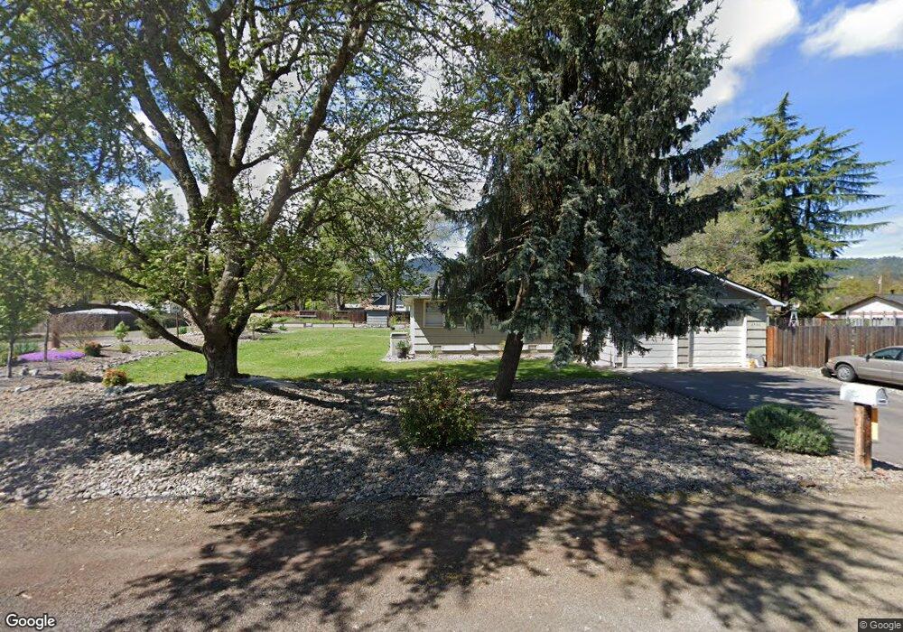
2926 Poplar Dr Central Point, OR 97502
Estimated Value: $489,418 - $566,000
3
Beds
1
Bath
1,528
Sq Ft
$346/Sq Ft
Est. Value
About This Home
This home is located at 2926 Poplar Dr, Central Point, OR 97502 and is currently estimated at $529,139, approximately $346 per square foot. 2926 Poplar Dr is a home located in Jackson County with nearby schools including Jacksonville Elementary School, McLoughlin Middle School, and South Medford High School.
Ownership History
Date
Name
Owned For
Owner Type
Purchase Details
Closed on
Jul 17, 2012
Sold by
Stephens Gail and Stephens Kent George
Bought by
Kays Francis A and Kays Chelsea S
Current Estimated Value
Home Financials for this Owner
Home Financials are based on the most recent Mortgage that was taken out on this home.
Original Mortgage
$150,000
Outstanding Balance
$103,347
Interest Rate
3.63%
Mortgage Type
New Conventional
Estimated Equity
$425,792
Create a Home Valuation Report for This Property
The Home Valuation Report is an in-depth analysis detailing your home's value as well as a comparison with similar homes in the area
Home Values in the Area
Average Home Value in this Area
Purchase History
| Date | Buyer | Sale Price | Title Company |
|---|---|---|---|
| Kays Francis A | $210,000 | Amerititle |
Source: Public Records
Mortgage History
| Date | Status | Borrower | Loan Amount |
|---|---|---|---|
| Open | Kays Francis A | $150,000 |
Source: Public Records
Tax History Compared to Growth
Tax History
| Year | Tax Paid | Tax Assessment Tax Assessment Total Assessment is a certain percentage of the fair market value that is determined by local assessors to be the total taxable value of land and additions on the property. | Land | Improvement |
|---|---|---|---|---|
| 2025 | $2,932 | $236,620 | $131,430 | $105,190 |
| 2024 | $2,932 | $229,730 | $137,720 | $92,010 |
| 2023 | $2,841 | $223,040 | $133,710 | $89,330 |
| 2022 | $2,774 | $223,040 | $133,710 | $89,330 |
| 2021 | $2,704 | $216,550 | $129,820 | $86,730 |
| 2020 | $2,640 | $210,250 | $126,050 | $84,200 |
| 2019 | $2,579 | $198,190 | $118,820 | $79,370 |
| 2018 | $2,514 | $192,420 | $115,360 | $77,060 |
| 2017 | $2,473 | $192,420 | $115,360 | $77,060 |
| 2016 | $2,426 | $181,380 | $108,740 | $72,640 |
| 2015 | $2,324 | $181,380 | $108,740 | $72,640 |
| 2014 | $2,290 | $170,980 | $102,500 | $68,480 |
Source: Public Records
Map
Nearby Homes
- 1916 Old Military Rd
- 2555 Old Military Rd
- 2805 Old Military Rd
- 3220 Freeland Rd
- 187 Vashti Way
- 3307 Freeland Rd
- 4425 W Main St Unit 23
- 4425 W Main St Unit 31
- 61 Vashti Way
- 0 Main St W Unit 220209697
- 3842 W Main St
- 3506 New Ray Rd
- 465 Creekside Cir
- 487 Creekside Cir
- 570 Bachand Cir
- 3642 Oak Pine Way
- 895 Holley Way
- 3275 Britt Ave
- 495 Shafer Ln
- 871 Holley Way
- 0 Juniper Ave
- 2962 Juniper Ave
- 2925 Ross Ln
- 2962 Juniper Ave
- 2884 Juniper Ave
- 2965 Ross Ln
- 2883 Ross Ln
- 2971 Juniper Ave
- 2883 Juniper Ave
- 1980 Niedermeyer Dr
- 2840 Juniper Ave
- 2910 Larch Ave
- 1920 Niedermeyer Dr
- 1882 Niedermeyer Dr
- 2849 Ross Ln
- 2950 Larch Ave
- 2841 Juniper Ave
- 2884 Larch Ave
- 1852 Niedermeyer Dr
- 2844 Larch Ave