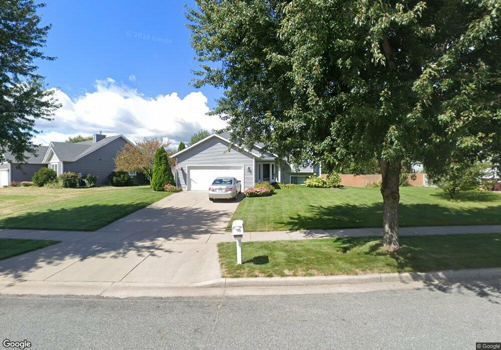
2926 W Frank St Eau Claire, WI 54703
Estimated Value: $350,000 - $398,000
3
Beds
2
Baths
1,626
Sq Ft
$226/Sq Ft
Est. Value
About This Home
This home is located at 2926 W Frank St, Eau Claire, WI 54703 and is currently estimated at $366,854, approximately $225 per square foot. 2926 W Frank St is a home located in Eau Claire County with nearby schools including Sherman Elementary School, Delong Middle School, and North High School.
Ownership History
Date
Name
Owned For
Owner Type
Purchase Details
Closed on
Jul 9, 2009
Sold by
Thornton Mark A and Thornton Margaret L
Bought by
Thornton Mark A and Thornton Margaret L
Current Estimated Value
Home Financials for this Owner
Home Financials are based on the most recent Mortgage that was taken out on this home.
Original Mortgage
$138,000
Interest Rate
5.27%
Mortgage Type
New Conventional
Create a Home Valuation Report for This Property
The Home Valuation Report is an in-depth analysis detailing your home's value as well as a comparison with similar homes in the area
Home Values in the Area
Average Home Value in this Area
Purchase History
| Date | Buyer | Sale Price | Title Company |
|---|---|---|---|
| Thornton Mark A | -- | None Available |
Source: Public Records
Mortgage History
| Date | Status | Borrower | Loan Amount |
|---|---|---|---|
| Previous Owner | Thornton Mark A | $138,000 |
Source: Public Records
Tax History Compared to Growth
Tax History
| Year | Tax Paid | Tax Assessment Tax Assessment Total Assessment is a certain percentage of the fair market value that is determined by local assessors to be the total taxable value of land and additions on the property. | Land | Improvement |
|---|---|---|---|---|
| 2024 | $5,014 | $263,700 | $35,500 | $228,200 |
| 2023 | $4,512 | $260,800 | $35,500 | $225,300 |
| 2022 | $4,415 | $260,800 | $35,500 | $225,300 |
| 2021 | $4,320 | $260,800 | $35,500 | $225,300 |
| 2020 | $3,905 | $204,300 | $35,500 | $168,800 |
| 2019 | $3,891 | $204,300 | $35,500 | $168,800 |
| 2018 | $3,829 | $204,300 | $35,500 | $168,800 |
| 2017 | $3,576 | $163,900 | $30,500 | $133,400 |
| 2016 | $3,588 | $163,900 | $30,500 | $133,400 |
| 2014 | -- | $163,900 | $30,500 | $133,400 |
| 2013 | -- | $163,900 | $30,500 | $133,400 |
Source: Public Records
Map
Nearby Homes
- Lot 7,8 & 9 33rd St
- 3128 Kohlhepp Rd
- 2314 Vesterheim St
- 3206 Rosewood Ln
- 1 Acre Rosewood Ln
- 1917 Sherwood Blvd
- 3316 Sanford Ln
- 3453 Creek Ridge Dr
- 1808 Dorret Rd
- 1806 Dorret Rd
- 3490 Creek Ridge Dr
- 1996 Tucker Trail
- 1712 Dorret Rd
- 3720 W Cameron St
- 3230 Preston Rd
- 2218 Fenner St
- 2825 Crestwood Rd
- 1805 Moholt Dr
- 1811 W Ridge Ct
- 1817 Sunset Dr
- 2932 W Frank St
- 2920 W Frank St
- 2936 W Frank St
- 2925 W Frank St
- 2929 W Frank St
- 2304 Marie Ct
- 2910 W Frank St
- 2942 2942 Frank
- 2942 W Frank St
- 2305 Marie Ct
- 2909 W Frank St
- 2933 W Frank St
- 2940 W Frank St
- 2944 W Frank St
- 2935 W Frank St
- 2935 W Frank St
- 2306 Marie Ct
- 2906 W Frank St
- 2937 W Frank St
- 2309 Marie Ct