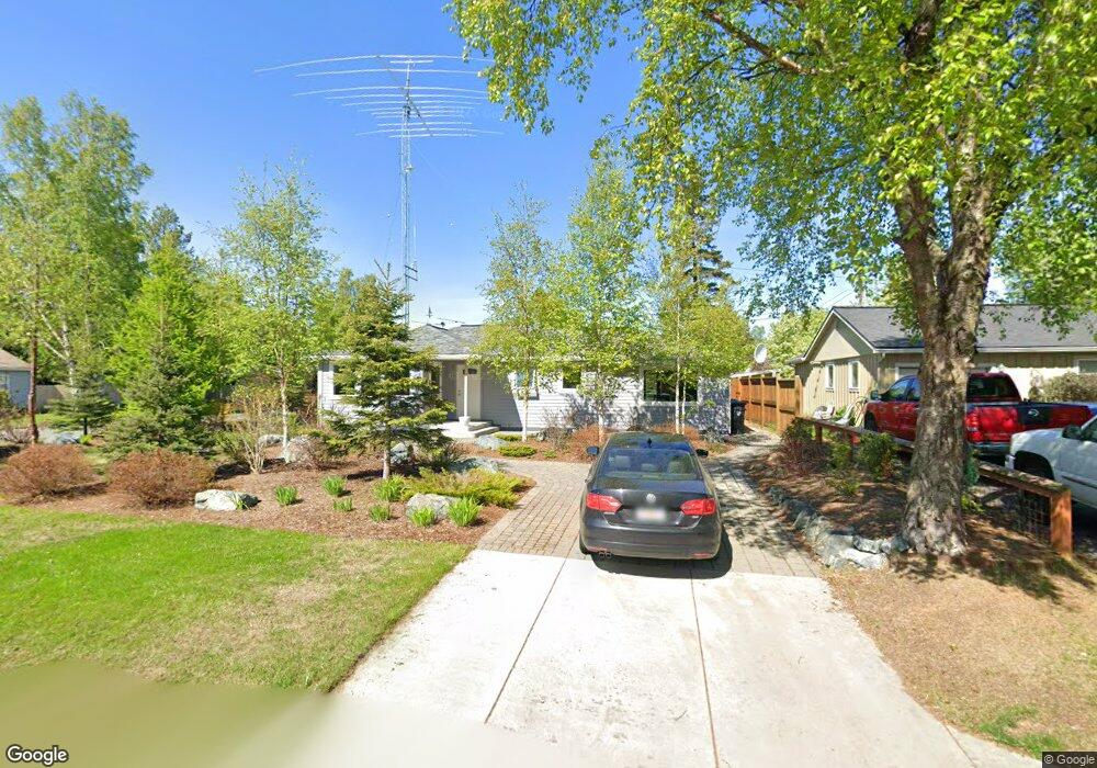
2927 Knik Ave Anchorage, AK 99517
Turnagain NeighborhoodEstimated Value: $261,000 - $592,000
2
Beds
1
Bath
1,860
Sq Ft
$250/Sq Ft
Est. Value
About This Home
This home is located at 2927 Knik Ave, Anchorage, AK 99517 and is currently estimated at $464,534, approximately $249 per square foot. 2927 Knik Ave is a home located in Anchorage Municipality with nearby schools including Turnagain Elementary School, Romig Middle School, and West High School.
Ownership History
Date
Name
Owned For
Owner Type
Purchase Details
Closed on
May 27, 2011
Sold by
Burkhart Kenneth John
Bought by
Heimke David H and Heimke Jill T
Current Estimated Value
Home Financials for this Owner
Home Financials are based on the most recent Mortgage that was taken out on this home.
Original Mortgage
$297,825
Outstanding Balance
$205,856
Interest Rate
4.84%
Mortgage Type
New Conventional
Estimated Equity
$258,678
Purchase Details
Closed on
Apr 1, 2004
Sold by
Burkhart Kenneth J
Bought by
Burkhart Kenneth John and Trust Agreement Of Kenneth John Burkhart
Purchase Details
Closed on
Sep 17, 1993
Sold by
Morrison Sheryl A
Bought by
Burkhart Kenneth J
Home Financials for this Owner
Home Financials are based on the most recent Mortgage that was taken out on this home.
Original Mortgage
$100,000
Interest Rate
7.25%
Mortgage Type
New Conventional
Create a Home Valuation Report for This Property
The Home Valuation Report is an in-depth analysis detailing your home's value as well as a comparison with similar homes in the area
Home Values in the Area
Average Home Value in this Area
Purchase History
| Date | Buyer | Sale Price | Title Company |
|---|---|---|---|
| Heimke David H | -- | United Title | |
| Burkhart Kenneth John | -- | -- | |
| Burkhart Kenneth J | -- | -- |
Source: Public Records
Mortgage History
| Date | Status | Borrower | Loan Amount |
|---|---|---|---|
| Open | Heimke David H | $297,825 | |
| Previous Owner | Burkhart Kenneth J | $100,000 |
Source: Public Records
Tax History Compared to Growth
Tax History
| Year | Tax Paid | Tax Assessment Tax Assessment Total Assessment is a certain percentage of the fair market value that is determined by local assessors to be the total taxable value of land and additions on the property. | Land | Improvement |
|---|---|---|---|---|
| 2025 | $5,999 | $472,200 | $210,200 | $262,000 |
| 2024 | $5,999 | $446,600 | $196,900 | $249,700 |
| 2023 | $7,236 | $424,900 | $196,900 | $228,000 |
| 2022 | $6,246 | $420,900 | $196,800 | $224,100 |
| 2021 | $6,986 | $387,700 | $196,800 | $190,900 |
| 2020 | $5,809 | $392,000 | $196,800 | $195,200 |
| 2019 | $5,454 | $383,400 | $196,800 | $186,600 |
| 2018 | $5,435 | $381,400 | $196,800 | $184,600 |
| 2017 | $5,899 | $396,700 | $196,800 | $199,900 |
| 2016 | $4,898 | $398,300 | $186,200 | $212,100 |
| 2015 | $4,898 | $346,600 | $185,200 | $161,400 |
| 2014 | $4,898 | $329,600 | $191,200 | $138,400 |
Source: Public Records
Map
Nearby Homes
- 2906 W 29th Ave
- 2543 La Honda Dr Unit 7
- 2638 Forest Park Dr Unit 112
- 3103 Barbara St
- 2607 W 33rd Ave
- 2401 W Marston Dr
- 3835 Carleton Ave
- Tr A W Northern Lights Blvd
- 3100 W 35th Ave
- 3516 Vintage Cir
- 3517 Vintage Cir
- 2925 W 36th Ave
- 2702 Mcrae Rd
- 2511 Abbey Ln
- 2155 W 29th Ave Unit 2
- 3100 Ward Place Unit 15
- 2064 Belair Dr
- 2820 Wiley Post Ave
- 4041 Woronzof Dr
- 3932 Starburst Cir
- 2915 Knik Ave
- 3011 Knik Ave
- 2901 Knik Ave
- 2612 Brooke Dr
- 2601 Saint Elias Dr
- 2916 Knik Ave
- 2612 Saint Elias Dr
- 3000 Knik Ave
- 3023 Knik Ave
- 2600 Brooke Dr
- 3014 Knik Ave
- 2900 Knik Ave
- 2545 Saint Elias Dr
- 2600 Saint Elias Dr
- 2871 Knik Ave
- 3037 Knik Ave
- 2882 Knik Ave
- 2615 Turnagain Pkwy
- 2536 Brooke Dr
- 3028 Knik Ave